
The N1 is a national route in South Africa that runs from Cape Town through Bloemfontein, Johannesburg, Pretoria and Polokwane to Beit Bridge on the border with Zimbabwe. It forms the first section of the famed Cape to Cairo Road.

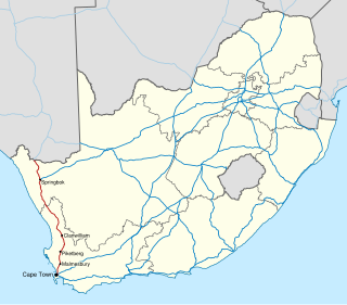
The R27 is a provincial route in South Africa that consists of two disjoint segments. The first segment, also known as the West Coast Highway, connects Cape Town with Velddrif along the West Coast. The second runs from Vredendal via Vanrhynsdorp, Calvinia, Brandvlei and Kenhardt to Keimoes on the N14 near Upington. The connection between Velddrif and Vredendal has never been built, although it can be driven on various gravel roads.

The R44 is a provincial route in Western Cape, South Africa that connects Piketberg with Kleinmond via Wellington, Stellenbosch, Somerset West and Strand. The coastal section between Kleinmond and Gordon's Bay is a very scenic ocean drive. The section between Gordon's Bay and Stellenbosch via Strand and Somerset West is a dual carriageway. The R44 is co-signed with the R46 between Gouda and Hermon in the Berg River valley.

The R45 is a provincial route in Western Cape, South Africa that connects Saldanha with Villiersdorp via Vredenburg, Malmesbury and Paarl. The route is mostly a two-lane wide-shouldered highway, however sections within Paarl and between Vredenburg and Saldanha are dual-carriageways. The R45 is co-signed with the N7 for a short segment north of Malmesbury.
The R304 is a Regional Route in South Africa that connects Stellenbosch with Atlantis.
The R311 is a Regional Route in South Africa that connects the R45 between Malmesbury and Hopefield to the north-west with Riebeek-Kasteel to the south-east.
The R315 is a Regional Route in South Africa that connects Yzerfontein on the West coast with Malmesbury to the east via Darling.
The R355 is a Regional Route in South Africa that connects the R46 near Ceres with Kleinsee via Calvinia and Springbok.
The R358 is a Regional Route in South Africa that connects the N7 north of Bitterfontein with the Namibian border at Onseepkans via Pofadder.
The R363 is a Regional Route in South Africa that connects Nuwerus on the N7 and Klawer, also on the N7, via Vredendal.
The R364 is a Regional Route in South Africa that connects Lamberts Bay to the R27 between Calvinia and Nieuwoudtville via Clanwilliam.
The R366 is a Regional Route in South Africa that connects Elands Bay in the north-west with the R365, and indirectly, Piketberg and the N7.

The Monarch's Way is a 625-mile (1,006 km) long-distance footpath in England that approximates the escape route taken by King Charles II in 1651 after being defeated in the Battle of Worcester. It runs from Worcester via Bristol and Yeovil to Shoreham, West Sussex.
The R399 is a Regional Route in South Africa that connects Vredenburg with the N7 between Piketberg and De Hoek.
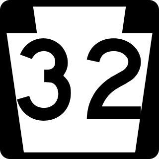
Pennsylvania Route 32 is a scenic two-lane highway that runs along the west side of the Delaware River in Bucks County, Pennsylvania. Signed north-south, it runs from U.S. Route 1 in Falls Township outside of Morrisville northwest to PA 611 in the village of Kintnersville in Nockamixon Township. PA 32 passes through Washington Crossing Historic Park, a Revolutionary War-themed historical park on the site of George Washington's crossing on the night of December 25–26, 1776. It also passes through the boroughs of Morrisville, Yardley, and New Hope.
The N7 is a national route in South Africa that runs from Cape Town northwards through the West Coast and Namaqualand regions to the Namibian border at Vioolsdrif. It is known as the Cape Namibia Road. After crossing the border, it changes designation to B1 and runs north through Windhoek and the north of Namibia.

Pennsylvania Route 443 is an 80-mile-long (130 km) east–west state highway in the US state of Pennsylvania. The western terminus is at an intersection with State Route 3009 at North Front Street on the east bank of the Susquehanna River in the community of Fort Hunter in Middle Paxton Township, just west of an interchange with the U.S. Route 22 /US 322 freeway. The eastern terminus is at US 209 in Lehighton. The route runs through rural areas in the Ridge-and-Valley Appalachians in Dauphin, Lebanon, Schuylkill, and Carbon counties, serving Fort Indiantown Gap, Pine Grove, Schuylkill Haven, Orwigsburg, New Ringgold, and South Tamaqua. PA 443 intersects several major roads, including US 22/US 322 near its western terminus, PA 72 in Union Township, Interstate 81 (I-81) near Pine Grove, PA 61 between Schuylkill Haven and Orwigsburg, and PA 309 in South Tamaqua.

Vredendal is a town in the northern Olifants River Valley in the Western Cape province of South Africa, with a population of 16,164 people. It lies 250 kilometres (160 mi) north of Cape Town on the banks of the Olifants River at the southern edge of Little Namaqualand.
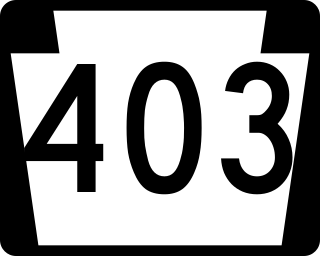
Pennsylvania Route 403 is a north–south state route in Somerset, Cambria and Indiana counties of Pennsylvania. The southern terminus is at U.S. Route 30 (US 30) in the hamlet of Kantner in Quemahoning Township. The northern terminus is at US 119 near Marion Center.

The N14 is a national route in South Africa which runs from Springbok in the Northern Cape to Pretoria in Gauteng. It passes through Upington, Kuruman, Vryburg, Krugersdorp and Centurion. The section between Pretoria and Krugersdorp is maintained by the Gauteng Provincial government and is also designated the P158.

