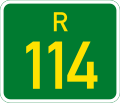
Numbered routes in South Africa

Last updated

In South Africa some roads are designated as numbered routes to help with navigation. There is a nationwide numbering scheme consisting of national, provincial and regional routes, and within various urban areas there are schemes of metropolitan route numbering. [1] [2]

Contents

Numbering

In the nationwide numbering scheme, routes are divided into a hierarchy of three categories: national routes, which are the most important routes connecting major cities; provincial routes, which connecting smaller cities and towns to the national route network; and regional routes, which connect smaller towns to the route network. Route numbers are allocated to these classes as follows: [3]

These numbers are allocated by the Route Numbering and Road Traffic Signs Sub Committee within the Roads Co-ordinating Body, [1] an organisation which contains representatives from road authorities in national, provincial and local government

Metropolitan Routes

In metropolitan numbering schemes the local authority can designate routes consisting of M followed by any number, but it should not use numbers the same as those used by national, provincial or regional routes in the same area. [3] This rule is not universally followed, for example in Johannesburg where there is both an N1 and an M1 and in Bloemfontein where there is both an R30 and an M30.

The Pietermaritzburg-Hilton area and Krugersdorp are the only urban areas that do not form part of a metropolitan municipality but still have metropolitan routes. The following metropolitan municipalities and their cities have metropolitan numbering schemes.

Lists of routes

Related Research Articles

<span class="mw-page-title-main">Provinces of South Africa</span> First-level administrative divisions of South Africa

South Africa is divided into nine provinces. On the eve of the 1994 general election, South Africa's former homelands, known as Bantustans, were reintegrated into the country, and the four provinces were increased to nine. The borders of Natal and the Orange Free State were retained, while the Cape Province and Transvaal were divided into three provinces each, plus North West Province which straddles the border of and contains territory from both these two former provinces. The twelfth, thirteenth and sixteenth amendments to the Constitution of South Africa changed the borders of seven of the provinces.

<span class="mw-page-title-main">Midrand</span> Place in Gauteng, South Africa

Midrand is a town in central Gauteng, South Africa. It is situated in-between Centurion and Sandton. Formerly an independent municipality, Midrand now forms part of the City of Johannesburg Metropolitan Municipality.

<span class="mw-page-title-main">Randburg</span> Place in Gauteng, South Africa

Randburg is an area located in the Gauteng province of South Africa. Formerly a separate municipality, its administration devolved to the newly created City of Johannesburg Metropolitan Municipality, along with neighbouring Sandton and Roodepoort, in the late 1990s. During the transitional period of 1996–2000, Randburg was part of the Northern Metropolitan Local Council (MLC).

<span class="mw-page-title-main">N3 (South Africa)</span> National road in South Africa

The N3 is a national route in South Africa that connects Johannesburg and Durban, respectively South Africa's largest and third-largest cities. Johannesburg is the financial and commercial heartland of South Africa, while Durban is South Africa's key port and one of the busiest ports in the Southern Hemisphere and is also a holiday destination. Durban is the port through which Johannesburg imports and exports most of its goods. As a result, the N3 is a very busy highway and has a high volume of traffic.

<span class="mw-page-title-main">Johannesburg freeways</span> Freeways of Johannesburg, South Africa

Johannesburg is heavily dependent upon freeways for transport around the city due to its location 1,500 metres above sea level, far from the coast or any major bodies of water. There are 10 freeways in the Greater Johannesburg Metropolitan Area: the N1, N3, N12, N14, N17, R21, R24, R59, M1 and M2. In addition, three new freeways are planned: the G5, G9 and G14. Freeways are sometimes called highways or motorways colloquially.

M13, M-13 or M13 may refer to:

M10, M-10 or M 10 may refer to:

M11 or M-11 may refer to:

M19, M.19, or M-19 most commonly refers to:

M30 or M-30 may refer to:

The Pretoria Ring Road, also known as the Pretoria Bypass, is a collection of two bypasses that together form a partial ring road around the city of Pretoria, South Africa. It consists of a section of the N1 highway as well as a section of the N4 highway. It is entirely in the City of Tshwane Metropolitan Municipality.

<span class="mw-page-title-main">National routes (South Africa)</span> National Roads in South Africa

National routes in South Africa are a class of trunk roads and freeways which connect major cities. They form the highest category in the South African route numbering scheme, and are designated with route numbers beginning with "N", from N1 to N18. Most segments of the national route network are officially proclaimed National Roads that are maintained by the South African National Roads Agency (SANRAL), but some segments are maintained by provincial or local road authorities.

<span class="mw-page-title-main">N1 (South Africa)</span> National road in South Africa

The N1 is a national route in South Africa that runs from Cape Town through Bloemfontein, Johannesburg, Pretoria and Polokwane to Beit Bridge on the border with Zimbabwe. It forms the first section of the famed Cape to Cairo Road.

<span class="mw-page-title-main">R24 (South Africa)</span> Road in South Africa

The R24 is a major East-West provincial route in the Gauteng and North West provinces that links OR Tambo International Airport with Rustenburg via Johannesburg, Krugersdorp and Magaliesburg. The process of renaming the streets and freeway that form the route from Krugersdorp eastward to OR Tambo International after anti-apartheid stalwart Albertina Sisulu was completed in 2013.

<span class="mw-page-title-main">R28 (South Africa)</span>

The R28 is a provincial route in Gauteng, South Africa that connects Krugersdorp with Vereeniging via Randfontein. The R28 used to connect with Pretoria, but that section of the road is now part of the N14.

<span class="mw-page-title-main">Metrorail (South Africa)</span>

Metrorail is an operator of commuter rail services in the major urban areas of South Africa. It is a division of the Passenger Rail Agency of South Africa (PRASA), a state-owned enterprise which is responsible for most passenger rail services in South Africa. The Metrorail system consists of 471 stations, 2,228 kilometres (1,384 mi) of track, and carries an average of 1.7 million passengers per weekday.

<span class="mw-page-title-main">N12 (South Africa)</span> National road in South Africa

The N12 is a national route in South Africa which runs from George through Beaufort West, Kimberley, Klerksdorp and Johannesburg to eMalahleni.

This page details the South African Army order of battle in 1940, before and after the formation of expeditionary forces.

References

  1. 1 2 Falkner, John (May 2012). South African Numbered Route Description and Destination Analysis (PDF). National Department of Transport. p. xi. Archived (PDF) from the original on 23 February 2019. Retrieved 22 February 2019.
  2. "RDDA SOUTH AFRICAN NUMBERED ROUTE DESCRIPTION AND DESTINATION ANALYSIS". NATIONAL DEPARTMENT OF TRANSPORT. May 2012. Retrieved 25 March 2021.
  3. 1 2 SADC Road Traffic Signs Manual, Volume 1: Uniform Traffic Control Devices. National Department of Transport. May 2012. p. 8.6.1. Retrieved 3 February 2022.