Images of regional roads
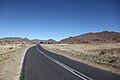 The R390 near Steynsburg
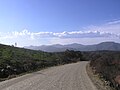
 Swartberg pass on the R328 near Oudtshoorn
 Hijacking Hotspot, R511 in Gauteng
 Pothole warning sign, R512 in North West Province
Regional routes (also sometimes known as minor regional routes) are the third category of road in the South African route numbering scheme. [1] They are designated with the letter "R" followed by a three-digit number. [2] They serve as feeders connecting smaller towns to the national and provincial routes. Designation as a regional road does not necessarily imply any particular size of road; they range from gravel roads (like the R340 between Plettenberg Bay and Uniondale) to multi-lane freeways (like the R300 near Cape Town).
Although most regional roads are maintained by provincial road authorities, this is not universally the case; in provinces which lack capacity, some may be under the control of the National Roads Agency (SANRAL), and in urban areas they may be ordinary streets under the control of the municipal roads department. Similarly, some national (N) roads and freeways are under the control of provincial or municipal authorities rather than SANRAL.


Highways in Australia are generally high capacity roads managed by state and territory government agencies, though Australia's federal government contributes funding for important links between capital cities and major regional centres. Prior to European settlement, the earliest needs for trade and travel were met by narrow bush tracks, used by tribes of Indigenous Australians. The formal construction of roads began in 1788, after the founding of the colony of New South Wales, and a network of three major roads across the colony emerged by the 1820s. Similar road networks were established in the other colonies of Australia. Road construction programs in the early 19th century were generally underfunded, as they were dependent on government budgets, loans, and tolls; while there was a huge increase in road usage, due to the Australian gold rushes. Local government authorities, often known as Road Boards, were therefore established to be primarily responsible for funding and undertaking road construction and maintenance. The early 1900s saw both the increasingly widespread use of motorised transportation, and the creation of state road authorities in each state, between 1913 and 1926. These authorities managed each state's road network, with the main arterial roads controlled and maintained by the state, and other roads remaining the responsibility of local governments. The federal government became involved in road funding in the 1920s, distributing funding to the states. The depression of the 1930s slowed the funding and development of the major road network until the onset on World War II. Supply roads leading to the north of the country were considered vital, resulting in the construction of Barkly, Stuart, and Eyre Highways.

The N3 is a national route in South Africa that connects Johannesburg and Durban, respectively South Africa's largest and third-largest cities. Johannesburg is the financial and commercial heartland of South Africa, while Durban is South Africa's key port and one of the busiest ports in the Southern Hemisphere and is also a holiday destination. Durban is the port through which Johannesburg imports and exports most of its goods. As a result, the N3 is a very busy highway and has a high volume of traffic.
The N21 is a proposed national route in the City of Cape Town, South Africa. It is also known as the Peninsula Expressway ring road. Once complete, it will link the northern suburbs on the Atlantic seaboard with the southern suburbs on False Bay (Muizenberg). The R300 freeway is entirely part of the proposed route.
A routenumber, designation or abbreviation is an identifying numeric designation assigned by a highway authority to a particular stretch of roadway to distinguish it from other routes and, in many cases, also to indicate its classification, general geographical location and/or orientation. The numbers chosen may be used solely for internal administrative purposes; however, in most cases they are also displayed on roadside signage and indicated on maps.

National routes in South Africa are a class of trunk roads and freeways which connect major cities. They form the highest category in the South African route numbering scheme, and are designated with route numbers beginning with "N", from N1 to N18. Most segments of the national route network are officially proclaimed National Roads that are maintained by the South African National Roads Agency (SANRAL), but some segments are maintained by provincial or local road authorities.

The N1 is a national route in South Africa that runs from Cape Town through Bloemfontein, Johannesburg, Pretoria and Polokwane to Beit Bridge on the border with Zimbabwe. It forms the first section of the famed Cape to Cairo Road.

The R24 is a major East-West provincial route in the Gauteng and North West provinces that links OR Tambo International Airport with Rustenburg via Johannesburg, Krugersdorp and Magaliesburg. The section of the route from OR Tambo International westwards up to a point in Roodepoort is has been named Albertina Sisulu Road since 2013, named after anti-apartheid stalwart Albertina Sisulu.

.

The R339 is a Regional Route in South Africa that connects Knysna with Uniondale via Avontuur. It is primarily a gravel road and crosses the Langkloof Mountains at Prince Alfred's pass.
The R340 is a Regional Route in South Africa that connects the N2 at Keurboomsrivier near Plettenberg Bay in the south-east with the R339.

The N2 is a national route in South Africa that runs from Cape Town through George, Gqeberha, East London, Mthatha, Port Shepstone and Durban to Ermelo. It is the main highway along the Indian Ocean coast of the country. Its current length of 2,255 kilometres (1,401 mi) makes it the longest numbered route in South Africa.

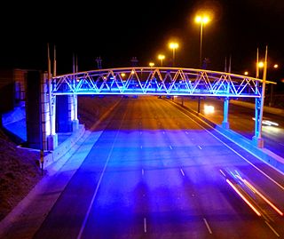
A controlled-access highway is a type of highway that has been designed for high-speed vehicular traffic, with all traffic flow—ingress and egress—regulated. Common English terms are freeway, motorway, and expressway. Other similar terms include throughway or thruway and parkway. Some of these may be limited-access highways, although this term can also refer to a class of highways with somewhat less isolation from other traffic.
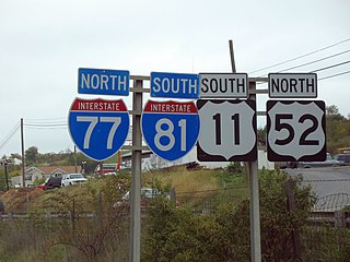
A highway shield or route marker is a sign denoting the route number of a highway, usually in the form of a symbolic shape with the route number enclosed. As the focus of the sign, the route number is usually the sign's largest element, with other items on the sign rendered in smaller sizes or contrasting colors. Highway shields are used by travellers, commuters, and all levels of government for identifying, navigating, and organising routes within a given jurisdiction. Simplified highway shields often appear on maps.

The N4 is a national route in South Africa that runs from Skilpadshek on the Botswana border, past Rustenburg, Pretoria, eMalahleni and Mbombela, to Komatipoort on the Mozambique border. The entire route is a toll road.
The South African National Roads Agency SOC Ltd or SANRAL is a South African parastatal responsible for the management, maintenance and development of South Africa's proclaimed National Road network which includes many National ("N") and some Provincial and Regional ("R") route segments.
e-toll consisted of the electronic toll collection (ETC) processes employed by South Africa's roads agency SANRAL on selected toll roads or toll lanes in the Gauteng province, subject to the Sanral Act of 1998. SANRAL derives its income both from toll income and the national fiscus, while initial capital outlay for large projects are funded by open market bond issues. In total SANRAL manages 13,000 km of non-toll roads in South Africa, besides the majority of its toll roads, including 187 km of Gauteng's freeways which were subject to e-toll.

In South Africa some roads are designated as numbered routes to help with navigation. There is a nationwide numbering scheme consisting of national, provincial and regional routes, and within various urban areas there are schemes of metropolitan route numbering.

Provincial routes are the second category of road in the South African route-numbering scheme. They are designated with the letter "R" followed by a number from 21 to 82, formerly with the letter "P" followed by a number from 66. They serve as feeders to the national routes and as trunk roads in areas where there is no national route.
The Gauteng Department of Roads and Transport is a department of the Government of Gauteng. It is responsible for the development of the transport system in the Gauteng province of South Africa, and for constructing and maintaining buildings and other structures for the other departments of the provincial government.

South Africa has a highly developed road network, considered one of the finest in Africa. According to official records, the total road network spans approximately 535,000 kilometers, comprising 168,000 kilometers of urban roads and 366,872 kilometers of other roads. The network includes a significant number of high-capacity roads, with 2,160 kilometers of motorway and 940 kilometers of four-lane roads. Additionally, there are 62,794 kilometers of single-carriageway paved roads and 300,978 kilometers of gravel roads. However, the Transport Department reports a more extensive network of 750,000 kilometers, with 158,124 kilometers of paved roads. This discrepancy may be due to differences in classification or data sources.