
KwaZulu-Natal is a province of South Africa that was created in 1994 when the government merged the Zulu bantustan of KwaZulu and Natal Province.
Pietermaritzburg is the capital and second-largest city in the province of KwaZulu-Natal, South Africa after Durban. It was named in 1838 and is currently governed by the Msunduzi Local Municipality. The town was named in Zulu after King Dingane's royal homestead uMgungundlovu. Pietermaritzburg is popularly called Maritzburg in Afrikaans and is often informally abbreviated to PMB. It is a regionally important industrial hub, producing aluminium, timber and dairy products, as well as the main economic hub of uMgungundlovu District Municipality. The public sector is a major employer in the city due to local, district and provincial government offices located here.

Ladysmith is a city in the Uthukela District of KwaZulu-Natal, South Africa. It lies 230 kilometres (140 mi) north-west of Durban and 365 kilometres (227 mi) south-east of Johannesburg. Important industries in the area include food processing, textiles, and tyre production. Ladysmith is the seat for both the Alfred Duma Local Municipality and Uthukela District Municipality.

Howick is a town located in the UMngeni Local Municipality of KwaZulu-Natal Province, South Africa. The town is 1050 m above sea level, and about 88 kilometres from the port city of Durban. It experiences warm summers and cool, dry winters. A snappy chill descends upon Howick when snow falls on the nearby Drakensberg. The town is located on the N3 freeway, connecting it with the rest of South Africa.

The N3 is a national route in South Africa that connects Johannesburg and Durban, respectively South Africa's largest and third-largest cities. Johannesburg is the financial and commercial heartland of South Africa, while Durban is South Africa's key port and one of the busiest ports in the Southern Hemisphere and is also a holiday destination. Durban is the port through which Johannesburg imports and exports most of its goods. As a result, the N3 is a very busy highway and has a high volume of traffic.
Hillcrest is a town in the KwaZulu-Natal province of South Africa that forms part of the eThekwini Metropolitan Municipality and is situated approximately 32 km north-west of Durban and 53 km south-east of Pietermaritzburg.

Port Shepstone is a large town situated on the mouth of the Mzimkhulu River, the largest river on the KwaZulu-Natal South Coast of South Africa. It is located halfway between Hibberdene and Margate and is positioned 120 km south of Durban. It serves as the administrative, educational, industrial and commercial centre for southern Natal.
Port Edward is a small resort town situated on the south coast of KwaZulu-Natal in South Africa and lies on the border between KwaZulu-Natal and the Eastern Cape. It is situated on the R61 road between Port Shepstone and Lusikisiki.

Mooi River is a small town situated at 1,389 m above sea level and 160 km from the coast in KwaZulu-Natal, South Africa. The first European settlement in the area was at Mooi River Drift in 1852. This was formally named Weston in 1866 after the first Governor of Natal, Martin West.
Pinetown is a city that forms part of the eThekwini Metropolitan Municipality, based just inland from Durban in KwaZulu-Natal, South Africa. The town is situated 16 km north-west of Durban and 64 km south-east of Pietermaritzburg.
Westville is an area in KwaZulu-Natal, South Africa, and is just west and 10 km inland from the Durban CBD. It was formerly and independent municipality and became part of the eThekwini Metropolitan Municipality in 2002.

The R56 is a provincial route in South Africa that connects Middelburg with Pietermaritzburg via Molteno, Maclear and Kokstad. It is co-signed with the N2 between Kokstad and Stafford's Post for 39 kilometres.
The R103 is a Regional Route in South Africa that is the designation for some of the old sections of roads that were previously the N3, prior to upgrading. It only has 3 sections, from Hillcrest to Ladysmith, from Warden to Villiers and from Heidelberg to Johannesburg.
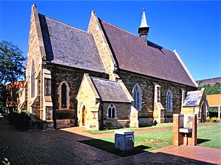
Hilton College, more commonly referred to as Hilton, is a South African private boarding school for boys located near the town of Hilton in the KwaZulu-Natal Midlands and is situated on a 1,762 ha estate that includes a 550 ha wildlife reserve and the 150 ha school campus

The KwaZulu-Natal midlands is an inland area of KwaZulu-Natal, South Africa that starts from Pietermaritzburg and ends before the Drakensberg mountain range.
Cato Ridge is a town in the KwaZulu-Natal province of South Africa named after George Christopher Cato (1814–1893), the first mayor of Durban. Organisationally and administratively it is included in the Ethekwini Metropolitan Municipality as a suburb of the Outer West region.

Southbroom is a coastal village on the South Coast of the KwaZulu-Natal province of South Africa situated approximately halfway between Port Shepstone – 23 km (14 mi) and Port Edward – 18 km (11 mi).
The R603 is a Regional Route in KwaZulu-Natal, South Africa connecting Kingsburgh on the South Coast with Umlaas Road, between Pietermaritzburg and Durban, via Umbumbulu.

The KwaZulu-Natal South Coast is a region along the southern stretch of coastline of KwaZulu-Natal, South Africa, south of the coastal city of Durban.


