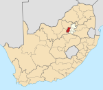
Krugersdorp

Last updated

Krugersdorp
Featherbrooke-landgoed, Krugersdorp.jpg
Featherbrooke estate in Krugersdorp
South Africa Gauteng location map.svg
Red pog.svg
Krugersdorp
South Africa adm location map.svg
Red pog.svg
Krugersdorp
Africa location map.svg
Red pog.svg
Krugersdorp
Coordinates: 26°6′S27°46′E / 26.100°S 27.767°E / -26.100; 27.767
Country South Africa
Province Gauteng
District West Rand
Municipality Mogale City
Established1887
Area
[1]
  Total247.22 km2 (95.45 sq mi)
Population
 (2011) [1]
  Total140,643
  Density570/km2 (1,500/sq mi)
Racial makeup (2011)
[1]
   Black African 42.3%
   Coloured 1.4%
   Indian/Asian 5.4%
   White 50.2%
  Other0.8%
First languages (2011)
[1]
   Afrikaans 42.0%
   English 19.5%
   Tswana 14.5%
   Zulu 4.8%
  Other19.2%
Time zone UTC+2 (SAST)
Postal code (street)
1739
PO box
1739
Area code 011

Krugersdorp (Afrikaans for Kruger's Village) is a mining city in the West Rand, Gauteng Province, South Africa founded in 1887 [2] by Marthinus Pretorius and Abner Cohen. [3] Following the discovery of gold on the Witwatersrand, a need arose for a major town in the west of the reef. The government bought part of the Paardekraal farm and named the new town after the Transvaal president, Paul Kruger. Krugersdorp no longer has a separate municipal government after it was integrated into Mogale City Local Municipality along with surrounding towns. It is now the seat of government for Mogale City.

Contents

History

Town Hall in Krugersdorp Rathaus Krugersdorp.JPG
Town Hall in Krugersdorp

Krugersdorp is the site of a December 1880 gathering at which more than 6,000 men vowed to fight for the Transvaal's independence. [2] Founded in 1887 by Marthinus Pretorius after the discovery of gold on his farm, Paardekraal, thereafter the mining industry played an important role in the development of the city. Two important events in the history of South Africa: the Transvaal War of Independence (1881) and the discovery of the Witwatersrand Goldfields (1886) took place in Krugersdorp. These events had far-reaching political and economic consequences for the country's development. [4]

In April 1887, the South African Republic's (ZAR) Executive Council purchased part of the farm Paarderkraal to build a town called Krugersdorp. [5] :35 By the time the town was founded, the existence of the gold reef along the Witwatersrand had become common knowledge, and thousands seeking their fortunes pitched their tents and pegged claims. In 1888, Krugersdorp was proclaimed a separate gold field. [6] By 1895, the proclaimed goldfields was separated from Krugersdorp, and the town and Distriksdorp, near the monument, were merged in April that year. [5] :35 By 1903, Krugersdorp became a municipality. [5] :35

During the Second Boer War (1899-1902), the British built a concentration camp in the valley that is now occupied by the Centenary Dam. This camp was overlooked by the "D" Shaft of the Luipardsvlei Estate Gold Mining Company, which was shut down in 1929 when mining shifted to deeper ore bodies that offered the prospect of larger tonnages. As of 2014 this shaft is being brought back into production. Part of the heritage of the area will feature in a museum to be built post-closure. An essential part of the museum's content will be the Boer War legacy. [7]

In 1952, the West Rand Consolidated Mine was the first in the world to extract uranium as a byproduct of the gold refining process. [8]

Demographics

Krugersdorp is home to the South African Branch of Jehovah's Witnesses, The Watchtower Bible, and Tract Society. [9]

In 2010, the town's Coronation Park area received international exposure for the depiction of Afrikaner poverty by Finbarr O'Reilly. [10] [11] [12] In 2014, the area was exposed again as a subject of the BBC documentary Reggie Yates' Extreme South Africa: White Slums . [13]

Economy

A view from Coronation Park overlooking the old town with the West Rand Consolidated Mines dump on the horizon West Rand Cons Dump from Coronation Park.jpg
A view from Coronation Park overlooking the old town with the West Rand Consolidated Mines dump on the horizon

Gold, manganese, iron, asbestos and lime are all mined in the area. [14]

Krugersdorp has a modern business centre and shopping malls alongside many smaller shops, schools, and necessary amenities. There are also game reserves and a nearby bird sanctuary. [14]

Krugersdorp is served by the Jack Taylor Airfield north-west of the town centre (adjacent to the game reserve) and Lanseria International Airport 28 kilometres to the north-east. O. R. Tambo International Airport is 50 kilometres to the east. [14]

The nearby 1,400 hectares (3,500 acres) Krugersdorp Game Reserve in the dense bush of the veld holds a large quantity of game and is one of the city's major tourist attractions. Also in close proximity are various provincial heritage sites including the Cradle of Humankind and its Sterkfontein Caves [2] and the Wonder Cave. [15]

Law and government

Government

Name change

Although the city's municipality changed its name from Krugersdorp to Mogale City, [16] the assumption that the city's name has been officially changed to Mogale City has been refuted by the Mogale City Municipality. [17]

Coat of arms

Krugersdorp was proclaimed a municipality in 1903. By 1931, the municipal council had assumed a pseudo-heraldic coat of arms. The shield was divided by a horizontal line, the upper half subdivided by a vertical line, the three sections depicting (1) the Paardekraal monument, (2) a mining landscape, and (3) a plough. The motto was Labor omnia vincit improbus. [18]

A proper coat of arms was designed in the 1960s. It was registered with the Transvaal Provincial Administration in November 1965 [19] and at the Bureau of Heraldry in January 1969. [20] The arms were : Per chevron ploye Azure and Or, dexter two mine hammers in saltire and sinister a cogwheel all Or, and in base the Paardekraal Monument Gules. In layman's terms, the shield was divided by a curved chevron-shaped line into blue and gold, displaying two crossed mine hammers and a cogwheel at the top, and the Paardekraal monument at the bottom. The crest was three horses' heads issuing from a golden mural crown; the supporters were an eland and a gemsbok; and the motto was Labor omnia vincit improbus .

Attractions

Krugersdorp has popular tourist attractions such as Krugersdorp Game Reserve, Maropeng Visitor Centre, Walter Sisulu Botanical Gardens and Sterkfonten Caves. [21]

The town is the host of the annual Gauteng Beach Party held at Coronation Park. [22] In recent years the event has featured performances by:

Afropop sensation Mafikizolo and Ntando Bangani are noted acts that hail from Krugersdorp. [23]

Sports

Krugersdorp also has an 18-hole golf course and many facilities for extreme sports.

Infrastructure

Health

Local clinics

  • Central Clinic
  • Kagiso Clinic B
  • Azaadville Clinic
  • Munsieville Clinic A
  • Dr Kaka Clinic

Provincial hospitals

  • Dr Yusuf Dadoo Hospital (Paardekraal)
  • Sterkfontein Hospital
  • Leratong Hospital

Private hospitals

  • Krugersdorp Private Hospital
  • Bell Street Day Hospital
  • Netcare Pinehaven Hospital
  • Medi-Cross Clinic

Education

The schools in Krugersdorp include: [24] [25]

Notable people

See also

Related Research Articles

<span class="mw-page-title-main">Johannesburg</span> Largest city in South Africa

Johannesburg is the most populous city in South Africa with 4,803,262 people, and is classified as a megacity; it is one of the 100 largest urban areas in the world. It is the provincial capital and largest city of Gauteng, which is the wealthiest province in South Africa. Johannesburg is the seat of the Constitutional Court, the highest court in South Africa. Most of the major South African companies and banks have their head offices in Johannesburg. The city is located within the mineral-rich Witwatersrand hills, the epicentre of the international-scale mineral, gold and (specifically) diamond trade.

<span class="mw-page-title-main">Gauteng</span> Province in South Africa

Gauteng is one of the nine provinces of South Africa.

<span class="mw-page-title-main">Centurion, South Africa</span> Place in Gauteng, South Africa

Centurion is an area with 236,580 inhabitants in the Gauteng Province of South Africa, between Pretoria and Midrand. Formerly an independent municipality, with its own town council, it has been part of the City of Tshwane Metropolitan Municipality since 2000. Its heart is at the intersection of the N1 and N14 freeways. The R21 freeway also passes through the eastern part of Centurion.

<span class="mw-page-title-main">Klerksdorp</span> City in North West, South Africa

Klerksdorp is located in the North West Province, South Africa. Klerksdorp, the largest city in the North West Province, is located 165 km (103 mi) southeast of Mahikeng, the provincial capital. Klerksdorp was also the first capital of the then Transvaal Republic and used to be the home of the first Stock Exchange in the region. It became an important trading town linking Kimberley to Johannesburg. It became home to a mix of farmers, miners and immigrants servicing the two industries.

<span class="mw-page-title-main">Brits, North West</span> Town in North West, South Africa

Brits is a town in the North West Province of South Africa. It is situated in a fertile citrus, vegetable and grain-producing area that is irrigated by the waters of the Hartbeespoort Dam. It is close to the City of Tshwane Metropolitan Municipality in Gauteng, which includes Pretoria, and it has the same dialling code as Pretoria. In addition to being a centre for agriculture, the city is home to several heavy industries. A factory of the Italian car manufacturer Alfa Romeo produced cars for the domestic market and export to Asia from 1974 to 1985. The city also plays an important role in the South African mining industry: 94% of South Africa's platinum comes from the Rustenburg and Brits districts, which together produce more platinum than any other single area in the world. In addition, there is a large vanadium mine in the district.

<span class="mw-page-title-main">Witwatersrand Gold Rush</span> Gold rush in Johannesburg, South Africa

The Witwatersrand Gold Rush was a gold rush that began in 1886 and led to the establishment of Johannesburg, South Africa. It was a part of the Mineral Revolution.

<span class="mw-page-title-main">Vereeniging</span> City in Gauteng, South Africa

Vereeniging is a city located in the south of Gauteng province, South Africa, situated where the Klip River empties into the northern loop of the Vaal River. It is also one of the constituent parts of the Vaal Triangle region and was formerly situated in the Transvaal province. The name Vereeniging is the Dutch word meaning "association".

<span class="mw-page-title-main">Springs, South Africa</span> Place in Gauteng, South Africa

Springs is a former independent city that is now part of the City of Ekurhuleni, based in the east of Johannesburg, in Gauteng Province, South Africa. It lies 50 km (31 mi) east of Johannesburg and 72 km (45 mi) southeast from Pretoria. Its name derives from the large number of springs in the area, and its estimated population is more than 121,610 in 2011. It is situated at 1628 m (5,340 ft) above sea level.

<span class="mw-page-title-main">Boksburg</span> Town in Gauteng, South Africa

Boksburg is a city on the East Rand (Ekurhuleni) of Gauteng province of South Africa. Gold was discovered in Boksburg in 1887. Boksburg was named after the State Secretary of the South African Republic, W. Eduard Bok. The Main Reef Road linked Boksburg to all the other major mining towns on the Witwatersrand and the Angelo Hotel (1887) was used as a staging post.

<span class="mw-page-title-main">Randfontein</span> Place in Gauteng, South Africa

Randfontein is a gold mining town in the West Rand, Gauteng, South Africa, 40 km (25 mi) west of Johannesburg. With the Witwatersrand gold rush in full swing, mining financier JB Robinson bought the farm Randfontein and, in 1889, floated the Randfontein Estates Gold Mining Company. The town was established in 1890 to serve the new mine and was administered by Krugersdorp until it became a municipality in 1929. Apart from having the largest stamp mill in the world, Randfontein, like many of the other outlying areas of Johannesburg, is essentially a rural collection of farms and small holdings in a particularly beautiful part of Gauteng.

Florida is a location in Gauteng province, South Africa. It is located about 16 kilometres west of Johannesburg. The area which is referred to as Florida was originally established as the farm Vogelstruisfontein. Today, it is a suburb of Roodepoort.

<span class="mw-page-title-main">R24 (South Africa)</span> Road in South Africa

The R24 is a major East-West provincial route in the Gauteng and North West provinces that links OR Tambo International Airport with Rustenburg via Johannesburg, Krugersdorp and Magaliesburg. The process of renaming the streets and freeway that form the route from Krugersdorp eastward to OR Tambo International after anti-apartheid stalwart Albertina Sisulu was completed in 2013.

<span class="mw-page-title-main">R28 (South Africa)</span>

The R28 is a provincial route in Gauteng, South Africa that connects Krugersdorp with Vereeniging via Randfontein. The R28 used to connect with Pretoria, but that section of the road is now part of the N14.

<span class="mw-page-title-main">West Rand</span> Western region of Gauteng, South Africa

The West Rand is the urban western part of the Witwatersrand that is functionally merged with the Johannesburg conurbation. This area became settled by Europeans after a gold-bearing reef discovered in 1886 and sparked the gold rush that gave rise to the establishment of Johannesburg.

Kagiso is a township situated at the southern end of the Mogale City Local Municipality, just south of Krugersdorp in Gauteng Province, South Africa. The word kagiso means peace in Tswana. Kagiso's administration comprises five wards, each headed by a councillor.

<span class="mw-page-title-main">Muldersdrift</span> Place in Gauteng, South Africa

Muldersdrift, in the Gauteng Province of South Africa, is a picturesque rural area situated 27 km north-west of Johannesburg, between Johannesburg and the Magaliesberg mountain range. The area falls under the West Rand District Municipality, and is part of the Mogale City Local Municipality.

Hoërskool Monument is a parallel medium strictly Afrikaans as a first language high school situated in Krugersdorp, Gauteng, South Africa.

<span class="mw-page-title-main">Rand Water</span> South African water utility supplying the Gauteng province

Rand Water is a South African water utility that supplies potable water to the Gauteng province and other areas of the country and is the largest water utility in Africa. The water is drawn from numerous sources and is purified and supplied to industry, mining and local municipalities and is also involved in sanitation of waste water.

Azaadville is a town in South Africa located in Mogale City in the West Rand region of Gauteng province of South Africa.

Bertha Peace Mabe is a South African politician serving as a Member of the National Assembly of South Africa since February 2017. She previously served in the National Assembly from May 2014 until August 2016. She served as a permanent delegate to the National Council of Provinces from Gauteng between May 2009 and April 2014. Mabe is a member of the African National Congress and the party's unsuccessful 2016 Mogale City mayoral candidate.

References

  1. 1 2 3 4 "Main Place Krugersdorp". Census 2011.
  2. 1 2 3 Chisholm, Hugh, ed. (1911). "Krugersdorp"  . Encyclopædia Britannica . Vol. 15 (11th ed.). Cambridge University Press. p. 932.
  3. Lipkind, Joseph (14 October 1898). "Cohen, Abner". Jewish Chronicle. Retrieved 10 March 2023.
  4. Fourie, Chantel. [PHOTOS] Krugersdorp from a historical perspective, Krugersdorp News, 5 June 2015. Retrieved on 7 September 2019.
  5. 1 2 3 "Krugersdorp". South African Panorama. Information Service of South Africa. 19 (1). 1974 via Internet Archive.
  6. Discovery of the Gold in 1884, South African History Online. Retrieved on 7 September 2019.
  7. Krugersdorp, South African History Online. Retrieved on 7 September 2019.
  8. A western town sparks a new golden era, the rise of Krugersdorp, facsa.co.za. Retrieved on 7 September 2019.
  9. Lotriet, Alanicka.Who and what is the Watch Tower Society on Robert Broom Drive?, Krugersdorp News, 4 September 2018. Retrieved on 7 September 2019.
  10. Poverty, and Little Sympathy, in South Africa (Lens) New York Times. 25 June 2010
  11. White poverty in South Africa Reuters. Retrieved on 31 December 2010
  12. Tough times for white South African squatters, Reuters.com. 26 March 2010.
  13. The Slums: Reggie Yates' Extreme South Africa, TV review: A reversal of a racial trope The Independent. 20 February 2014
  14. 1 2 3 Krugersdorp, www.gauteng-info.co.za. Retrieved on 7 September 2019.
  15. KRUGERSDORP HISTORY AND INFORMATION, Johannesburg Happenings. Retrieved on 7 September 2019.
  16. http://www.gautengfilm.co.za/live/content.php?Item_ID=876 Archived 2 October 2011 at the Wayback Machine
  17. "What's in a town's name? - News24". 4 September 2012. Archived from the original on 4 September 2012. Retrieved 15 April 2018.
  18. The arms were depicted on a cigarette card issued in 1931.
  19. Transvaal Official Gazette 1381 (17 November 1965).
  20. http://www.national.archsrch.gov.za%5B%5D
  21. "Things to do in Krugersdorp". www.safarinow.com. Retrieved 15 April 2018.
  22. Tsumele, Edward (22 September 2009). "Peaches on the beaches". SowetanLIVE. Retrieved 7 September 2019.
  23. Stich is back!, Krugersdorp News, 7 July 2019. Retrieved on 7 September 2019.
  24. These are Gauteng's most popular public schools, TimesLIVE, 5 December 2017. Retrieved on 7 September 2019.
  25. Browse Schools in Krugersdorp at School4SA, Schools4SA. Retrieved on 7 September 2019.
  26. "Tina Cowley Reading Centre Krugersdorp". www.facebook.com. Retrieved 15 April 2018.
External image
Searchtool.svg Memorial to those who died in the concentration camp - from the Genealogical Society of South Africa