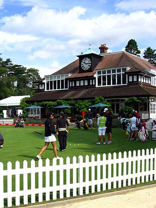
Sunningdale is a large village with a retail area and a civil parish in the Royal Borough of Windsor and Maidenhead. It takes up the extreme south-east corner of Berkshire, England. It has a railway station on the (London) Waterloo to Reading Line and is adjoined by green buffers including Sunningdale Golf Club and Wentworth Golf Club. Its northern peripheral estates adjoin Virginia Water Lake.
Fairwood is a suburb of Johannesburg, South Africa. It is a small elevated suburb on the edge of Linksfield Ridge tucked between the suburbs of Orange Grove, Linksfield and Mountain View. Sylvia Pass winds down through the suburb. It is located in Region E of the City of Johannesburg Metropolitan Municipality.

Northcliff is a wealthy residential suburb of Johannesburg, South Africa. The suburb is located on Northcliff Ridge which provides views to both the north and the south. Northcliff's huge homes are nestled around a steep incline of the hill, and on the foot of Northcliff borders the suburbs of Fairland, Blackheath, Cresta and Berario. Recently some streets have been secured with boom gates. Although erroneously included by Google Maps as part of Randburg, Northcliff has never been part of Randburg. It is located in Region B of the City of Johannesburg Metropolitan Municipality.
Doornkop is a ridge and locality on the western outskirts of Soweto in the Gauteng Province, South Africa.
Kensington is a hilly suburb of Johannesburg, South Africa. It was established in 1897 by Max Langermann. It is located in Region F of the City of Johannesburg Metropolitan Municipality and is bounded to the west by the suburb of Troyeville, to the east by Bedfordview and the north by Bruma and Cyrildene.
Oaklands is an affluent suburb of Johannesburg, South Africa. It is located in Johannesburg Region E. It is a small suburb surrounded by the suburbs of Houghton Estate, Norwood, Orchards, The Gardens and Highlands North.
President Ridge is a suburb of Johannesburg, South Africa. It is located in Region 3.
Sunningdale is a suburb of Johannesburg, South Africa. It is located in Region E and Ward 72 of the City of Johannesburg Metropolitan Municipality.
Parktown is a wealthy suburb of Johannesburg, South Africa, the first suburb north of the inner city. It is affectionately known as one of the Parks, others including Parkview, Parkwood, Westcliff, Parktown North, Parkhurst and Forest Town. Parktown is one of Johannesburg's largest suburbs, neighbouring Hillbrow, Braamfontein and Milpark to the South; Berea and Houghton to the East; Killarney and Forest Town to the North, and Westcliff, Melville and Richmond to the West. Originally established by the Randlords in the 1890s, Parktown is now home to many businesses, hospitals, schools, churches and restaurants, whilst still maintaining quiet residential areas. It is also home to three of the five campuses of the University of the Witwatersrand including the education campus, medical school and Wits Business School. Parktown is now divided into Parktown and Parktown West with Jan Smuts Avenue forming the dividing line. It is located in Region F of the City of Johannesburg Metropolitan Municipality.
Rabie Ridge is a township near Johannesburg, South Africa. It is located in Region A of the City of Johannesburg Metropolitan Municipality and is located east of Midrand. It is a township formed due to forced removals of the coloured community from Alexandra and is named after Jack Rabie.
Observatory Ridge is the highest point in Johannesburg, South Africa. It is 1,808 metres (5,932 ft) above sea level. It is in the suburb of Observatory.
Louis Botha Avenue is a major street in Johannesburg, South Africa. Originally part of the main road between central Johannesburg and Pretoria, it runs along through the north-eastern parts of the city from Hillbrow to Sandton, passing through numerous older suburbs, including Houghton and Orange Grove, before it becomes the Pretoria Main Road (R101) which passes the Alexandra Township and continues to Midrand and Pretoria.
The Ridge School is a private, preparatory school for boys situated in Westcliff, Johannesburg, Gauteng, South Africa.
Randpark Ridge is an upmarket suburb of Randburg, South Africa. It is located in the Randburg region of the City of Johannesburg. It fell into the town of Randburg during the apartheid era. Developed in the early 1980s and still relatively new, Randpark Ridge is bordered by several other suburbs including Weltevreden Park, Sundowner, Boskruin, Bromhof, Honeydew and Fairland. It is located on the north-west extremity of Johannesburg.
Beyers Naudé Drive is a large arterial route in Johannesburg, South Africa. It starts at the University of Johannesburg in Auckland Park, travelling through Melville, Roosevelt Park, Northcliff, Blackheath and traversing the N1 Western Bypass at Randpark Ridge. It terminates at the N14 freeway near Muldersdrift. It was previously known as DF Malan Drive. It forms part of Johannesburg's M5 road.
Observatory is a Suburb in Johannesburg's east and is located in Region E of the City of Johannesburg Metropolitan Municipality; it borders the suburbs of Houghton Estate, Cyrildene, Linksfield, Bellevue, Bellevue East and Dewetshof.
Jan Smuts Avenue is a major street in Johannesburg, South Africa. It begins in Randburg, and passes through important business areas like Rosebank. It passes the Johannesburg Zoo, Zoo Lake and Wits University before becoming Bertha Street, and the Nelson Mandela Bridge near the Johannesburg CBD. It has been described as "the most important road for a tourist" in Johannesburg. It forms part of Johannesburg's M27 route.

Rand Water, previously known as the Rand Water Board, is a South African water utility that supplies potable water to the Gauteng province and other areas of the country and is the largest water utility in Africa. The water is drawn from numerous sources and is purified and supplied to industry, mining and local municipalities and is also involved in sanitation of waste water.
Endstead is an historic house in Parktown, Johannesburg, South Africa built in 1903 by Ernest Willmot Sloper for his own use.
Linksfield is a suburb of Johannesburg, South Africa. It is a suburb lying north-east of the Johannesburg CBD and is surrounded southerly by Linksfield Ridge, easterly by Linksfield North and Bedford, St Andrews and Senderwood. Linksfield itself is located in Region E of the City of Johannesburg Metropolitan Municipality. On the southerly side and over the ridge are the areas of Cyrildene, Observatory and Morninghill, but these suburbs are not visible to Linksfield as they are hidden behind the Linksfield Ridge.

