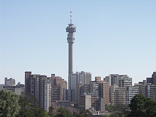
Hillbrow is an inner city residential neighbourhood of Johannesburg, Gauteng Province, South Africa. It is known for its high levels of population density, unemployment, poverty, prostitution and crime.
Lenasia, often called Lenz, is a suburb south of Soweto in the Gauteng province, South Africa, originally created to house Indians. It is part of the City of Johannesburg Metropolitan Municipality. Lenasia is approximately 35 kilometres southwest of the Johannesburg Central Business District and 45 kilometres south of the Sandton Central Business District.
Auckland Park is a suburb of Johannesburg, South Africa. It lies on a gentle slope, and is in close proximity to the suburbs of Melville, Brixton, Westdene and Richmond. Auckland Park is one of the few suburbs close to the Johannesburg city centre that has remained largely unaffected by the recent migration of Johannesburg residents to the city's northern suburbs. Auckland Park is home to a mix of nationalities and cultures, and the suburb is well known as the location of the South African Broadcasting Corporation headquarters.
Moffat View is a suburb of Johannesburg, South Africa. The area lies to the south of the Johannesburg CBD. It is located in Region F of the City of Johannesburg Metropolitan Municipality.
Blairgowrie is a suburb of Johannesburg, South Africa. It is located in Region B of the City of Johannesburg Metropolitan Municipality. It is named after the town of Blairgowrie in Scotland.
Houghton Estate, often simply called Houghton is an affluent suburb of Johannesburg, South Africa, north-east of the city centre.
Bertrams is a suburb of Johannesburg, South Africa. It is a small suburb found on the eastern edge of the Johannesburg central business district (CBD), tucked between the suburbs of New Doornfontein and Lorentzville, with Troyeville to the south. It is located in Region F of the City of Johannesburg Metropolitan Municipality.
Fairview is a suburb of Johannesburg, South Africa. It is a small suburb found on the eastern edge of the Johannesburg central business district (CBD), with the suburb of Troyeville to the north, Jeppestown to the south and Malvern to its east. Commissioner Street, the main street in the CBD, has its eastern end in the suburb. It is located in Region F of the City of Johannesburg Metropolitan Municipality.
Fordsburg is a suburb of Johannesburg, South Africa. It is located in Region 8. Fordsburg is a residential suburb, although housing numerous shops and factories.
Lorentzville is a suburb of Johannesburg, South Africa. It is a small suburb found on the eastern edge of the Johannesburg central business district (CBD), tucked between the suburbs of Bertrams and Judith's Paarl, with Troyeville to the south. It is located in Region F of the City of Johannesburg Metropolitan Municipality.
Malvern is a suburb of Johannesburg, South Africa. Situated east of the Johannesburg CBD, it lies south of Kensington and north of the industrial suburb of Denver. It is located in Region F of the City of Johannesburg Metropolitan Municipality and lies just west of Bedfordview in the City of Ekurhuleni Metropolitan Municipality.
Pageview is a suburb of Johannesburg, South Africa. It is located in Region F of the City of Johannesburg Metropolitan Municipality. Populated by non-whites, predominantly Indians, until the 1970s, it was one of two adjacent suburbs commonly known as Fietas.

Kliptown is a suburb of the formerly black township of Soweto in Gauteng, South Africa, located about 17 km south-west of Johannesburg. Kliptown is the oldest residential district of Soweto, and was first laid out in 1891 on land which formed part of Klipspruit farm. The farm was named after the klipspruit that runs nearby. From 1903 the area was home to informal settlements, and the area now contains a mixture of purpose-built housing and many shacks and other informal homes which form the Chris Hani and Dlamini settlements.
Linden is a suburb of Johannesburg, South Africa - situated towards the north western suburbs of the city on the border of the former independent town of Randburg. This established up-market suburb between 5 km (3.1 mi) to 8 km (5.0 mi) north-west of the Johannesburg CBD was designed so that most of the streets and avenues form similar sized blocks. A number of shops, churches and schools can be found on 3rd Avenue and 4th Avenue. Attractions include arts, crafts, studios, coffee shops, pubs, restaurants and small shops. Bordering suburbs include Northcliff, Blairgowrie, Victory Park, Greenside and Cresta.
The Oriental Plaza, known locally as the Plaza is a large shopping centre and tourist attraction in Fordsburg, a suburb of Johannesburg, South Africa. Consisting of multiple connected malls, it was created for Indian traders who were forcibly removed from nearby Fietas by the apartheid government.
Linksfield is a suburb of Johannesburg, South Africa. It is a suburb lying north-east of the Johannesburg CBD and is surrounded southerly by Linksfield Ridge, easterly by Linksfield North and Bedford, St Andrews and Senderwood. Linksfield itself is located in Region E of the City of Johannesburg Metropolitan Municipality. On the southerly side and over the ridge are the areas of Cyrildene, Observatory and Morninghill, but these suburbs are not visible to Linksfield as they are hidden behind the Linksfield Ridge.
Bezuidenhout Valley is a suburb of Johannesburg, South Africa. The area lies to the east of the Johannesburg CBD and is surrounded by the suburbs of Kensington to the south and Observatory to the north. It is located in Region E of the City of Johannesburg Metropolitan Municipality. It is colloquially known as the Bez Valley.
Lombardy East is a residential suburb of eastern Johannesburg, South Africa. It is located in Region E of the City of Johannesburg Metropolitan Municipality.
Crosby is a suburb of Johannesburg, South Africa. The suburb is west of the Johannesburg CBD and is adjacent to Mayfair West. It is located in Region F of the City of Johannesburg Metropolitan Municipality.
Eldorado Park is a suburb of Soweto, Johannesburg, South Africa. It is located in Region G of the City of Johannesburg Metropolitan Municipality. It lies on the southern boundary of Soweto and prior to 1994, was a Coloured township during Apartheid.

