
The N3 is a national route in South Africa that connects Johannesburg and Durban, respectively South Africa's largest and third-largest cities. Johannesburg is the financial and commercial heartland of South Africa, while Durban is South Africa's key port and one of the busiest ports in the Southern Hemisphere and is also a holiday destination. Durban is the port through which Johannesburg imports and exports most of its goods. As a result, the N3 is a very busy highway and has a high volume of traffic.

Johannesburg is heavily dependent upon freeways for transport around the city due to its location 1,500 metres above sea level, far from the coast or any major bodies of water. There are 10 freeways in the Greater Johannesburg Metropolitan Area: the N1, N3, N12, N14, N17, R21, R24, R59, M1 and M2. In addition, three new freeways are planned: the G5, G9 and G14. Freeways are sometimes called highways or motorways colloquially.

The Johannesburg Ring Road is a set of freeways that circle the city of Johannesburg, South Africa and service the City of Johannesburg Metropolitan Municipality. The entire ring road is approximately 83 km long and was an e-toll highway from 3 December 2013 up until e-tolls were shut down in Gauteng on 12 April 2024.

The Western Bypass is a section of the N1 and the Johannesburg Ring Road located in the city of Johannesburg, South Africa. Known at the time as the Concrete Highway, the freeway was initially opened in 1975 as a route to avoid the city centre of Johannesburg and to provide access to the western areas of the Witwatersrand. From the south, the Western Bypass begins at the Diepkloof Interchange in Soweto, where it splits from the N12 freeway and ends at the Buccleuch Interchange, where it merges with the N3 Eastern Bypass, M1 South and N1 Ben Schoeman freeways.

The N12 Southern Bypass is a section of the Johannesburg Ring Road that forms a beltway around the city of Johannesburg, South Africa, as part of the N12. The freeway was the last section of the Ring Road to be built, with the final section opening in 1986. As part of the old South African Freeways, It was initially called the N13. The entire Southern Bypass freeway was an e-toll highway from 3 December 2013 to 11 April 2024.

The N1 is a national route in South Africa that runs from Cape Town through Bloemfontein, Johannesburg, Pretoria and Polokwane to Beit Bridge on the border with Zimbabwe. It forms the first section of the famed Cape to Cairo Road.

Alberton is a town situated on the southern part of the East Rand of the Gauteng Province in South Africa and is situated very close to the major urban centre of Johannesburg.

Bedfordview is an affluent suburb in western Ekurhuleni, sharing an administrative boundary with the City of Johannesburg Metropolitan Municipality, Gauteng, South Africa. Bedfordview has been part of the City of Ekurhuleni Metropolitan Municipality since 2000. The Eastgate Shopping Centre, one of the biggest in Africa when first built, is also located here.

The R21 is a major north–south provincial route in eastern Gauteng Province, South Africa. Built in the early 1970s, it remains one of two freeways linking Pretoria with Johannesburg, via the R24. As the eastern of the two freeways, it links the Pretoria city centre with OR Tambo International Airport and Boksburg. Between the Solomon Mahlangu Drive on-ramp in Monument Park, Pretoria, and the N12 interchange in Boksburg, the R21 is an 8 lane highway and motorway (freeway), with 4 lanes in each direction. It has off-ramps leading to Irene, Olifantsfontein, Benoni, and Kempton Park. The route intersects the N1 highway near Centurion, the R24 near the airport, the N12 and N17 in Boksburg, and the N3 near Vosloorus on the East Rand, where it ends. The section from the N12 to the N3 is not a freeway. The R21 is also designated as the P157.

The R24 is a major East-West provincial route in the Gauteng and North West provinces that links OR Tambo International Airport with Rustenburg via Johannesburg, Krugersdorp and Magaliesburg. The process of renaming the streets and freeway that form the route from Krugersdorp eastward to OR Tambo International after anti-apartheid stalwart Albertina Sisulu was completed in 2013.
The R103 is a Regional Route in South Africa that is the designation for some of the old sections of roads that were previously the N3, prior to upgrading. It only has 3 sections, from Hillcrest to Ladysmith, from Warden to Villiers and from Heidelberg to Johannesburg.
The M1 De Villiers Graaff motorway is a metropolitan route and major freeway in the City of Johannesburg, South Africa. The highway connects the southern areas with the city centre and extends further north through Sandton into the Ben Schoeman Highway towards Pretoria. Construction began in 1962 and resulted in the demolition of many properties and houses including numerous historical Parktown Mansions.
The M2 is a major highway and metropolitan route in Greater Johannesburg, South Africa. It is named the Francois Oberholzer Freeway. It runs just to the south of the Johannesburg Central Business District eastwards where it connects with the N3 and enters Germiston, ending near its CBD. The north–south M1 intersects with the M2 just to the south-west of the Johannesburg CBD.

The N12 is a national route in South Africa which runs from George through Beaufort West, Kimberley, Klerksdorp and Johannesburg to eMalahleni.

The N17 is a national route in South Africa which runs from Johannesburg to Oshoek (Ngwenya) on the border with Eswatini. It passes through Springs, Bethal and Ermelo.

The Ben Schoeman Freeway or Ben Schoeman Highway is the main freeway between Johannesburg and Pretoria, and consists of portions of the M1, N1, and N14. Opened in 1968, it is named after former Minister of Transport Ben Schoeman, and is undoubtedly the busiest road in South Africa.
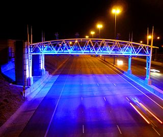
e-toll consisted of the electronic toll collection (ETC) processes employed by South Africa's roads agency SANRAL on selected toll roads or toll lanes in the Gauteng province, subject to the Sanral Act of 1998. SANRAL derives its income both from toll income and the national fiscus, while initial capital outlay for large projects are funded by open market bond issues. In total SANRAL manages 13,000 km of non-toll roads in South Africa, besides the majority of its toll roads, including 187 km of Gauteng's freeways which were subject to e-toll.
The 2016 Johannesburg flood was a natural disaster in South Africa that took place on 9 November 2016. The flooding, which occurred in the area east of Johannesburg, affected both Johannesburg and Ekurhuleni. The storm and flash floods caused significant damage to the township of Alexandra, while the suburb of Buccleuch was declared a disaster area. The flooding was caused by a significant cloud burst from a convective system.
The M37 is a metropolitan route in Greater Johannesburg, South Africa. It connects the N3 at Greenstone Shopping Mall with Katlehong via Edenvale and Germiston.
The M39 is a long metropolitan route in Greater Johannesburg, South Africa. It connects Kyalami with Germiston via Midrand, Kempton Park & Isando.

