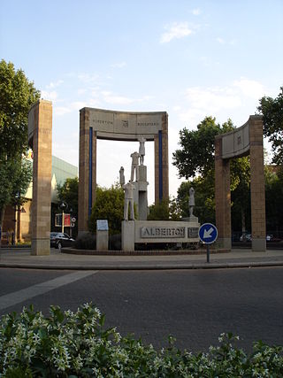
Alberton is a city situated on the southern part of the East Rand of the Gauteng Province in South Africa and is situated very close to the major urban centre of Johannesburg.

Northcliff is a wealthy residential suburb of Johannesburg, South Africa. The suburb is located on Northcliff Ridge which provides views to both the north and the south. Northcliff's huge homes are nestled around a steep incline of the hill, and on the foot of Northcliff borders the suburbs of Fairland, Blackheath, Cresta and Berario. Recently some streets have been secured with boom gates. Although erroneously included by Google Maps as part of Randburg, Northcliff has never been part of Randburg. It is located in Region B of the City of Johannesburg Metropolitan Municipality.
Mondeor is a suburb of Johannesburg, South Africa. It is located in Region F of the City of Johannesburg Metropolitan Municipality. Known as the Jewel of the South, Mondeor is set amongst hills outside the urban Johannesburg area but is only a 15-minute drive from the city centre.
Ophirton is a suburb of Johannesburg, South Africa. This industrial suburb lies three kilometers to south-west of the Johannesburg CBD. It is located in Region F of the City of Johannesburg Metropolitan Municipality.
Regents Park is a suburb of Johannesburg, South Africa. The suburb is found north of The Hill. It is located in Region F of the City of Johannesburg Metropolitan Municipality.
South Hills is a suburb of Johannesburg, South Africa. Also known as Suidheuwels in Afrikaans, it is about 20 minutes drive from Johannesburg Central. It is located in Region F of the City of Johannesburg Metropolitan Municipality.
The Hill is a suburb of Johannesburg, South Africa. The area lies to the south of the Johannesburg CBD and is surrounded by the suburbs of Regents Park, Rosettenville and Linmeyer. It is located in Region F of the City of Johannesburg Metropolitan Municipality.
Chrisville is a suburb of Johannesburg, South Africa. It is located in Region F of the City of Johannesburg Metropolitan Municipality. A large part of the suburb is currently taken up by a mine dump.
Bordeaux is a suburb of Johannesburg, South Africa. Found north of the Johannesburg CBD, it is next to the suburbs of Ferndale, Blairgowrie and Hurlingham. It is located in Region B of the City of Johannesburg Metropolitan Municipality.
Cheltondale is a suburb of Johannesburg, South Africa. It is located in Region E of the City of Johannesburg Metropolitan Municipality.
Benrose is a suburb of Johannesburg, South Africa. Slightly south of the Johannesburg CBD, it is next door to Jeppestown and Belgravia. It is light industry and commercial suburb. It is located in Region F of the City of Johannesburg Metropolitan Municipality.
Berea is an inner city neighbourhood of Johannesburg, in the South African province of Gauteng. It is east and adjacent to the Johannesburg CBD. It is located in Region F of the City of Johannesburg Metropolitan Municipality.
Malvern is a suburb of Johannesburg, South Africa. Situated east of the Johannesburg CBD, it lies south of Kensington and north of the industrial suburb of Denver. It is located in Region F of the City of Johannesburg Metropolitan Municipality and lies just west of Bedfordview in the City of Ekurhuleni Metropolitan Municipality.
Parkview is a suburb of Johannesburg, South Africa. It borders the suburb of Greenside and overlooks Zoo Lake, a park which lies on the opposite side of Jan Smuts Avenue from the Johannesburg Zoo. All of its streets are named after Irish counties. Parkview, established more than a century ago, is one of the oldest suburbs in Johannesburg, and much of its historic architecture remains intact. The Alliance Française in Johannesburg is situated in Parkview.
Observatory is a Suburb in Johannesburg's east and is located in Region E of the City of Johannesburg Metropolitan Municipality; it borders the suburbs of Houghton Estate, Cyrildene, Linksfield, Bellevue, Bellevue East and Dewetshof.
Morningside is a commercial and residential suburb of Johannesburg, South Africa, located in Region E of the City of Johannesburg Metropolitan Municipality. As a part of the former Sandton municipality, it constitutes many affluent residential areas as well as small and medium business enterprises, clinics, schools, hotels and shopping centres.
Waverley is a suburb of Johannesburg, South Africa. A suburb in northern Johannesburg, it is surrounded by Bramley, Highlands North and Savoy Estate. It is located in Region E of the City of Johannesburg Metropolitan Municipality. Waverley is located close to the M1 highway, running North and South through Johannesburg.
Linksfield is a suburb of Johannesburg, South Africa. It is a suburb lying north-east of the Johannesburg CBD and is surrounded southerly by Linksfield Ridge, easterly by Linksfield North and Bedford, St Andrews and Senderwood. Linksfield itself is located in Region E of the City of Johannesburg Metropolitan Municipality. On the southerly side and over the ridge are the areas of Cyrildene, Observatory and Morninghill, but these suburbs are not visible to Linksfield as they are hidden behind the Linksfield Ridge.
Bezuidenhout Valley is a suburb of Johannesburg, South Africa. The area lies to the east of the Johannesburg CBD and is surrounded by the suburbs of Kensington to the south and Observatory to the north. It is located in Region E of the City of Johannesburg Metropolitan Municipality. It is colloquially known as the Bez Valley.
Boysens is a suburb of Johannesburg, South Africa, located around 3.2 km southwest of city hall.


