This article needs additional citations for verification .(December 2023) |
Vosloorus | |
|---|---|
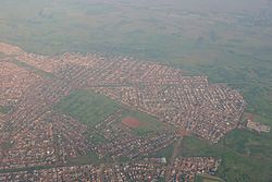 Aerial view of Vosloorus | |
 Vosloorus  Vosloorus  Vosloorus | |
| Coordinates: 26°21′30″S28°12′27″E / 26.35833°S 28.20750°E | |
| Country | South Africa |
| Province | Gauteng |
| Municipality | Ekurhuleni |
| Main Place | Boksburg |
| Area | |
• Total | 32.10 km2 (12.39 sq mi) |
| Population (2011) [1] | |
• Total | 163,216 |
| • Density | 5,085/km2 (13,170/sq mi) |
| Racial makeup (2011) | |
| • Black African | 99.3% |
| • Coloured | 0.3% |
| • Indian/Asian | 0.2% |
| • White | 0.1% |
| • Other | 0.1% |
| First languages (2011) | |
| • Zulu | 46.8% |
| • Sotho | 18.0% |
| • Xhosa | 8.2% |
| • Northern Sotho | 7.3% |
| • Other | 19.7% |
| Time zone | UTC+2 (SAST) |
| Postal code (street) | 1475 |
| PO box | 1486 |
Vosloorus is a large township situated south of Boksburg and just east of Katlehong in Ekurhuleni, just 30 kilometres south-east of Johannesburg, Gauteng, South Africa. It was established in 1963 when Black Africans were removed from Stirtonville [2] because it was considered by the government too close to a white town. Stirtonville, renamed Reiger Park, has since become home to Boksburg's coloured community. A local authority was established in 1983 when Vosloorus was given full municipal status.
