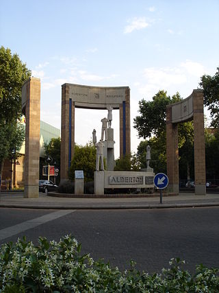
Alberton is a city situated on the southern part of the East Rand of the Gauteng Province in South Africa and is situated very close to the major urban centre of Johannesburg.

Rosebank is a cosmopolitan commercial and residential suburb to the north of central Johannesburg, South Africa. It is located in Region B of the City of Johannesburg Metropolitan Municipality, and is the location of a Gautrain station.
Meadowlands is a suburb of Soweto, Gauteng Province, South Africa. It was founded in the early 1950s during the apartheid era for black residents from Sophiatown.
Lenasia, often called Lenz, is a suburb south of Soweto in the Gauteng province, South Africa, originally created to house Indians. It is part of the City of Johannesburg Metropolitan Municipality. Lenasia is approximately 35 kilometres southwest of the Johannesburg Central Business District and 45 kilometres south of the Sandton Central Business District.

The suburbs of Johannesburg are officially demarcated areas within the City of Johannesburg Metropolitan Municipality, South Africa. As in other Commonwealth countries, the term suburb refers to a "neighbourhood", although in South Africa as most "suburbs" have legally recognised borders and often separate postal codes. The municipal functions for the area, such as municipal policing and social services, are still managed by the city government.
Florida is a location in Gauteng province, South Africa. It is located about 16 kilometres west of Johannesburg. The area which is referred to as Florida was originally established as the farm Vogelstruisfontein. Today, it is a suburb of Roodepoort.

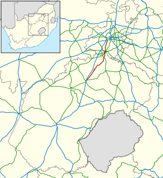
The R82 is a provincial route in South Africa that connects Johannesburg with Kroonstad via Vereeniging and Sasolburg. It starts just south of the M1 Johannesburg Municipal Highway's interchange with the N12 Southern Bypass, going south, meeting the R59, R54, R42 & R28 routes at Vereeniging before crossing the Vaal River into the Free State & proceeding to Kroonstad. It is an alternative, but longer route to the N1 National Route between Johannesburg & Kroonstad.
Auckland Park is a suburb of Johannesburg, South Africa. It lies on a gentle slope, and is in close proximity to the suburbs of Melville, Brixton, Westdene and Richmond. Auckland Park is one of the few suburbs close to the Johannesburg city centre that has remained largely unaffected by the recent migration of Johannesburg residents to the city's northern suburbs. Auckland Park is home to a mix of nationalities and cultures, and the suburb is well known as the location of the South African Broadcasting Corporation headquarters.
Johannesburg North is a suburb of Johannesburg, South Africa. It is located in Region C of the City of Johannesburg Metropolitan Municipality.
Abbotsford is a suburb of Johannesburg, South Africa. This suburb lies north-east of the Johannesburg CBD next to Oaklands, Highlands North and Melrose. It is located in Region E of the City of Johannesburg Metropolitan Municipality.
Fellside is a suburb of Johannesburg, South Africa. It is a small suburb located north-east of the city centre with Orange Grove to its north, south and east, with Houghton Estate to its west. It is located in Region E of the City of Johannesburg Metropolitan Municipality.
Houghton Estate, often simply called Houghton is an affluent suburb of Johannesburg, South Africa, north-east of the city centre.
Killarney is a suburb of Johannesburg, South Africa. A relatively wealthy area, located west of the M1 freeway, Killarney is a densely built-up area, and it has numerous apartment blocks, as well as a large shopping mall, Killarney Mall.
Orange Grove is a suburb of Johannesburg, South Africa. It is located in Region E of the City of Johannesburg Metropolitan Municipality.
Doornfontein is an inner-city suburb of Johannesburg, South Africa, located to the east of the city centre, Region 8.

Braamfontein is a central suburb of Johannesburg, in South Africa, seat of the Constitutional Court of South Africa and some of South Africa's major corporations such as Liberty Holdings Limited, JD Group, Sappi, Bidvest Bank and Hollard. Situated due north of the city centre, Braamfontein is the fourth-largest office node in the city of Johannesburg containing many multi-storied buildings representing various architectural styles including Art Deco and Brutalist. Numerous office buildings have and are in the process of being converted to residential apartments. The offices of the Johannesburg City Council and the University of the Witwatersrand are situated in Braamfontein. The Nelson Mandela Bridge is a landmark that connects Braamfontein to the city centre, traversing South Africa's most extensive passenger train marshalling yard. Jan Smuts Avenue and Empire Road are two major road thoroughfares that run through the suburb.

Emmarentia Dam is a dam in Emmarentia, Johannesburg, South Africa. There are several dams that make up Emmarentia Dam, despite its allusion to the singular, with two small dams found upstream in the Johannesburg Botanical Gardens.
Linksfield is a suburb of Johannesburg, South Africa. It is a suburb lying north-east of the Johannesburg CBD and is surrounded southerly by Linksfield Ridge, easterly by Linksfield North and Bedford, St Andrews and Senderwood. Linksfield itself is located in Region E of the City of Johannesburg Metropolitan Municipality. On the southerly side and over the ridge are the areas of Cyrildene, Observatory and Morninghill, but these suburbs are not visible to Linksfield as they are hidden behind the Linksfield Ridge.
Claremont is a suburb of Johannesburg, South Africa, around 9 km west-northwest of City Hall. Under the old municipal borders, it was one of the westernmost suburbs of the city and bordered Roodepoort.
Denver is an industrial suburb in eastern Johannesburg, South Africa, on the railway to Germiston and Hoofrif Road, around 6 km east of City Hall. It borders Benrose to the west, Jeppestown and Malvern to the north, Cleveland to the east, and the François Oberholzer Freeway to the south. Just a small portion of the suburb in the northwest has residential zoning; otherwise, Denver consists of industrial land and squatter camps both in the west and up north, the latter largely on Hoofrif Road.


