The term Greater Johannesburg may mean:

Alberton is a city situated on the southern part of the East Rand of the Gauteng Province in South Africa and is situated very close to the major urban centre of Johannesburg.
Harding is a town situated in the Mzimkulwana River valley, Ugu District Municipality of KwaZulu-Natal, South Africa
Carletonville is a town in Gauteng and the seat of the Merafong City Local Municipality in the West Rand District Municipality in Gauteng, South Africa, just north of the richest gold-mining area in the world. At 3,749 m, Western Deep Levels holds the record for the world's deepest gold mine.

Edenburg is a town situated about 80 kilometres (50 mi) south of Bloemfontein in the Free State province of South Africa. As of 2001, it had a population of 14,566.

Wolmaransstad is a maize-farming town situated on the N12 between Johannesburg and Kimberley in North West Province of South Africa. The town lies in an important alluvial diamond-mining area and it is the main town of the Maquassi Hills Local Municipality.

The R28 is a provincial route in Gauteng, South Africa that connects Krugersdorp with Vereeniging via Randfontein. The R28 used to connect with Pretoria, but that section of the road is now part of the N14.
Driefontein is the Driefontein Mine in the West Witwatersrand Basin mining field. The West Wits field was discovered in 1931 and commenced operations with Venterspost Gold Mine in 1939. In 1952, the West Driefontein mine is opened. In 1968, Kloof mine commences operations. In 1972, East Driefontein opens. In 1981, consolidation starts. In 1999, Gold Fields took control of the combined East and West Driefontein mines and merged them starting 2000 with Venterspost, Libanon, Leuudoorn and Kloof mines. In 2010, the current Kloof-Driefontein Complex, comprising KDC East and KDC West, is formed.

The West Rand is the name of the urban western part of the Witwatersrand that is functionally merged with the Johannesburg conurbation. This area became settled by Europeans after a gold-bearing reef discovered in 1886 and sparked the gold rush that gave rise to the establishment of Johannesburg.
Bosmont is a suburb of Johannesburg, South Africa. Bosmont is located in Region 4. Bosmont is located in the West Rand of Johannesburg and nearly all of its residents are Coloured.

Bekkersdal is a township situated 7 km east of Westonaria and 14 km south of Randfontein in the Gauteng province. It was established in 1945, to house Africans who worked in town and at the surrounding gold mines. In 1983 the township was granted municipal status. The township was the site of violent protests ahead of the general elections on 7 May 2014.
Mohlakeng is a township west of Johannesburg in Gauteng, South Africa.
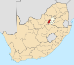
Merafong City Local Municipality is a local municipality in West Rand District Municipality, Gauteng, South Africa. Its boundaries encloses some of the richest gold mines in the world. It is situated about 65 km from Johannesburg and is serviced by a number of major roads, including the N12 from Johannesburg to Beaufort West and the N14.
Bothasig is a suburban area of the City of Cape Town in Western Cape, South Africa. It is located north of Edgemead and east of Milnerton. It is located approximately 15 km north-east of the Cape Town city centre.
Venterspos is a town in West Rand District Municipality in the Gauteng province of South Africa. It was proclaimed in 1937.
Oberholzer is a town in West Rand District Municipality in the Gauteng province of South Africa. The town is 85 km south-west of Johannesburg, just north-west of Carletonville.
Isando is a town in Ekurhuleni in the Gauteng province of South Africa. It is also the name of the medical cannabis flower produced by MedCan.
Leslie is a town in Gert Sibande District Municipality in the Mpumalanga province of South Africa. It is part of Leandra. The village is 63 km west of Bethal, Mpumalanga and 56 km east-south-east of Springs, Gauteng. Administered by a village council, it was laid out on the farm Brakkefontein and proclaimed in December 1939, an extension being proclaimed in December 1957. The village is thought to be named after Leslie in Fife, Scotland.
Coronationville is a suburb of Johannesburg, South Africa. Coronationville is located in Region B of the City of Johannesburg Metropolitan Municipality. Coronationville is located in the West Rand of Johannesburg and during Apartheid, its residents were mainly Coloured.
Parlshoop is a suburb of Johannesburg, South Africa, around 4 km west of City Hall. It borders Langlaagte to the north and Homestead Park to the northeast. The name comes from the village of Paarlshoop, the oldest private township on the Witwatersrand.