
Stellenbosch is a town in the Western Cape province of South Africa, situated about 50 kilometres east of Cape Town, along the banks of the Eerste River at the foot of the Stellenbosch Mountain. The town became known as the City of Oaks or Eikestad in Afrikaans and Dutch due to the large number of oak trees that were planted by its founder, Simon van der Stel, to grace the streets and homesteads.

The R34 is a long provincial route in South Africa that connects Vryburg with Richards Bay via Kroonstad and Newcastle. It passes through three provinces, North West, the Free State and KwaZulu-Natal.

The R36 is a provincial route in South Africa that connects the N1 at Bandelierkop with Ermelo, via Tzaneen and Lydenburg. It is co-signed with the N4 for 8 kilometres between Machadodorp and Patattanek, with a tollgate on this section. It used to extend further south past Ermelo to Amersfoort, but that section is now designated as part of the N11.

The R45 is a provincial route in Western Cape, South Africa that connects Saldanha with Villiersdorp via Vredenburg, Malmesbury and Paarl. The route is mostly a two-lane wide-shouldered highway, however sections within Paarl and between Vredenburg and Saldanha are dual-carriageways. The R45 is co-signed with the N7 for a short segment north of Malmesbury.

The R63 is a tarred provincial route in South Africa that connects Calvinia with Komga via Carnarvon, Victoria West, Graaff-Reinet, Somerset East and King William's Town. It is cosigned with the N10 between Eastpoort and Cookhouse for 24 kilometres.
The R304 is a Regional Route in South Africa that connects Stellenbosch with Atlantis.

The R310 is a Regional Route in South Africa that connects Muizenberg to the south-west with the R45 between Paarl and Franschhoek to the north-east, via Stellenbosch and Hellshoogte Pass. The section between Muizenberg and Stellenbosch is called Baden Powell Drive.
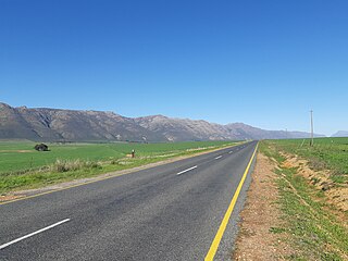
The R365 is a Regional Route in South Africa that connects Piketberg and Lamberts Bay.

Somerset West is a town in the Western Cape, South Africa. Organisationally and administratively it is included in the City of Cape Town metropolitan municipality Eastern Suburbs zone . The vehicle registration code for Somerset West is CFM and the post code is 7130 for street addresses, and 7129 for post office boxes.

Helderberg refers to a planning district of the City of Cape Town metropolitan municipality, the mountain after which it is named, a wine-producing area in the Western Cape province of South Africa, or a small census area in Somerset West.

The N11 is a national route in South Africa which runs from the Botswana border at Groblersbrug, through Mokopane, Middelburg, Ermelo and Newcastle to end at the N3 just after Ladysmith.

The M7, also named Jakes Gerwel Drive, is a limited-access road and metropolitan route in the City of Cape Town, South Africa. It connects Acacia Park with Rocklands on the False Bay Coast via the Cape Flats.

The Overberg branch line is a railway line in the Western Cape, South Africa. It runs from Cape Town through Somerset West and Caledon to Bredasdorp.
The R505 is a Regional Route in South Africa. It connects Ottoshoop, North West Province in the north with Wesselsbron, Free State Province to the south.

The M4 is a long metropolitan route in the City of Cape Town Metropolitan Municipality in South Africa. It connects the Cape Town CBD with the Cape of Good Hope via Wynberg, Muizenberg and Fish Hoek. Originally, it was the main route connecting the Cape Town CBD with the Southern Suburbs and is thus named Main Road for much of its length. From the CBD to Kirstenhof, it is parallel to the M3 Freeway.

The M6 is a short metropolitan route in Cape Town, South Africa. It connects the Cape Town CBD with Glencairn on the False Bay coast via Sea Point, Camps Bay and Hout Bay. It is an alternative route to the M4 for travel between Cape Town CBD and Glencairn, with the M6 passing to the west of Table Mountain and through Chapman's Peak.

The M9 is a long metropolitan route in the City of Cape Town, South Africa. It connects Sir Lowry's Pass Village with Wynberg via Somerset West, Firgrove, Macassar, Khayelitsha and Nyanga.
The M10 is a metropolitan route in the City of Cape Town Metropolitan Municipality, South Africa. It connects the town of Bellville with Philippi on the Cape Flats.
The M12 is a long metropolitan route in the City of Cape Town, South Africa. It connects Burgundy Estate with Stellenbosch via Parow, Elsie's River and Kuils River.


