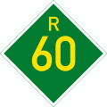
Route
The R60 begins in the north-eastern part of Worcester at a junction with the N1 national route. It begins by heading southwards as High Street to reach a junction in Worcester Central, where it becomes Robertson Road towards the south-east. It heads south-east for 47 kilometres, bypassing Zweletemba, following the Breede River and the Langeberg mountain range, to pass through the town of Robertson and meet the northern terminus of the R317 route next to the Robertson Airfield. [1]
From Robertson, the R60 heads eastwards for 17 kilometres to pass through the town of Ashton and meet the western terminus of the R62 road (Cogmanskloof Pass), where the R60 turns to the south-east. It continues following the Breede River and the Langeberg mountain range south-east for 45 kilometres, bypassing Zolani, to reach its end at a junction with the N2 national route south-west of the town centre of Swellendam. [1]
This page is based on this
Wikipedia article Text is available under the
CC BY-SA 4.0 license; additional terms may apply.
Images, videos and audio are available under their respective licenses.


