Robertson, South Africa

Last updated

Robertson
NG Kerk, Robertson. Founded in 1853. 02.jpg
Robertson City Hall & Municipality. Church Street. 01.jpg
NG Kerk, Robertson. Founded in 1853. 59 Paul Kruger Street..jpg
Robertson, Western Cape.jpg
Druid's Lodge, Robertson Museum. Built in 1860. Collapsed in August 2014 during renovations. 01.jpg
Clockwise from top: View of Robertson, Dutch Reformed Church, Druid's Lodge, Robertson in 1987, Robertson Town Hall
South Africa Western Cape location map.svg
Red pog.svg
Robertson
South Africa adm location map.svg
Red pog.svg
Robertson
Coordinates: 33°48′S19°53′E / 33.800°S 19.883°E / -33.800; 19.883
Country South Africa
Province Western Cape
District Cape Winelands
Municipality Langeberg
Established1853 [1]
Area
[2]
  Total21.2 km2 (8.2 sq mi)
Population
 (2011) [2]
  Total9,355
  Density440/km2 (1,100/sq mi)
Racial makeup (2011)
[2]
   Black African 7.1%
   Coloured 48.3%
   Indian/Asian 0.5%
   White 42.5%
  Other1.6%
First languages (2011)
[2]
   Afrikaans 89.3%
   Xhosa 0.9%
   English 7.1%
  Other2.7%
Time zone UTC+2 (SAST)
Postal code (street)
6705
PO box
6705
Area code 023
Website robertsonr62.com

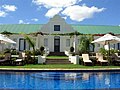
Robertson is a town in the Western Cape Province of South Africa, known as the valley of wine and roses, at the heart of the wine route - Route 62. [3] [4]

Contents

Founded in 1853 and named after Dr William Robertson  [ af ], a Scottish Dutch Reformed Church minister. [5] :302

Situated in the fertile Robertson Valley, farming and wagon building were the town's original industries. However, after the Second Anglo-Boer War of 1899, the wagon building industry collapsed when the railways took over the transport of all goods.

Robertson subsequently became famous for its ostrich farming, but this industry collapsed as well shortly after World War I, and the farmers of the area turned to wine and fruit farming. Later, several successful racehorse stud farms were founded. Agriculture remains the mainstay of the town's economy.

Tourism

Tourism has grown in recent years and the town has several Western Cape provincial heritage sites, such as the Pink Church (1859), the Museum (1860), the Edwardian-style house 12 Piet Retief Street (1904), the Victorian-style house at 59 Van Reenen Street (1914), and the Powder House (used as a store for gunpowder).

Robertson has a population of over 20,000 civilians

Skydiving at Robertson

Western Province Sport Parachute Club (WPSPC) - Skydive Robertson, founded in 1972, is the oldest remaining skydiving club in South Africa. In July 2008, the club relocated to Robertson. [6]

WPSPC operates from Robertson Airfield on weekends and public holidays and facilitates tandem skydiving and student training, and provides a facility for sports skydivers.

The 2011 South African National Skydiving Championships was hosted by Skydive Robertson and held at Robertson Airfield. This is the first time the national skydiving championships has been held in the Western Cape. [7]

Robertson Airfield

Robertson Airfield is an unmanned airfield, with a 1 600 meter asphalt runway, situated 1 km to the east of Robertson.


Related Research Articles

<span class="mw-page-title-main">Cape Town</span> Legislative capital of South Africa

Cape Town is the legislative capital of South Africa. It is the country's oldest city and the seat of the Parliament of South Africa. It is the country's second-largest city, after Johannesburg, and the largest in the Western Cape. The city is part of the City of Cape Town metropolitan municipality.

<span class="mw-page-title-main">Eastern Cape</span> Province in South Africa

The Eastern Cape is one of the nine provinces of South Africa. Its capital is Bhisho, but its two largest cities are East London and Gqeberha. Due to its climate and nineteenth century towns, it is a common location for tourists. It is also known for being home to many anti-apartheid activists, the most famous being Nelson Mandela hailing from the province.

<span class="mw-page-title-main">Paarl</span> Town in Western Cape, South Africa

Paarl is a town with 285,574 inhabitants in the Western Cape province of South Africa. It is the third-oldest European settlement in the Republic of South Africa and the largest town in the Cape Winelands. Due to the growth of the Mbekweni township, it is now a de facto urban unit with Wellington. It is situated about 60 kilometres (37 mi) northeast of Cape Town in the Western Cape Province and is known for its scenic environment and viticulture and fruit-growing heritage.

<span class="mw-page-title-main">Stellenbosch</span> Town in Western Cape, South Africa

Stellenbosch is a town in the Western Cape province of South Africa, situated about 50 kilometres east of Cape Town, along the banks of the Eerste River at the foot of the Stellenbosch Mountain. The town became known as the City of Oaks or Eikestad in Afrikaans and Dutch due to the large number of oak trees that were planted by its founder, Simon van der Stel, to grace the streets and homesteads.

<span class="mw-page-title-main">Petrus Steyn</span> Place in Free State, South Africa

Petrus Steyn, is a small farming town between Tweeling and Kroonstad, 35 km north-east of Lindley in the Free State province of South Africa. It is at the centre of an agricultural area known for wheat, maize, sunflower, potato, cattle, hunting, sheep production and forms part of the breadbasket in the Free State. It is the highest town above sea level in the Free State. In 2012 the town's name was changed to Mamafubedu. Farming industries in Mamafubedu provide potatoes worldwide.

<span class="mw-page-title-main">Rustenburg</span> City in North West province, South Africa

Rustenburg is a city at the foot of the Magaliesberg mountain range. Rustenburg is the most populous city in North West province, South Africa. In 2017, the city's Gross Domestic Product (GDP) reached ZAR 63.8 billion, accounting for 21.1% of the GDP of the North West Province, and 1.28% of the GDP of South Africa. Rustenburg was one of the official host cities of the 2010 FIFA World Cup, being in close proximity to Phokeng, the capital of the Royal Bafokeng Nation, where the Royal Bafokeng Stadium is located. The England national football team also used this as their base camp for the tournament.

<span class="mw-page-title-main">Oudtshoorn</span> Place in Western Cape, South Africa

Oudtshoorn is a town in the Western Cape province of South Africa, located between the Swartberg mountains to the north and the Outeniqua Mountains to the south. Dubbed the "ostrich capital of the world", Oudtshoorn is known for its ostrich-feather booms, during 1865–1870 and 1900–1914. With approximately 60,000 inhabitants, it is the largest town in the Little Karoo region. The town's economy is primarily reliant on the ostrich farming and tourism industries. Oudtshoorn is home to the world's largest ostrich population, with a number of specialised ostrich breeding farms, such as the Safari Show Farm and the Highgate Ostrich Show Farm, as told by Mnr. Pierre D. Toit.

Route 62 is a tourist route in South Africa that meanders between Cape Town, Oudtshoorn, the Garden Route, and Gqeberha, offering the scenic alternative to the N2 highway. Route 62 is named for the R62 provincial route, which it follows from Montagu to Humansdorp, but the tourist route extends further along other highways to Cape Town and Gqeberha.

<span class="mw-page-title-main">Worcester, South Africa</span> Town in Western Cape, South Africa

Worcester is a town in the Western Cape, South Africa. It is the third-largest city in the western cape province of South Africa. It is located 120 kilometres (75 mi) north-east of Cape Town on the N1 highway north to Johannesburg.

<span class="mw-page-title-main">Durbanville</span> Town in Western Cape, South Africa

Durbanville, previously called Pampoenkraal, is a town in the Western Cape province of South Africa, part of the greater Cape Town metropolitan area. Durbanville is a semi-rural residential suburb on the north-eastern outskirts of the metropolis surrounded by farms producing wine and wheat.

<span class="mw-page-title-main">Elgin, South Africa</span> Region in the Western Cape, South Africa

Elgin is a large, lush area of land, circled by mountains, in the Overberg region of South Africa. This broad upland valley lies about 70 km southeast of Cape Town, just beyond the Hottentots Holland Mountains.

<span class="mw-page-title-main">McGregor, South Africa</span> Place in Western Cape, South Africa

McGregor is a small village in the mountains of the Western Cape, South Africa. It is roughly 150 km east of Cape Town. It is located in Ward 5 of the Langeberg Municipality. According to the Census 2001, this Ward has a population of 10,254 people.

Moruya Airport is an airport located 3.5 NM northeast of Moruya, New South Wales, Australia, at the mouth of the Moruya River. It is one of two airports with regular passenger flights in the state's South Coast region, but also caters to general aviation and tourism operators, as well as emergency services.

<span class="mw-page-title-main">Grabouw</span> Town in Western Cape, South Africa

Grabouw is a town located in the Western Cape province of South Africa. Grabouw is located some 65 km south-east of Cape Town, over Sir Lowry's Pass from Somerset West, along the N2 highway.The town is the commercial centre for the vast Elgin Valley, the largest single export fruit-producing area in Southern Africa, which extends between the Hottentots-Holland, Kogelberg, Groenland, and Houwhoek Mountains. The town's population has grown rapidly, with 44 593 people in 2019 from 21 593 as listed by the 2001 census.

<span class="mw-page-title-main">Parachute Association of South Africa</span>

The Parachute Association of South Africa (PASA) manages the sports of parachuting and skydiving in South Africa on behalf of the South African Civil Aviation Authority.

<span class="mw-page-title-main">The Ranch Resort</span> Multi-purpose centre in South Africa

The Ranch Resort is a leisure complex in the Capricorn District of the Limpopo Province.

<span class="mw-page-title-main">Economy of the Western Cape</span>

The economy of the Western Cape in South Africa is dominated by the city of Cape Town, which accounted for 72% of the Western Cape's economic activity in 2016. The single largest contributor to the region's economy is the financial and business services sector, followed by manufacturing. Close to 30% of the gross regional product comes from foreign trade with agricultural products and wine dominating exports. High-tech industries, international call centres, fashion design, advertising and TV production are niche industries rapidly gaining in importance.

The Western Province Sport Parachute Club (WPSPC) provides a facility for sports skydiving and student training and is operated and managed on a volunteer basis by a committee elected by its members. The club is a not-for-gain body corporate under common law.

Robertson Airfield, licensed according to South African Civil Aviation Authority standards, is an unmanned municipal airport situated 1 km to the east of the Western Cape town of Robertson in South Africa.

<span class="mw-page-title-main">Mother City SkyDiving - Cape Town</span> Sports skydiving drop zone

Mother City SkyDiving - Cape Town is a sports skydiving drop zone licensed by the Parachute Association of South Africa (PASA) and the South African Civil Aviation Authority (CAA).

References

  1. Robson, Linda Gillian (2011). "Annexure A" (PDF). The Royal Engineers and settlement planning in the Cape Colony 1806–1872: Approach, methodology and impact (PhD thesis). University of Pretoria. pp. xlv–lii. hdl:2263/26503.
  2. 1 2 3 4 Sub Place Robertson from Census 2011.
  3. SA-Venues.co.za, retrieved 18 February 2012
  4. SA-Route62.co.za, retrieved 18 February 2012
  5. Joyce, Peter (1989). The South African family encyclopaedia. Internet Archive. Cape Town : Struik Publishers. ISBN   978-0-86977-887-6.
  6. PASA Toggle Times Newsletter, Retrieved 19 February 2012
  7. Robertson Tourism website, Retrieved 19 February 2012