
Cape Town is the oldest and second largest city in South Africa, after Johannesburg, and also the seat of the Parliament of South Africa.

The Western Cape is a province of South Africa, situated on the south-western coast of the country. It is the fourth largest of the nine provinces with an area of 129,449 square kilometres (49,981 sq mi), and the third most populous, with an estimated 7 million inhabitants in 2020. About two-thirds of these inhabitants live in the metropolitan area of Cape Town, which is also the provincial capital. The Western Cape was created in 1994 from part of the former Cape Province. The two largest cities are Cape Town and George.

Philippolis is a town in the Free State province of South Africa. The town is the birthplace of many South African celebrities including the writer and intellectual Sir Laurens van der Post, actress Brümilda van Rensburg, writer and poet, Terry Terblanche Botha and Springboks rugby player Adriaan Strauss. It is regarded as one of the first colonial settlements in the Free State.

Drakenstein Municipality is a local municipality located within the Cape Winelands District Municipality, in the Western Cape province of South Africa. As of 2011 it had a population of 251,262. Its municipality code is WC023.

Wynberg is a southern suburb of the City of Cape Town in Western Cape, South Africa. It is situated between Plumstead and Kenilworth, and is a main transport hub for the Southern Suburbs of Cape Town.

Hankey is a small town on the confluence of the Klein and Gamtoos rivers in South Africa. It is part of the Kouga Local Municipality of the Sarah Baartman District in the Eastern Cape.
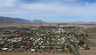
Porterville is a town in the Western Cape province of South Africa.
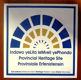
Provincial heritage sites in South Africa are places that are of historic or cultural importance within the context of the province concerned and which are for this reason declared in terms of Section 28 of the National Heritage Resources Act (NHRA) or legislation of the applicable province. The designation was a new one that came into effect with the introduction of the Act on 1 April 2000 when all former national monuments declared by the former National Monuments Council and its predecessors became provincial heritage sites as provided for in Section 58 of the Act.

Matjiesfontein is a settlement in Central Karoo District Municipality in the Western Cape province of South Africa.

Redelinghuys is a village in the Bergrivier Local Municipality in the Western Cape province of South Africa, located about 160 kilometres (100 mi) north of Cape Town on the Verlorevlei River. The 2001 Census recorded the population as 581 people in 167 households. The village is situated on the R366 regional route between Piketberg and Elands Bay. It is served by a police station, a public library, a satellite health clinic, and two primary schools.

Leeu-Gamka is a small town in the Western Cape province of South Africa, located 355 kilometres (221 mi) north-east of Cape Town in the Karoo.

Keimoes is a town in the Northern Cape province of South Africa. It lies on the Orange River and is about halfway between Upington and Kakamas.

The economy of the Western Cape in South Africa is dominated by the city of Cape Town, which accounts for 72% of the Western Cape's economic activity in 2016. The single largest contributor to the region's economy is the financial and business services sector, followed by manufacturing. Close to 30% of the gross regional product comes from foreign trade with agricultural products and wine dominating exports. High-tech industries, international call centres, fashion design, advertising and TV production are niche industries rapidly gaining in importance.

Heritage Western Cape (HWC) is a provincial heritage resources authority established by the Minister of Cultural Affairs and Sport of the government of the Western Cape province in South Africa. It is a public entity set up under the terms of the National Heritage Resources Act. It is mandated to care for that part of South Africa's national estate that is of provincial and local significance in the Western Cape. It may delegate responsibility for heritage resources of local significance to competent municipal governments.

The National Monuments Council (NMC) was the national heritage conservation authority of South Africa, and therefore also of Namibia, during the major part of the apartheid era. It was the successor body to the Historical Monuments Commission and became known principally for its declaration of several thousand national monuments. It came into being through the promulgation of the National Monuments Act of 1969 and ceased to exist on 31 March 2000 when it was replaced by SAHRA and the provincial heritage resources authorities established in terms of the National Heritage Resources Act of 1999.
A provincial heritage resources authority (PHRA) is a government agency established at provincial level in South Africa and is responsible for the management of immovable heritage. In some instances, they are also responsible for moveable heritage, interpretation centres and museums.
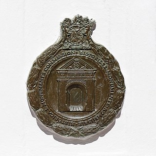
The Historical Monuments Commission (HMC) was the national heritage conservation authority of South Africa from 1923 to 1969. The HMC was the first such body to be established in South Africa and was the predecessor of the National Monuments Council and therefore also of SAHRA and South Africa's provincial heritage resources authorities. From 1934 onwards the Commission became known principally for its declaration of several hundred historical monuments, later known as 'national monuments' and today as provincial heritage sites.

The Cenotaph is a war memorial on Heerengracht Street in Cape Town. The city's annual Remembrance Day ceremonies are held there. It is classified as a public memorial and as such is subject to protection in terms of heritage legislation administered by Heritage Western Cape, the provincial heritage resources authority of the Western Cape province of South Africa.

Hawthorndon House is a double-storeyed house on Herschel Walk in the suburb of Wynberg in Cape Town, South Africa. The house likely dates from 1683, but was substantially rebuilt in the French Victorian style in 1881 by a Capt. John Spence. It was bought by the Randlord Sir J.B. Robinson in 1891 and was where he lived until his death in 1927. Count Natale Labia, grandson of J.B. Robinson, donated Hawthornden to what is now the Government of the Western Cape Province in 1978, but will continue to live there during his lifetime.


