
Afrikaner Calvinism is a cultural and religious development among Afrikaners that combined elements of seventeenth-century Calvinist doctrine with a "chosen people" ideology based in the Bible. It had origins in ideas espoused in the Old Testament of the Jews as the chosen people.

The Orange Free State was an independent Boer sovereign republic under British suzerainty in Southern Africa during the second half of the 19th century, which ceased to exist after it was defeated and surrendered to the British Empire at the end of the Second Boer War in 1902. It is one of the three historical precursors to the present-day Free State province.

Khoekhoe are the traditionally nomadic pastoralist indigenous population of South Africa. They are often grouped with the hunter-gatherer San peoples. The designation "Khoekhoe" is actually a kare or praise address, not an ethnic endonym, but it has been used in the literature as an ethnic term for Khoe-speaking peoples of Southern Africa, particularly pastoralist groups, such as the !Ora, !Gona, Nama, Xiri and ǂNūkhoe nations. The Khokhoe were once known as Hottentots, a term now considered offensive.

Stellenbosch is a town in the Western Cape province of South Africa, situated about 50 kilometres east of Cape Town, along the banks of the Eerste River at the foot of the Stellenbosch Mountain. The town became known as the City of Oaks or Eikestad in Afrikaans and Dutch due to the large number of oak trees that were planted by its founder, Simon van der Stel, to grace the streets and homesteads.

Bethulie is a small sheep and cattle farming town in the Free State province of South Africa. The name meaning chosen by God was given by directors of a mission station in 1829 which the town formed around. The mission building is the oldest settler built building still standing in the Free State. The town was also home to one of the largest concentration camps run by the British during the Boer War. The Dutch Reformed Church was built in 1862.

Stellenbosch Municipality is the local municipality that governs the towns of Stellenbosch, Franschhoek and Pniel, and the surrounding rural areas, in the Western Cape province of South Africa. It covers an area of 831 square kilometres (321 sq mi), and as of 2011 had a population of 155,733 people in 43,420 households. It falls within the Cape Winelands District Municipality.
The following lists events that happened during 1845 in South Africa.

The Berg River is a river located just north of Cape Town in the Western Cape Province of South Africa. It is approximately 294 km (183 mi) long with a catchment area of 7,715 km2 (2979 mi2) and empties into the Atlantic Ocean. About 65% of the Berg River area is under agriculture. The major towns in the Berg River area are Velddrif and Laaiplek near the coast, and Piketberg, Hopefield, Moorreesburg and Darling further inland.
João Infante was a Portuguese explorer of the African coast. He accompanied Bartolomeu Dias in his journey around the Cape of Good Hope in 1487/1488 by leading a second caravel, the São Pantaleão.

Port Alfred is a small town with a population of just under 26,000 in the Eastern Cape province of South Africa. It is situated on the eastern seaboard of the country at the mouth of the Kowie River, almost exactly halfway between the larger cities of Gqeberha and East London and 30 kilometres (19 mi) east of Cannon Rocks.

Gardens is an affluent inner-city suburb of Cape Town located just to the south of the city centre located in the higher elevations of the "City Bowl" and directly beneath Table Mountain and Lion's Head. It is home to several national museums such as Iziko South African National Gallery and the Iziko South African Museum. The University of Cape Town also houses its Fine Arts department in the suburb, at Michaelis School of Fine Art. Company's Garden, South Africa's oldest garden, a public park and heritage site is a focal point of the suburb. The area is also home to the oldest synagogue in Southern Africa, the Old Shul and its successor, the Gardens Shul, "The Mother Synagogue of South Africa."

Colonel James Henry Bowker, was a Cape Colony naturalist, archaeologist and soldier. He was co-author with Roland Trimen of South African Butterflies.
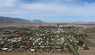
Porterville is a town in the Western Cape province of South Africa.
Richard Miles was a Motswana (Tswana) catechist and preacher "to the native tribes beyond the border" in South Africa.
Joe Slovo Park is a township located between Milnerton and Montague Gardens near Cape Town, South Africa.

Koringberg is a settlement in West Coast District Municipality in the Western Cape province of South Africa.

Port Beaufort is a settlement in Garden Route District Municipality in the Western Cape province of South Africa.
Mhlangeni, also known as Hertzog, is a settlement in Amathole District Municipality in the Eastern Cape province of South Africa.

Bakoven is a small residential suburb on the west coast of the Cape Peninsula, in the southwest of Camps Bay.


