
The R27 is a provincial route in South Africa that consists of two disjoint segments. The first segment, also known as the West Coast Highway, connects Cape Town with Velddrif along the West Coast. The second runs from Vredendal via Vanrhynsdorp, Calvinia, Brandvlei and Kenhardt to Keimoes on the N14 near Upington. The connection between Velddrif and Vredendal has never been built, although it can be driven on various gravel roads.

The R44 is a provincial route in Western Cape, South Africa that connects Piketberg with Kleinmond via Wellington, Stellenbosch, Somerset West and Strand. The coastal section between Kleinmond and Gordon's Bay is a very scenic ocean drive. The section between Gordon's Bay and Stellenbosch via Strand and Somerset West is a dual carriageway. The R44 is co-signed with the R46 between Gouda and Hermon in the Berg River valley.

The R45 is a provincial route in Western Cape, South Africa that connects Saldanha with Villiersdorp via Vredenburg, Malmesbury and Paarl. The route is mostly a two-lane wide-shouldered highway, however sections within Paarl and between Vredenburg and Saldanha are dual-carriageways. The R45 is co-signed with the N7 for a short segment north of Malmesbury.

The R63 is a tarred provincial route in South Africa that connects Calvinia with Komga via Carnarvon, Victoria West, Graaff-Reinet, Somerset East and King William's Town. It is cosigned with the N10 between Eastpoort and Cookhouse for 24 kilometres.
The R302 is a Regional Route in South Africa that connects Bellville with Malmesbury. It covers a distance of 54 kilometres (34 mi) in a north-south direction.
The R304 is a Regional Route in South Africa that connects Stellenbosch with Atlantis.

The R310 is a Regional Route in South Africa that connects Muizenberg to the south-west with the R45 between Paarl and Franschhoek to the north-east, via Stellenbosch and Hellshoogte Pass. The section between Muizenberg and Stellenbosch is called Baden Powell Drive.
The R311 is a Regional Route in South Africa that connects the R45 between Malmesbury and Hopefield to the north-west with Riebeek-Kasteel to the south-east.
The R315 is a Regional Route in South Africa that connects Yzerfontein on the West coast with Malmesbury to the east via Darling.
The R355 is a Regional Route in South Africa that connects the R46 near Ceres with Kleinsee via Calvinia and Springbok.

The R357 is a Regional Route in South Africa that connects Nieuwoudtville and Kimberley via Loeriesfontein and Prieska.
The R362 is a Regional Route in South Africa that connects Strandfontein with the N7 at Klawer.
The R364 is a Regional Route in South Africa that connects Lamberts Bay to the R27 between Calvinia and Nieuwoudtville via Clanwilliam.
The R399 is a Regional Route in South Africa that connects Vredenburg with the N7 between Piketberg and De Hoek.

The N4 is a national route in South Africa that runs from Skilpadshek on the Botswana border, past Rustenburg, Pretoria, eMalahleni and Mbombela, to Komatipoort on the Mozambique border. The entire route is a toll road.
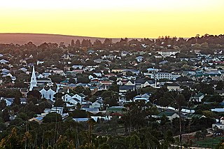
Malmesbury is a town of approximately 36,000 inhabitants in the Western Cape province of South Africa, about 65 km north of Cape Town.

The N14 is a national route in South Africa which runs from Springbok in the Northern Cape to Pretoria in Gauteng. It passes through Upington, Kuruman, Vryburg, Krugersdorp and Centurion. The section between Pretoria and Krugersdorp is maintained by the Gauteng Provincial government and is also designated the P158.

Hopefield is a settlement in West Coast District Municipality in the Western Cape province of South Africa on the R45 between Malmesbury and Vredenburg. The town lies east of Saldanha Bay and Langebaan, 40 km (25 mi) southeast of Vredenburg and 120 km (75 mi) north of Cape Town.
The R101 is a Regional Route in South Africa that is the designation for some of the old sections of roads that were previously the N1, prior to upgrading. It only has 2 sections, from Bellville to Worcester and from Johannesburg to Polokwane.
The R301 is a regional route in the Western Cape province of South Africa that connects Wemmershoek with Wolseley via Paarl and Wellington.

