Swartland Municipality is a local municipality located in the Western Cape province of South Africa. Malmesbury is the seat of the municipality. As of 2022, it had a population of 148,331. Its municipality code is WC015.

The R27 is a provincial route in South Africa that consists of two disjoint segments. The first segment, also known as the West Coast Highway, connects Cape Town with Velddrif along the West Coast. The second runs from Vredendal via Vanrhynsdorp, Calvinia, Brandvlei and Kenhardt to Keimoes on the N14 near Upington. The connection between Velddrif and Vredendal has never been built, although it can be driven on various gravel roads.

The R44 is a provincial route in Western Cape, South Africa that connects Piketberg with Kleinmond via Wellington, Stellenbosch, Somerset West and Strand. The coastal section between Kleinmond and Gordon's Bay is a very scenic ocean drive. The section between Gordon's Bay and Stellenbosch via Strand and Somerset West is a dual carriageway. The R44 is co-signed with the R46 between Gouda and Hermon in the Berg River valley.

The R45 is a provincial route in Western Cape, South Africa that connects Saldanha with Villiersdorp via Vredenburg, Malmesbury and Paarl. The route is mostly a two-lane wide-shouldered highway, however sections within Paarl and between Vredenburg and Saldanha are dual-carriageways. The R45 is co-signed with the N7 for a short segment north of Malmesbury.
The R307 is a Regional Route in South Africa that connects the R27 north of Melkbosstrand with the R45 south-west of Moorreesburg.
The R311 is a Regional Route in South Africa that connects the R45 between Malmesbury and Hopefield to the north-west with Riebeek-Kasteel to the south-east.
The R323 is a Regional Route in South Africa that connects Riversdale in the south with Laingsburg in the north.
The R344 is a Regional Route in South Africa that connects Grahamstown with Dordrecht.
The R356 is a Regional Route in South Africa that connects the R46 near Ceres with Loxton by way of Sutherland and Fraserburg.

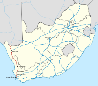
The N7 is a national route in South Africa that runs from Cape Town northwards through the West Coast and Namaqualand regions to the Namibian border at Vioolsdrif. It is known as the Cape Namibia Road. After crossing the border, it changes designation to B1 and runs north through Windhoek and the north of Namibia.

Darling is a small town in a farming area on the west coast region of the Western Cape, about 75 km (46.6 mi) from Cape Town.

The West Coast is a region of the Western Cape province in South Africa and is bordered by the Atlantic Ocean on the west and the Swartland region on the east.

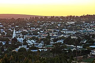
Malmesbury is a town of approximately 36,000 inhabitants in the Western Cape province of South Africa, about 65 km north of Cape Town.

The Swartland is a region of Western Cape Province that begins some 50 kilometres (31 mi) north of Cape Town and consists of the area between the towns of Malmesbury in the south, Darling in the west, Piketberg in the north, Moorreesburg in the middle and the Riebeek West and Riebeek Kasteel in the east. Jan van Riebeeck called this softly undulating country between the mountain ranges "Het Zwarte Land" because of the endemic Renosterbos. After the rains, mainly in winter, the Renosterbos takes on a dark appearance when viewed from the distance in large numbers. This is due to the fine leaf-hairs adhering to the leaves when wet. The wide fertile plain is the bread basket of Cape Town with its wheat fields reaching up to the foot of the mountains, interrupted by wine, fruit, and vegetable farms. In Moorreesburg can be found only one of two museums in the world that shows the history of wheat farming.

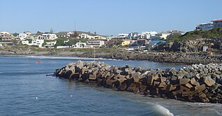
Yzerfontein, or Ysterfontein, is a small harbour town with about 1200 inhabitants on the west coast of South Africa about 90 km north of Cape Town. The name in Afrikaans means "Iron Fountain".The town started out when the farm 'Yzerfontein' was bought by the Katz-family in the 1930s. Then they started dividing the farm into plots. The main sources of income are tourism, mining and fishing.

The R62 is a provincial route in South Africa that connects Ashton with Humansdorp. The R62 runs through the Little Karoo and the Langkloof, passing through Montagu, Ladismith, Calitzdorp, Oudtshoorn, and Joubertina.

The N14 is a national route in South Africa which runs from Springbok in the Northern Cape to Pretoria in Gauteng. It passes through Upington, Kuruman, Vryburg, Krugersdorp and Centurion. The section between Pretoria and Krugersdorp is maintained by the Gauteng Provincial government and is also designated the P158.

Darling Wind Farm was one of the first three wind farms in South Africa. It is located 70 km (43 mi) north of Cape Town, between Darling and Yzerfontein on the west coast of South Africa. Darling Wind Power was incorporated in 2004 as the special purpose vehicle to develop, construct, finance, own and operate the Darling Wind Farm, which was at the time declared a national demonstration project.
The R703 is a regional route in Free State, South Africa that connects Dealesville with Clocolan via Brandfort, Verkeerdevlei and Excelsior.


