
The N1 is a national route in South Africa that runs from Cape Town through Bloemfontein, Johannesburg, Pretoria and Polokwane to Beit Bridge on the border with Zimbabwe. It forms the first section of the famed Cape to Cairo Road.

The R33 is a provincial route in South Africa that connects Pietermaritzburg with Lephalale via Greytown, Paulpietersburg, Carolina, Belfast and Vaalwater. It is a very long road, passing through 3 provinces.

The R43 is a provincial route in the Western Cape province of South Africa which connects Ceres with Gansbaai via Worcester, Botrivier and Hermanus. It is co-signed with the N2 for nine kilometres near Botrivier.

The R44 is a provincial route in Western Cape, South Africa that connects Piketberg with Kleinmond via Wellington, Stellenbosch, Somerset West and Strand. The coastal section between Kleinmond and Gordon's Bay is a very scenic ocean drive. The section between Gordon's Bay and Stellenbosch via Strand and Somerset West is a dual carriageway. The R44 is co-signed with the R46 between Gouda and Hermon in the Berg River valley.

The R56 is a provincial route in South Africa that connects Middelburg with Pietermaritzburg via Molteno, Maclear and Kokstad. It is co-signed with the N2 between Kokstad and Stafford's Post for 39 kilometres.

The R61 is a long provincial route in South Africa that connects Beaufort West with Port Shepstone via Graaff-Reinet, Komani, Mthatha and Port Edward.

The R63 is a tarred provincial route in South Africa that connects Calvinia with Komga via Carnarvon, Victoria West, Graaff-Reinet, Somerset East and King William's Town. It is cosigned with the N10 between Eastpoort and Cookhouse for 24 kilometres.

The R66 is a provincial route in KwaZulu-Natal, South Africa that connects Gingindlovu with Pongola via Eshowe, Melmoth and Ulundi. It starts and ends at a junction with the N2.
The R67 is a provincial route in Eastern Cape, South Africa that connects Port Alfred with Komani via Grahamstown.

The R72 is a provincial route in Eastern Cape, South Africa that connects the N2 north-east of Gqeberha with East London via Port Alfred. It provides an alternative to the N2 for travel between Gqeberha and East London.

The R102 is a Regional Route in South Africa. It is the route designation for all old sections of the N2, thus it is a discontinuous road that resumes in areas where a new N2 has been constructed.
The R322 is a Regional Route in South Africa. Its northern origin is a t-junction with the R324 between Suurbraak and Barrydale. The northern and western routes are signed the R324, with R322 signed as the easterly road. It heads east-south-east to reach Heidelberg, where it meets the N2. It becomes co-signed with the N2 south-west for 4 kilometres before diverging to head south-south-west. It ends at Port Beaufort, where it rejoins the R324.
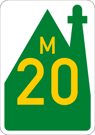
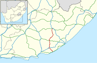
The R334 is a Regional Route in the Nelson Mandela Bay Metropolitan Municipality of South Africa that connects the N2 west of Gqeberha to the N2 at Coega north of Gqeberha via Uitenhage. The middle section of the route is also designated as the M20 metropolitan route.
The R335 is a Regional Route in South Africa that connects Nelson Mandela Bay in the south to Somerset East to the north via Addo.
The R346 is a Regional Route in Eastern Cape, South Africa that connects Stutterheim with East London Airport via King William’s Town.

The N2 is a national route in South Africa that runs from Cape Town through George, Gqeberha, East London, Mthatha, Port Shepstone and Durban to Ermelo. It is the main highway along the Indian Ocean coast of the country. Its current length of 2,255 kilometres (1,401 mi) makes it the longest numbered route in South Africa.

The N12 is a national route in South Africa which runs from George through Beaufort West, Kimberley, Klerksdorp and Johannesburg to eMalahleni.

The R62 is a provincial route in South Africa that connects Ashton with Humansdorp. The R62 runs through the Little Karoo and the Langkloof, passing through Montagu, Ladismith, Calitzdorp, Oudtshoorn, and Joubertina.

The M9 is a long metropolitan route in the City of Cape Town, South Africa. It connects Sir Lowry's Pass Village with Wynberg via Somerset West, Firgrove, Macassar, Khayelitsha and Nyanga.

Tradouw Pass is a pass through the Langeberg mountain range in South Africa. It is part of the R324 and is the main road between Swellendam and Barrydale in the Western Cape.

