This article needs additional citations for verification .(August 2014) |
Barrydale | |
|---|---|
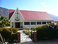
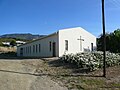
From top: Skyline of Barrydale, left: NG Church, right: View of Barrydale and the Tradouws Pass, left: Skyline, right: An old house in Barrydale | |
 Barrydale  Barrydale | |
| Coordinates: 33°54′13″S20°43′18″E / 33.903665°S 20.721697°E | |
| Country | South Africa |
| Province | Western Cape |
| District | Overberg |
| Municipality | Swellendam |
| Area | |
• Total | 25.77 km2 (9.95 sq mi) |
| Population (2011) [1] | |
• Total | 4,156 |
| • Density | 161.3/km2 (417.7/sq mi) |
| Racial makeup (2011) | |
| • Black African | 3.6% |
| • Coloured | 83.3% |
| • Indian/Asian | 0.4% |
| • White | 11.9% |
| • Other | 0.8% |
| First languages (2011) | |
| • Afrikaans | 90.6% |
| • English | 6.6% |
| • Xhosa | 1.1% |
| • Other | 1.7% |
| Time zone | UTC+2 (SAST) |
| Postal code (street) | 6750 |
| PO box | 6750 |
| Area code | 028 |


Barrydale is a village on the border of the Overberg and Klein Karoo regions of the Western Cape Province in South Africa. It was named after Joseph Barry, a merchant of the 19th century. [2] It is situated at the northern end of the Tradouws Pass which winds its way through the mountains to Swellendam.