Overstrand Local Municipality

Last updated
Overstrand
Overstrand CoA.png
Map of the Western Cape with Overstrand highlighted (2016).svg
Location in the Western Cape
Coordinates: 34°25′S19°20′E / 34.417°S 19.333°E / -34.417; 19.333
Country South Africa
Province Western Cape
District Overberg
Seat Hermanus
Wards 13
Government
[1]
  Type Municipal council
  Mayor Annelie Rabie (DA)
Area
  Total1,708 km2 (659 sq mi)
Population
 (2011) [2]
  Total80,432
  Density47/km2 (120/sq mi)
Racial makeup (2011)
[2]
   Black African 36.2%
   Coloured 31.0%
   Indian/Asian 0.3%
   White 31.2%
First languages (2011)
[2]
   Afrikaans 53.5%
   Xhosa 29.2%
   English 12.3%
   Sotho 1.4%
  Other3.6%
Time zone UTC+2 (SAST)
Municipal codeWC032

Overstrand Municipality (Afrikaans : Overstrand Munisipaliteit; Xhosa : uMasipala wase Overstrand) is a local municipality in the Western Cape province of South Africa. It is located along the Atlantic coast between Cape Town and Cape Agulhas, within the Overberg District Municipality. The principal towns in the municipality are Hermanus, Gansbaai and Kleinmond. As of 2011, it had a population of 80,432. [2]

Contents

Geography

Topographic map of the Overstrand Municipality Overstrand LM topographic map.svg
Topographic map of the Overstrand Municipality

The municipality covers an area of 1,708 square kilometres (659 sq mi) stretching along the coast of the Overberg, from the eastern edge of False Bay almost to Cape Agulhas. At its western end it is separated from the City of Cape Town by the Kogelberg mountains; to the north it is separated from the Theewaterskloof Municipality by the Kogelberg and the Kleinrivier Mountains; and to the east it abuts on the Cape Agulhas Municipality along a boundary that runs generally north-south just to the west of Elim. The western part of the municipality consists mostly of a narrow coastal plain with mountains immediately behind, while the eastern part beyond the Klein River expands away from the coast to include a wider agricultural region.

According to the 2011 census the municipality has a population of 80,432 people in 28,010 households. Of this population, 36.2% describe themselves as "Black African", 31.2% as "White", and 31.0% as "Coloured". The first language of 53.5% of the population is Afrikaans, while 29.2% speak Xhosa, 12.3% speak English and 1.4% speak Sotho. [3]

Most of the towns in the municipality are on the coast, and due to the proximity to Cape Town many are holiday resorts. The largest town is Hermanus, which is situated on the northern edge of Walker Bay next to the Klein River mouth. As of 2011 Hermanus, which is the site of the municipal headquarters, has a population of 32,769. [4] West of Hermanus, between it and the Bot River, are Onrusrivier (pop. 5,151) and Hawston (pop. 8,214) on the coast, and Fisherhaven (pop. 723) on the Bot River lagoon. On the other side of the Bot River mouth is the town of Kleinmond (pop. 6,634) and beyond it along the coast are Betty's Bay (pop. 1,380), Pringle Bay (pop. 801) and Rooi-Els (pop. 125).

East of Hermanus the municipality includes a wider agricultural area away from the coast. The village of Stanford (pop. 4,797) is about 15 kilometres (10 mi) inland on the Klein River. To the south, on the opposite side of Walker Bay from Hermanus, is the second-largest town in the municipality, Gansbaai (pop. 11,598). Just south of Gansbaai, on the southern edge of the Danger Point peninsula, are Van Dyksbaai (pop. 500) and Franskraalstrand (pop. 1,165). A little further along the coast is Pearly Beach (pop. 1,042). Inland from Pearly Beach, separated from the coast by a range of hills, is the agricultural hamlet of Baardskeerdersbos (pop. 103), while Wolvengat (pop. 50) is another agricultural hamlet in the far south-east of the municipality.

Politics

Seats in the council after the 2016 election
.mw-parser-output .legend{page-break-inside:avoid;break-inside:avoid-column}.mw-parser-output .legend-color{display:inline-block;min-width:1.25em;height:1.25em;line-height:1.25;margin:1px 0;text-align:center;border:1px solid black;background-color:transparent;color:black}.mw-parser-output .legend-text{}
DA (16)
ANC (8)
EFF (1) Overstrand 2016 council seats.svg
Seats in the council after the 2016 election
   DA (16)
   ANC (8)
   EFF (1)

The municipal council consists of twenty-five members elected by mixed-member proportional representation. Thirteen councillors are elected by first-past-the-post voting in thirteen wards, while the remaining twelve are chosen from party lists so that the total number of party representatives is proportional to the number of votes received.

History

By the end of the apartheid era in the early 1990s there were various local authorities established on a racially-segregated basis in the area that was to become Overstrand. Municipal councils were elected by the white residents of the towns of Betty's Bay, Kleinmond, Onrusrivier, Hermanus, Stanford, and Gansbaai; and local councils by the white residents of the villages and holiday resorts: Pringle Bay, Rooi-Els, Vermont, Sandbaai, Pearly Beach, De Kelders, Kleinbaai, and Franskraalstrand. The coloured areas of Kleinmond, Stanford, Hawston, Mount Pleasant and Gansbaai were governed by management committees subordinate to the white municipalities; and the black area of Zwelihle was governed by a town council established under the Black Local Authorities Act. Rural areas were served by the Overberg Regional Services Council.

While the negotiations to end apartheid were taking place a process was established for local authorities to negotiate voluntary mergers. In January 1993 the Municipality of Kleinmond merged with its management committee to form a single Municipality for the Area of Kleinmond; and the Municipality of Gansbaai merged with its management committee and the local councils of De Kelders, Kleinbaai, Franskraalstrand and Pearly Beach to form a single Municipality for the Area of Gansbaai. In January 1994 the Betty's Bay Municipality merged with the local councils of Pringle Bay and Rooi-Els to form the Hangklip Municipality.

After the national elections of 1994 a process of local government transformation began, in which negotiations were held between the existing local authorities, political parties, and local community organisations. As an outcome of these negotiations, transitional local councils (TLCs) were created and the existing local authorities were dissolved. In December 1994, the Greater Hermanus TLC replaced the Hermanus Municipality, the Onrusrivier Municipality, the Zwelihle Town Council, the management committees of Hawston and Mount Pleasant, and the local councils of Vermont and Sandbaai. In the same month the Gansbaai TLC replaced the Municipality for the Area of Gansbaai. In January 1995 Hangklip/Kleinmond TLC replaced Hangklip Municipality and the Municipality for the Area of Kleinmond, and the Stanford TLC replaced the Municipality of Stanford and the Stanford Management Committee.

The transitional councils were initially made up of members nominated by the various parties to the negotiations, until May 1996 when elections were held. At these elections the Overberg District Council was established, replacing the Overberg Regional Services Council. Transitional representative councils (TRCs) were also elected to represent rural areas outside the TLCs on the District Council; the area that was to become Overstrand included the Hermanus TRC as well as parts of the Caledon and Bredasdorp TRCs.

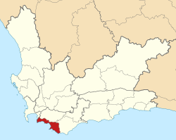
At the local elections of December 2000 the TLCs and TRCs were dissolved, and the Overstrand Municipality was created as a single local authority incorporating both rural and urban areas. It was considered a stronghold of the now defunct New National Party (NNP), which had held (sometimes concealed) majorities of two thirds in the predecessor municipalities after the November 1995 municipal elections, which were the first since South Africa had its first multi-racial elections.

After the 2000 election, Willie Smuts, previously mayor of Hangklip-Kleinmond Municipality, was elected mayor, representing the Democratic Alliance (DA), before he defected along with seven other DA councillors to the New National Party (NNP) after the October 2002 floor-crossing window. The NNP then formed a coalition with the African National Congress (ANC) when the council was reconstituted. After the September 2004 floor crossing Smuts then crossed the floor to the ANC along with most NNP councillors which gave the ANC an outright majority in the town for the first time.

At the time of the March 2006 local elections the eastern boundary with Cape Agulhas Municipality was moved west, with Cape Agulhas taking over rural land to the north and south of Elim. In the 2006 elections the DA won an outright majority of 10 seats in the 19-seat council. Willie Smuts was replaced as Mayor by Theo Beyleveldt. The DA consolidated its hold in the council following the September 2007 floor crossing window which saw the party gain an eleventh seat from the African Christian Democratic Party (ACDP). The ANC lost a seat to the newly formed National People's Party, as did the Independent Democrats, whose only representative in the Overstrand Council crossed over.

In the May 2011 local elections, the DA again won Overstrand outright, taking fifteen of the twenty-five seats on the council, with the ANC taking nine and the National Independent Civic Organisation one.

In the August 2016 local elections, the DA increased its majority to sixteen of twenty-five seats, with the ANC taking eight and the Economic Freedom Fighters (EFF) taking one.

In a by-election in December 2020, the Land Party won a seat from the ANC [5]

In the November 2021 local elections, the council was expanded to twenty-seven seats. The DA won seventeen seats, the ANC four, the Land Party and the Freedom Front Plus two each, and the EFF and the ACDP one each.

Election results

The most recent election of the municipal council was held on 1 November 2021; the Democratic Alliance won a majority of 17 seats on the council. The following table shows the results of the 2021 election.

PartyWardListTotal
seats
Votes%SeatsVotes%Seats
Democratic Alliance 22,11163.711021,88763.66717
African National Congress 5,40515.5835,45215.8614
Land Party 2,5927.4712,6607.7412
Freedom Front Plus 1,8935.4501,8605.4122
Economic Freedom Fighters 9062.6109232.6811
African Christian Democratic Party 7992.3007712.2411
Independent candidates 2350.6800
8 other parties7622.2008262.4000
Total34,703100.001434,379100.001327
Valid votes34,70399.2134,37999.23
Invalid/blank votes2760.792680.77
Total votes34,979100.0034,647100.00
Registered voters/turnout59,97958.3259,97957.77
Source: Electoral Commission [6] [7] [8]

Mayors

Related Research Articles

<span class="mw-page-title-main">Western Cape</span> Province of South Africa on the south-western coast

The Western Cape is a province of South Africa, situated on the south-western coast of the country. It is the fourth largest of the nine provinces with an area of 129,449 square kilometres (49,981 sq mi), and the third most populous, with an estimated 7 million inhabitants in 2020. About two-thirds of these inhabitants live in the metropolitan area of Cape Town, which is also the provincial capital. The Western Cape was created in 1994 from part of the former Cape Province. The two largest cities are Cape Town and George.

<span class="mw-page-title-main">Knysna Local Municipality</span> Local municipality in Western Cape, South Africa

Knysna Municipality is a local municipality within the Garden Route District Municipality, in the Western Cape province of South Africa. As of 2011, the population is 68,659. Its municipal code is WC048.

<span class="mw-page-title-main">Stellenbosch Local Municipality</span> Local municipality in Western Cape, South Africa

Stellenbosch Municipality is the local municipality that governs the towns of Stellenbosch, Franschhoek and Pniel, and the surrounding rural areas, in the Western Cape province of South Africa. It covers an area of 831 square kilometres (321 sq mi), and as of 2011 had a population of 155,733 people in 43,420 households. It falls within the Cape Winelands District Municipality.

<span class="mw-page-title-main">George Local Municipality</span> Local municipality in Western Cape, South Africa

George Municipality is a local municipality within the Garden Route District Municipality, in the Western Cape province of South Africa. As of 2011, the population is 193,672. Its municipality code is WC044.

<span class="mw-page-title-main">Mossel Bay Local Municipality</span> Local municipality in Western Cape, South Africa

Mossel Bay Municipality is a local municipality within the Garden Route District Municipality, in the Western Cape province of South Africa. As of 2011, the population was 89,430.

<span class="mw-page-title-main">Bitou Local Municipality</span> Local municipality in Western Cape, South Africa

Bitou Municipality, formerly known as Plettenberg Bay Municipality, is a local municipality within the Garden Route District Municipality, in the Western Cape province of South Africa. Its municipality code is WC047.

<span class="mw-page-title-main">Cape Agulhas Local Municipality</span> Local municipality in Western Cape, South Africa

Cape Agulhas Municipality is a municipality located in the Western Cape province of South Africa. As of 2011, it had a population of 33,038. Its municipality code is WC033. It is named after Cape Agulhas, the southernmost point of Africa. The largest town is Bredasdorp, which is the seat of the municipal headquarters. It also includes the villages of Napier, Struisbaai, Elim, Arniston and L'Agulhas, and the De Hoop Nature Reserve.

<span class="mw-page-title-main">Cederberg Local Municipality</span> Local municipality in Western Cape, South Africa

Cederberg Municipality is a local municipality which governs an area of the Western Cape province of South Africa stretching from the Cederberg mountains through the middle valley of the Olifants River to the Atlantic coast. It includes the towns of Clanwilliam, Citrusdal and Lamberts Bay, and the surrounding villages and farms. As of 2011 it had a population of 49,768. It is located within the West Coast District Municipality and its municipality code is WC012.

<span class="mw-page-title-main">Kannaland Local Municipality</span> Local municipality in Western Cape, South Africa

Kannaland Municipality is a local municipality located within the Garden Route District Municipality, in the Western Cape province of South Africa. The municipal area is situated in the western part of the Little Karoo and includes the towns of Ladismith, Calitzdorp and Zoar. As of 2011, it has a population of 24,767. Its municipality code is WC041.

<span class="mw-page-title-main">Swellendam Local Municipality</span> Local municipality in Western Cape, South Africa

Swellendam Municipality is a local municipality located within the Overberg District Municipality, in the Western Cape province of South Africa. As of 2011, it had a population of 35,916. Its municipality code is WC034.

<span class="mw-page-title-main">Theewaterskloof Local Municipality</span> Local municipality in Western Cape, South Africa

Theewaterskloof Municipality is a local municipality located within the Overberg District Municipality, in the Western Cape province of South Africa. As of 2007, the population was 108,790. Its municipality code is WC031. The enormous Theewaterskloof Dam, which provides water for Cape Town and the surrounding areas, is located in this municipality.

<span class="mw-page-title-main">Overberg District Municipality</span> District municipality in Western Cape, South Africa

The Overberg District Municipality is a district municipality that governs the Overberg region in the Western Cape province of South Africa. It is divided into four local municipalities and includes the major towns of Grabouw, Caledon, Hermanus, Bredasdorp and Swellendam. The municipal area covers 12,241 square kilometres (4,726 sq mi) and had in 2007 an estimated population of 212,787 people in 60,056 households.

<span class="mw-page-title-main">Gansbaai</span> Place in Western Cape, South Africa

Gansbaai is a fishing town and popular tourist destination in the Overberg District Municipality, Western Cape, South Africa. It is known for its dense population of great white sharks and as a whale-watching location.

<span class="mw-page-title-main">City of Cape Town</span> Metropolitan municipality in South Africa

The City of Cape Town is a metropolitan municipality that forms the local government of Cape Town and surrounding areas. As of the 2016 community survey, it had a population of 4,005,016.

<span class="mw-page-title-main">2006 South African municipal elections</span>

Municipal elections were held in South Africa on 1 March 2006, to elect members to the local governing councils in the municipalities of South Africa. The municipalities form the local government of South Africa and are subdivisions of the provinces, thus making them responsible for local service delivery, such as electricity, water and fire services.

<span class="mw-page-title-main">Thembelihle Local Municipality</span> Local municipality in Northern Cape, South Africa

Thembelihle Municipality, formerly known as Oranje-Karoo Municipality, is a local municipality within the Pixley ka Seme District Municipality, in the Northern Cape province of South Africa. Thembelihle is a Xhosa word meaning "good hope".

Hawston is a village in the Western Cape, South Africa, It is a fishing village north-east of Mudge Point, 5 km north-west of Onrusrivier and 11 km from Hermanus. It is named after C.R. Haw, a civil commissioner of Caledon.

Franskraalstrand, also known as Franskraal, is a coastal village near to Gansbaai in the Western Cape province of South Africa. As of 2011 it had a population of 1,165 people in 592 households.

The council of the Overstrand Local Municipality in the Western Cape, South Africa is elected every five years by a system of mixed-member proportional representation. Half of the councillors are elected by first-past-the-post voting from individual wards, while the other half are appointed from party lists so that the total number of party representatives is proportional to the number of votes received. By-elections are held to replace the councillors elected by wards if a vacancy occurs.

References

  1. 1 2 "New Mayoral Committee for the 2016-2021 Term". Overstrand Municipality. 23 August 2016. Retrieved 27 August 2016.
  2. 1 2 3 4 "Statistics by place". Statistics South Africa. Retrieved 27 September 2015.
  3. "Overstrand Local Municipality". Census 2011.
  4. Sum of the Main Places Hermanus, Sand Bay and Zwelihle from Census 2011.
  5. "BY-ELECTIONS 09 Dec 2020 RESULTS REPORT" (PDF). Electoral Commission. Retrieved 10 December 2020.
  6. "Results Summary – All Ballots: Overstrand" (PDF). Electoral Commission of South Africa. Retrieved 6 November 2021.
  7. "Seat Calculation Detail: Overstrand" (PDF). Electoral Commission of South Africa. Retrieved 6 November 2021.
  8. "Voter Turnout Report: Overstrand" (PDF). Electoral Commission of South Africa. Retrieved 6 November 2021.
  9. "New Mayoral Committee for the 2021 - 2026 Term". Overstrand Municipality. 26 November 2021. Retrieved 25 June 2022.