
Overberg is a region in South Africa to the east of Cape Town beyond the Hottentots-Holland mountains. It lies along the Western Cape Province's south coast between the Cape Peninsula and the region known as the Garden Route in the east. The boundaries of the Overberg are the Hottentots-Holland mountains in the West; the Riviersonderend Mountains, part of the Cape Fold Belt, in the North; the Atlantic and Indian Oceans in the South and the Breede River in the East.
Langeberg Municipality, known before 28 August 2009 as Breede River/Winelands Municipality, is a local municipality located within the Cape Winelands District Municipality, in the Western Cape province of South Africa. As of 2011, it had a population of 97,724. Its municipality code is WC026.

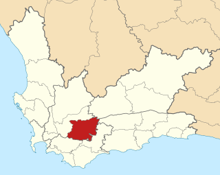
Cape Agulhas Municipality is a municipality located in the Western Cape province of South Africa. As of 2011, it had a population of 33,038. Its municipality code is WC033. It is named after Cape Agulhas, the southernmost point of Africa. The largest town is Bredasdorp, which is the seat of the municipal headquarters. It also includes the villages of Napier, Struisbaai, Elim, Arniston and L'Agulhas, and the De Hoop Nature Reserve.

The Overberg District Municipality is a district municipality that governs the Overberg region in the Western Cape province of South Africa. It is divided into four local municipalities and includes the major towns of Grabouw, Caledon, Hermanus, Bredasdorp and Swellendam. The municipal area covers 12,241 square kilometres (4,726 sq mi) and had in 2007 an estimated population of 212,787 people in 60,056 households.
The R316 is a regional route in the Western Cape province of South Africa that connects Caledon to the northwest with Arniston to the southeast via Bredasdorp and Napier. It runs for 96 kilometres (60 mi). It maintains a south-easterly direction for most of its course.
The R319 is a Regional Route in South Africa that connects L'Agulhas and Struisbaai in the south with the N2 near Swellendam via Bredasdorp.
Boland is a first-class cricket team that nominally represents the Boland region, in the South African province of Western Cape, in the CSA Provincial Competitions. The team is selected and supported by the Boland Cricket Board (BCB) and plays its home games at Boland Park in Paarl. At organisational level, the BCB is responsible for the administration and development of cricket in the region and among its primary functions are management and promotion of the Boland team. The current BCB was founded in 1992 as a merger between the Boland Cricket Union and an earlier Boland Cricket Board.

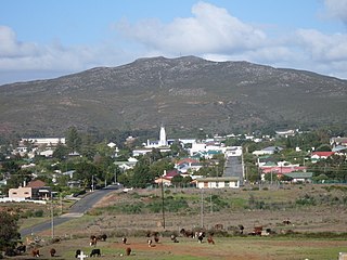
Caledon, originally named Swartberg, is a town in the Overberg region in the Western Cape province of South Africa, located about 100 kilometres (62 mi) east of Cape Town next to mineral-rich hot springs. As of 2011 it had a population of 13,020. It is located in, and the seat of, the Theewaterskloof Local Municipality.
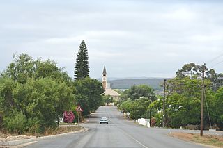
Bredasdorp is a town in the Southern Overberg region of the Western Cape, South Africa, and the main economic and service hub of that region. It lies on the northern edge of the Agulhas Plain, about 160 kilometres (100 mi) south-east of Cape Town and 35 kilometres (22 mi) north of Cape Agulhas, the southernmost tip of Africa.
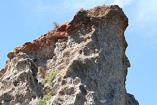
The Enon Formation is a geological formation found in the Eastern and Western Cape provinces in South Africa. It is the lowermost of the four formations found within the Uitenhage Group of the Algoa Basin, its type locality, where it has been measured at a maximum thickness of 480 metres (1,570 ft). Discontinuous outcrops are also found in the Worcester-Pletmos and Oudshoorn-Gamtoos Basins, including isolated occurrences in the Haasvlakte, Jubilee, and Soutpansvlakte Basins near the small town Bredasdorp.
Bonnievale is a settlement in the Cape Winelands District Municipality in the Western Cape province of South Africa.

The Overberg branch line is a railway line in the Western Cape, South Africa. It runs from Cape Town through Somerset West and Caledon to Bredasdorp.

The South African Railways Class 15B 4-8-2 of 1918 was a steam locomotive.

Stormsvlei is a town on the southern bank of the Riviersonderend, some 17 km south of Bonnievale and 50 km north of Bredasdorp. Of Afrikaans origin, the name means 'storm marsh'.

Conophytum ficiforme is a small South African species of succulent plant of the genus Conophytum.
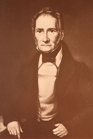
Michiel van Breda was a Cape Colony farmer, founder of Bredasdorp, Mayor of Cape Town and a Freemason.
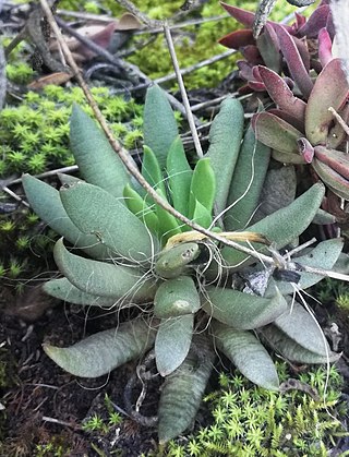
Anacampseros lanceolata is a species of succulent plant native to the western Karoo and Overberg regions of South Africa.

Drosanthemum lavisii is a succulent plant in the ice plant family, Aizoaceae, indigenous to the Overberg region of the Western Cape Province, South Africa.

