
Cape Town is the legislative capital of South Africa. It is the country's oldest city and the seat of the Parliament of South Africa. It is the country's second-largest city, after Johannesburg, and the largest in the Western Cape. The city is part of the City of Cape Town metropolitan municipality.

Fynbos is a small belt of natural shrubland or heathland vegetation located in the Western Cape and Eastern Cape provinces of South Africa. This area is predominantly coastal and mountainous, with a Mediterranean climate and rainy winters. The fynbos ecoregion is within the Mediterranean forests, woodlands, and scrub biome. In fields related to biogeography, fynbos is known for its exceptional degree of biodiversity and endemism, consisting of about 80% species of the Cape floral kingdom, where nearly 6,000 of them are endemic. This land continues to face severe human-caused threats, but due to the many economic uses of the fynbos, conservation efforts are being made to help restore it.

The Western Cape is a province of South Africa, situated on the south-western coast of the country. It is the fourth largest of the nine provinces with an area of 129,449 square kilometres (49,981 sq mi), and the third most populous, with an estimated 7 million inhabitants in 2020. About two-thirds of these inhabitants live in the metropolitan area of Cape Town, which is also the provincial capital. The Western Cape was created in 1994 from part of the former Cape Province. The two largest cities are Cape Town and George.

Rondebosch is one of the Southern Suburbs of Cape Town, South Africa. It is primarily a residential suburb, with shopping and business districts as well as the main campus of the University of Cape Town.

The West Coast District Municipality is a district municipality located in the Western Cape province of South Africa. Its municipality code is DC1. Moorreesburg is the seat of the district. As of 2011, it had a total population of 391,766.

Bergrivier Municipality is a local municipality in the Western Cape province of South Africa. It governs the towns of Piketberg, Velddrif and Porterville, as well as the surrounding villages and rural areas. As of 2011, it had a population of 61,897. It is located within the West Coast District Municipality and its municipality code is WC013.

Cederberg Municipality is a local municipality which governs an area of the Western Cape province of South Africa stretching from the Cederberg mountains through the middle valley of the Olifants River to the Atlantic coast. It includes the towns of Clanwilliam, Citrusdal and Lamberts Bay, and the surrounding villages and farms. As of 2011 it had a population of 49,768. It is located within the West Coast District Municipality and its municipality code is WC012.

Matzikama Municipality is a local municipality which governs the northernmost part of the Western Cape province of South Africa, including the towns of Vredendal, Vanrhynsdorp, Klawer and Lutzville, and the surrounding villages and rural areas. As of 2011, it had a population of 67,147. It forms part of the West Coast District Municipality, and its municipality code is WC011.

Swellendam Municipality is a local municipality located within the Overberg District Municipality, in the Western Cape province of South Africa. As of 2011, it had a population of 35,916. Its municipality code is WC034.
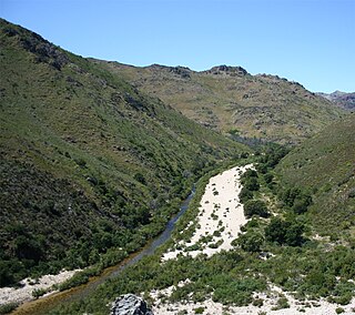
The Olifants River is a river in the northwestern area of the Western Cape Province of South Africa. The upper and main catchment area of the Olifants river is around Ceres and the Cederberg mountains. The Clanwilliam and Bulshoek dams are located on the river and provide water for the towns and farms along the watercourse. The river is approximately 285 km long with a catchment area of 46,220 km2. It flows into the Atlantic Ocean at Papendorp, 250 km north of Cape Town.

The Overberg District Municipality is a district municipality that governs the Overberg region in the Western Cape province of South Africa. It is divided into four local municipalities and includes the major towns of Grabouw, Caledon, Hermanus, Bredasdorp and Swellendam. The municipal area covers 12,241 square kilometres (4,726 sq mi) and had in 2007 an estimated population of 212,787 people in 60,056 households.
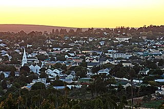
Malmesbury is a town of approximately 36,000 inhabitants in the Western Cape province of South Africa, about 65 km north of Cape Town.
Piketberg is a town in the Western Cape, South Africa, located about 80 km east of Saldanha Bay. The original spelling of the name was "Piquetberg". The town is in the foothills of the Piketberg mountains, a range of low mountains formed from Table Mountain Sandstone.

Vredendal is a town in the northern Olifants River Valley in the Western Cape province of South Africa, with a population of 16,164 people. It lies 250 kilometres (160 mi) north of Cape Town on the banks of the Olifants River at the southern edge of Little Namaqualand.

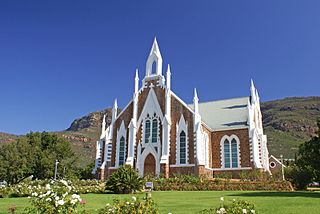
Citrusdal is a town of 5,000 people in the Olifants River Valley in the Western Cape province of South Africa. It is situated at the base of the Cederberg mountains about 160 kilometres (100 mi) north of Cape Town. Agriculture in the area is dominated by citrus fruit farming, hence the town's name. Natural hot water springs occur in the area. It also has a high school named Cederberg Academy and a private school and two other primary schools and lots of creches.

Touws River is a small railway town of 8,126 people in the Western Cape province of South Africa. It is located on the river of the same name, about 160 kilometres (100 mi) north-east of Cape Town. The Touwsrivier CPV Solar Project is located just outside of the town and supplies 50 MW to the national electrical grid.

Eendekuil is a settlement in West Coast District Municipality in the Western Cape province of South Africa.

Redelinghuys is a village in the Bergrivier Local Municipality in the Western Cape province of South Africa, located about 160 kilometres (100 mi) north of Cape Town on the Verlorevlei River. The 2001 Census recorded the population as 581 people in 167 households. The village is situated on the R366 regional route between Piketberg and Elands Bay. It is served by a police station, a public library, a satellite health clinic, and two primary schools.

Strandfontein is a coastal village in the Matzikama Municipality, in the Western Cape province of South Africa. According to the 2011 census it has 431 residents in 92 households. It lies on the Atlantic coast to the south of the mouth of the Olifants River, 300 kilometres (190 mi) north of Cape Town. The name is Afrikaans for "beach spring".
The Kammanassie Mountains are a mountain range in the Western Cape, South Africa. The highest peak is Mannetjiesberg at 1,955 metres above sea level and the mountain range is one of the prominent east-west trending ranges composing the southern branch of the Cape Fold Belt.


