
Harrismith is a large town in the Free State province of South Africa. It was named for Sir Harry Smith, a 19th-century British governor and high commissioner of the Cape Colony. It is situated by the Wilge River, alongside the N3 highway, about midway between Johannesburg, about 300 km to the north-west, and Durban to the southeast. The town is located at the junction of the N5 highway, which continues westward towards the provincial capital Bloemfontein, some 340 km to the south-west. This important crossroads in South Africa's land trade routes is surrounded by mesas and buttes. It is located at the base of one of these called Platberg.

Overberg is a region in South Africa to the east of Cape Town beyond the Hottentots-Holland mountains. It lies along the Western Cape Province's south coast between the Cape Peninsula and the region known as the Garden Route in the east. The boundaries of the Overberg are the Hottentots-Holland mountains in the West; the Riviersonderend Mountains, part of the Cape Fold Belt, in the North; the Atlantic and Indian Oceans in the South and the Breede River in the East.
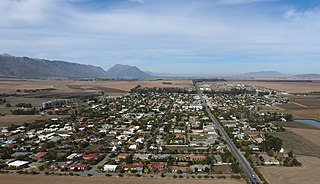
Wesselsbron is a small maize farming town 75 kilometres south of Bothaville in Free State province of South Africa.

Britstown is a small farming town situated in the Northern Cape province of South Africa, in the Pixley ka Seme District Municipality, Emthanjeni Local Municipality. The town is named after Hans Brits who settled here after he accompanied David Livingstone on a venture into the interior.

Swellendam is the third oldest town in South Africa, a town with 17,537 inhabitants situated in the Western Cape province. The town has over 50 provincial heritage sites, most of them buildings of Cape Dutch architecture. Swellendam is situated on the N2, approximately 220 km from both Cape Town and George.

The Langeberg Range is a mountain range in the Western Cape province of South Africa. Its highest peak is Keeromsberg at 2,075 m that lies 15 km North East of the town of Worcester. Some of the highest peaks of the range are located just to the north of Swellendam, in a subrange known as the Clock Peaks whose highest point is the 1,710 m high Misty Point. Local lore states one can tell the time by means of the shadows cast by the seven summits of the Clock Peaks.

Heidelberg is a town in the Western Cape, South Africa. It is located near South Africa's south coast, on the N2 highway, 274 km east of Cape Town. Heidelberg is just east of the Overberg region, and some consider it the beginning of the Garden Route. Heidelberg is part of the Hessequa Local Municipality. Fourie House on Fourie Street is the oldest house in Heidelberg.
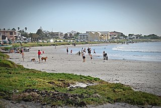
Melkbosstrand is a coastal town located on the South West Coast of South Africa, 30 km north of Cape Town. It forms part of the City of Cape Town Metropolitan Municipality, the municipality governing Cape Town and its greater metropolitan area.

Durbanville is a town in the Western Cape province of South Africa, part of the greater City of Cape Town metropolitan area. Durbanville is a semi-rural residential suburb on the northern outskirts of the metropolis and is surrounded by farms producing wine and wheat.
Ceres is the administrative centre and largest town of the Witzenberg Local Municipality in the Western Cape Province of South Africa. Ceres serves as a regional centre for the surrounding towns of Wolseley, Tulbagh, Op-die-Berg and Prince Alfred Hamlet. It is situated in the Warmbokkeveld Valley about 170 km north-east of Cape Town. Ceres is located at the north-eastern entrance to Michell's Pass and was the old route north between Cape Town and Johannesburg, which was later replaced by the N1 highway, which traverses the Breede River Valley to the south.
Botrivier is a small town of approximately 10 000 people, situated in the Overberg region of the Western Cape in South Africa.
Malmesbury is a town of approximately 36,000 inhabitants in the Western Cape province of South Africa, about 65 km north of Cape Town.

Bredasdorp is a town in the Southern Overberg region of the Western Cape, South Africa, and the main economic and service hub of that region. It lies on the northern edge of the Agulhas Plain, about 160 kilometres (100 mi) south-east of Cape Town and 35 kilometres (22 mi) north of Cape Agulhas, the southernmost tip of Africa.

Moorreesburg is a rural town situated about 90 kilometres (60 mi) north of Cape Town, in the Western Cape province of South Africa. It was laid out in 1879 on the farm Hooikraal, was administered by a village management board from 1882 and attained municipal status in 1909. Today it falls within the Swartland Local Municipality, which is part of the West Coast District Municipality. The town is the seat of government for the West Coast District Municipality.

Riebeek West is a small town situated about 75 km north-east of Cape Town and 5 km north of its twin town Riebeek Kasteel in the Swartland area of the Western Cape, South Africa.
Porterville is a town in the Western Cape province of South Africa.
Bothasig is a suburban area of the City of Cape Town in Western Cape, South Africa. It is located north of Edgemead and east of Milnerton. It is located approximately 15 km north-east of the Cape Town city centre.

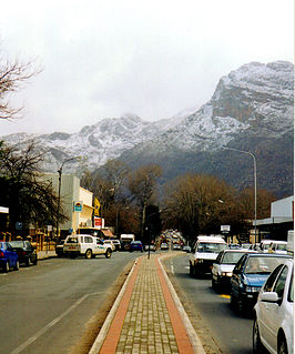
Jamestown is a town on the N6 national road 58 km south of Aliwal North and 105 km north of Komani in the Joe Gqabi District Municipality of the Eastern Cape, South Africa. It is at the centre of a fertile sheep, cattle and wheat-farming area and was the terminus of a branch railway line from Molteno. It was named after James Wagenaar, original owner of the farm on which the town was laid out.

Jansenville is a town in Sarah Baartman District Municipality in the Eastern Cape province of South Africa.

Mamre is a small rural town in the Western Cape province of South Africa. It is situated on the northernmost border of the City of Cape Town Metropolitan Municipality. It is situated approximately 55 kilometres (30 mi) north of central Cape Town, and 5–6 km to the neighbouring industrial town of Atlantis.


