
Sandboarding is a boardsport and extreme sport similar to snowboarding that involves riding down a sand dune while standing on a board, with both feet strapped in. Sand Sledding can also be practised sitting down or lying on the belly or the back. It typically involves a sand sled, although it is also somewhat possible to use snow sleds,or a snowboards. The invention of modern sandboarding is largely attributed to Lon Beale aka 'Doctor Dune' who began sandboarding in 1972 in California's Mojave Desert. Sandboarding has adherents throughout the world, but is most prevalent in desert areas or coastal areas with beach dunes. It is less popular than snowboarding, partly because it is very difficult to build a mechanised ski lift on a sand dune, meaning participants must climb or ride a dune buggy or all-terrain vehicle back to the top of the dune. On the other hand, dunes are normally available year-round as opposed to ski resorts, which are seasonal.
Ballito is an affluent coastal town located in KwaZulu-Natal, South Africa. Ballito is about 40 kilometres (25 mi) north of Durban and 24 kilometres south of KwaDukuza. It forms part of the KwaDukuza Local Municipality, and iLembe District Municipality. Dolphins and Whales are common on this stretch of the North Coast shoreline, hence the nickname Dolphin Coast.
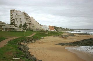
Port Edward is a small resort town situated on the south coast of KwaZulu-Natal in South Africa and lies on the border between KwaZulu-Natal and the Eastern Cape. It is situated on the R61 road between Port Shepstone and Lusikisiki.

Bergrivier Municipality is a local municipality in the Western Cape province of South Africa. It governs the towns of Piketberg, Velddrif and Porterville, as well as the surrounding villages and rural areas. As of 2011, it had a population of 61,897. It is located within the West Coast District Municipality and its municipality code is WC013.
Denare Beach is a northern village on the east shore of Amisk Lake, Saskatchewan. Located on Highway 167, the community is 20 kilometres (12 mi) south-west of Flin Flon and 422 kilometres (262 mi) north-east of Prince Albert.

Somerset West is a town in the Western Cape, South Africa. Organisationally and administratively it is included in the City of Cape Town metropolitan municipality Eastern Suburbs zone . The vehicle registration code for Somerset West is CFM and the post code is 7130 for street addresses, and 7129 for post office boxes.

Noordhoek is a seaside town in the Western Cape, South Africa, located below Chapman's Peak on the west coast of the Cape Peninsula and is approximately 35 kilometres (22 mi) to the south of Cape Town. The name "Noordhoek" was taken from Dutch and literally means "north corner". It was given this name in 1743 as being the northern corner of the Slangkop farm. The first permanent resident of European origin is Jaco Malan who built his house there. In 1857, the region was divided into six plots, most of which were bought by a single family, that of the de Villiers. Noordhoek nevertheless remains a predominantly rural area where farmers grow vegetables to supply ships calling at Simon's Town. It is best known for its shoreline and its long, wide, sandy beach, which stretches south to the neighbouring village of Kommetjie. Near the southern end of this beach is the wreck of the steamship "Kakapo", which ran aground in 1900, when the captain mistook Chapman's Peak for the Cape of Good Hope and put the helm over to port.

Bloubergstrand is a seaside suburb of the City of Cape Town, South Africa, along the shores of Table Bay, 15 kilometres (9.3 mi) due north of the city centre of Cape Town. The name Bloubergstrand literally means "blue mountain beach" in Afrikaans, and is derived from Blaauwberg, a nearby hill. Bloubergstrand is mainly a residential area, and attracts large numbers of visitors especially kitesurf enthusiasts. The beach at Bloubergstrand is a popular location for a classic view of Table Mountain across the bay and is one of the world's top kitesurf destinations. Robben Island is located 6.9 kilometres (4.3 mi) west of the coast of Bloubergstrand.

Rosedale is a beachside settlement in New South Wales, Australia. It is on the south coast, about 18 kilometres by road south of Batemans Bay. The area is administered by the Eurobodalla Shire. At the 2016 census, Rosedale had a population of 221.
Melkbosstrand is a coastal town located on the South West Coast of South Africa, 30 km north of Cape Town. It forms part of the City of Cape Town Metropolitan Municipality, the municipality governing Cape Town and its greater metropolitan area.

Salt Rock is a small coastal village just north of Ballito and Shaka's Rock situated along the Dolphin Coast of KwaZulu-Natal, South Africa. It is a favorite holiday destination for many local South Africans. It is approximately located 52 kilometres north-east of Durban and 19 km south-east of KwaDukuza. Salt Rock owes much of its history to Basil Hulett and his wife Gwen who started not only the Salt Rock Hotel but went on to develop the town of Salt Rock as found today.
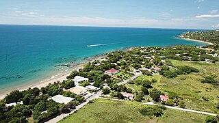
Treasure Beach is the name given to a stretch of four Jamaican coves and their associated settlements: Billy's Bay, Frenchman's Bay, Calabash Bay and Great (Pedro) Bay.

Taghazout is a small Berber fishing village 19 km (12 mi) north of the city of Agadir in southwestern Morocco. The inhabitants are mostly of Berber origin. Fishing, tourism, and the production of Argan oil being the main source of income. In recent years, tourism has been increasing in importance to the local economy and it is a popular surfing destination.

Velddrif or Velddrift, is a coastal fishing town in the Bergrivier Local Municipality, Western Cape, South Africa. The town had a population 12507 in 2015 and is located on the estuary at which the Berg River flows into St. Helena Bay.

Coffee Bay is a town on the Wild Coast of the Eastern Cape Province of South Africa. It is located about 250 kilometres south-west of the city of Durban and has a population of 258 people.
Britannia Bay is a small town in the West Coast District Municipality in the Western Cape province of South Africa, approximately 141 kilometres (88 mi) from Cape Town.
Narubis is a settlement in the ǁKaras Region of southern Namibia with post office, hotel and shops, situated off the national road B1 68 kilometres (42 mi) south-east of Keetmanshoop and 100 kilometres (62 mi) north-north-east of Karasburg. The name is of Khoekhoen origin and means 'place of Inaru trees', after the Euclea pseudebenus.
Rocherpan Nature Reserve is a nature reserve on the West Coast of Western Cape, South Africa. It borders the sea, about 25 km (16 mi) north of Velddrif on the road between Velddrif and Laaiplek to Elands Bay, and is north of Dwarskersbos. The reserve occupies an area of 1,080 ha.
The Rocherpan Marine Protected Area is a small coastal conservation region on the West Coast of the Western Cape province, in the territorial waters of South Africa. It is about 25 km north of Velddrif on the road to Elands Bay, north of Dwarskersbos.
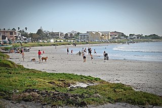
Leisure Bay is a small coastal village located on the Lower South Coast of KwaZulu-Natal in South Africa.


