Nuwerus

Last updated
Nuwerus
Nuwerus.jpg
Nuwerus
South Africa Western Cape location map.svg
Red pog.svg
Nuwerus
South Africa adm location map.svg
Red pog.svg
Nuwerus
Coordinates: 31°08′56″S18°21′29″E / 31.149°S 18.358°E / -31.149; 18.358 Coordinates: 31°08′56″S18°21′29″E / 31.149°S 18.358°E / -31.149; 18.358
Country South Africa
Province Western Cape
District West Coast
Municipality Matzikama
Area
[1]
  Total0.75 km2 (0.29 sq mi)
Population
(2011) [1]
  Total650
  Density870/km2 (2,200/sq mi)
Racial makeup (2011)
[1]
   Black African 7.7%
   Coloured 81.3%
   Indian/Asian 0.8%
   White 9.8%
  Other0.5%
First languages (2011)
[1]
   Afrikaans 96.4%
   English 2.3%
  Other1.3%
Time zone UTC+2 (SAST)
PO box
8201
Area code 027

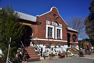
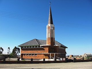
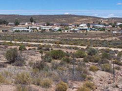
Nuwerus is a settlement in Matzikama Municipality, West Coast District in the Western Cape province of South Africa.

West Coast District Municipality District municipality in Western Cape, South Africa

The West Coast District Municipality is a district municipality located in the Western Cape province of South Africa. Its municipality code is DC1. Moorreesburg is the seat of the district. As of 2011 it had a total population of 391,766.

Western Cape Province of South Africa on the south-western coast

The Western Cape is a province of South Africa, situated on the south-western coast of the country. It is the fourth largest of the nine provinces with an area of 129,449 square kilometres (49,981 sq mi), and the third most populous, with an estimated 6.6 million inhabitants in 2018. About two-thirds of these inhabitants live in the metropolitan area of Cape Town, which is also the provincial capital. The Western Cape was created in 1994 from part of the former Cape Province.

South Africa Republic in the southernmost part of Africa

South Africa, officially the Republic of South Africa (RSA), is the southernmost country in Africa. It is bounded to the south by 2,798 kilometres (1,739 mi) of coastline of Southern Africa stretching along the South Atlantic and Indian Oceans; to the north by the neighbouring countries of Namibia, Botswana, and Zimbabwe; and to the east and northeast by Mozambique and Eswatini (Swaziland); and it surrounds the enclaved country of Lesotho. South Africa is the largest country in Southern Africa and the 25th-largest country in the world by land area and, with over 57 million people, is the world's 24th-most populous nation. It is the southernmost country on the mainland of the Old World or the Eastern Hemisphere. About 80 percent of South Africans are of Sub-Saharan African ancestry, divided among a variety of ethnic groups speaking different African languages, nine of which have official status. The remaining population consists of Africa's largest communities of European (White), Asian (Indian), and multiracial (Coloured) ancestry.

Village 16 km south-east of Bitterfontein and 70 km north-west of Vanrhynsdorp. The name is Afrikaans and means ‘new rest’. [2]

Bitterfontein Place in Western Cape, South Africa

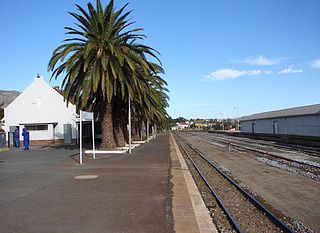
Bitterfontein is a village in the Knersvlakte, the northernmost area of the Western Cape province of South Africa, 320 kilometres (200 mi) north of Cape Town. It is the railhead of a line from Cape Town; ore from the copper mines at Okiep is transferred there from road transport to the railway. It is also located on the N7 national road; the distance from Cape Town is 386 kilometres (240 mi) by road and 465 kilometres (289 mi) by rail.

Vanrhynsdorp Place in Western Cape, South Africa

Vanrhynsdorp is a settlement in West Coast District Municipality in the Western Cape province of South Africa.

Related Research Articles

Mahikeng Place in North West, South Africa

Mahikeng, formerly, and still commonly known as Mafikeng, is the capital city of the North-West Province of South Africa.

Westonaria Place in Gauteng, South Africa

Westonaria is a town in the west of Gauteng province of South Africa. It is situated in the Rand West City Local Municipality, part of the West Rand District Municipality. During the apartheid era, blacks lived outside town in Bekkersdal. The town is some 45 km west of Johannesburg and 18 km south of Randfontein.

Delareyville Place in North West, South Africa

Delareyville is a maize and peanut farming town situated in North West Province of South Africa. The town is 96 km south-west of Lichtenburg, 82 km north-east of Vryburg, 114 km north-west of Wolmaransstad, and 61 km north of Schweizer-Reneke.

Matzikama Local Municipality Local municipality in Western Cape, South Africa

Matzikama Local Municipality is a local municipality which governs the northernmost part of the Western Cape province of South Africa, including the towns of Vredendal, Vanrhynsdorp, Klawer and Lutzville, and the surrounding villages and rural areas. As of 2011 it had a population of 67,147. It forms part of the West Coast District Municipality, and has municipality code WC011.

Koster, North West Place in North West, South Africa

Koster is a small farming town situated on the watershed between the Orange and Limpopo Rivers in North West Province of South Africa.

Derby, North West Place in North West, South Africa

Derby is a small town situated in North West Province of South Africa that was named after the British Secretary of State Lord Derby. Derby began as a refuge for destitute people.

Swartruggens Place in North West, South Africa

Swartruggens is a small farming town in North West Province, South Africa that was established in 1875.

Soshanguve Place in Gauteng, South Africa

Soshanguve is a township situated about 30 km north of Pretoria, Gauteng, South Africa. The name Soshanguve is an acronym for SOtho, SHAngaan, NGUni and VEnda, thus showing the multi-ethnic composition of the population (Mashabela 1988:138). The major African languages of South Africa are heard in Soshanguve.

Aberdeen, Eastern Cape Place in Eastern Cape, South Africa

Aberdeen is a small town in the Sarah Baartman District Municipality of the Eastern Cape province of South Africa. With its numerous examples of Victorian architecture, it is one of the architectural conservation areas of the Karoo.

Prieska Place in Northern Cape, South Africa

Prieska is a town on the south bank of the Orange River, in the province of the Northern Cape, in western South Africa.

Postmasburg Place in Northern Cape, South Africa

Postmasburg is a town in the Northern Cape province of South Africa, located approximately 170 km east of Upington.

Bothasig A suburban area of the Northern Suburbs of Cape Town

Bothasig also known as 'The Sig' is a suburban area of the City of Cape Town in Western Cape, South Africa. It is located north of Edgemead and east of Milnerton. It is located approximately 15 km north-east of the Cape Town city centre.

Klawer Place in Western Cape, South Africa

Klawer is a settlement in West Coast District Municipality in the Western Cape province of South Africa.

Umbogintwini Place in KwaZulu-Natal, South Africa

Umbogintwini is a town near Durban in KwaZulu-Natal, South Africa. Its post office received the corrected name in 1997. It is best known for the industrial complex which has Acacia, Chemical Initiatives and Sammar warehouses.

Hendrina Place in Mpumalanga, South Africa

Hendrina is a settlement in Nkangala District Municipality in the Mpumalanga province of South Africa. Town is 53km north-west of Ermelo, 40km west-south-west of Carolina and 53km south-east of Middelburg.

Willowmore Place in Eastern Cape, South Africa

Willowmore is a town in Sarah Baartman District Municipality in the Eastern Cape province of South Africa.

Trichardt Place in Mpumalanga, South Africa

Trichardt is a town in Gert Sibande District Municipality in the Mpumalanga province of South Africa. The village 34km west of Bethal and 32km west-south-west of Leandra, next door to Secunda.

Mpumalanga, KwaZulu-Natal Place in KwaZulu-Natal, South Africa

Mpumalanga is a town in eThekwini in the KwaZulu-Natal province of South Africa. It is a township about 10 km south-south-east of Cato Ridge and some 40 km west of Durban. Derived from Zulu, the name means 'sunrise', 'the sun comes out'.

Rietbron Place in Eastern Cape, South Africa

Rietbron is a town in Sarah Baartman District Municipality in the Eastern Cape province of South Africa.

Spoegrivier Place in Northern Cape, South Africa

Spoegrivier is a town in Namakwa District Municipality in the Northern Cape province of South Africa.

References

  1. 1 2 3 4 "Main Place Nuwerus". Census 2011.
  2. "Dictionary of Southern African Place Names (Public Domain)". Human Science Research Council. p. 344.