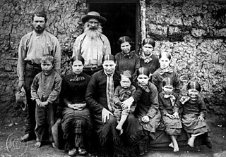
Boers are the descendants of the proto Afrikaans-speaking Free Burghers of the eastern Cape frontier in Southern Africa during the 17th, 18th, and 19th centuries. From 1652 to 1795, the Dutch East India Company controlled Dutch Cape Colony, but the United Kingdom incorporated it into the British Empire in 1806. The name of the group is derived from Trekboer then later "boer", which means "farmer" in Dutch and Afrikaans.

Afrikaner Calvinism is a cultural and religious development among Afrikaners that combined elements of seventeenth-century Calvinist doctrine with a "chosen people" ideology based in the Bible. It had origins in ideas espoused in the Old Testament of the Jews as the chosen people.

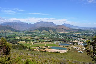
Stellenbosch is a town in the Western Cape province of South Africa, situated about 50 kilometres east of Cape Town, along the banks of the Eerste River at the foot of the Stellenbosch Mountain. The town became known as the City of Oaks or Eikestad in Afrikaans and Dutch due to the large number of oak trees that were planted by its founder, Simon van der Stel, to grace the streets and homesteads.
Franschhoek is a small town in the Western Cape Province and one of the oldest towns in South Africa. It was formerly known as Oliphants hoek. It is situated about 75 kilometres (47 mi) from Cape Town, a 45-minute drive away. The whole area, including townships such as Groendal and suburbs such as Wemmershoek, has a population of slightly over 20,000 people while the town proper, known as Hugenote, has a population of around 1,000. Since 2000, it has been incorporated into Stellenbosch Municipality. In 2022, Franschhoek was mentioned in Time magazine as one of the top 50 places in the world to visit.
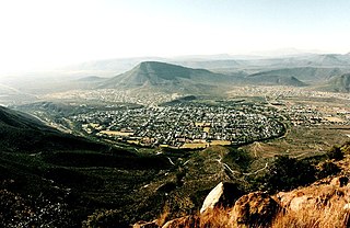
Graaff-Reinet is a town in the Eastern Cape Province of South Africa. It is the oldest town in the province and the fourth oldest town in South Africa, after Cape Town, Stellenbosch, Simon's Town, Paarl and Swellendam. The town was the centre of a short-lived republic in the late 18th century. The town was a starting point for Great Trek groups led by Gerrit Maritz and Piet Retief and furnished large numbers of the Voortrekkers in 1835–1842.

Cederberg Municipality is a local municipality which governs an area of the Western Cape province of South Africa stretching from the Cederberg mountains through the middle valley of the Olifants River to the Atlantic coast. It includes the towns of Clanwilliam, Citrusdal and Lamberts Bay, and the surrounding villages and farms. As of 2011 it had a population of 49,768. It is located within the West Coast District Municipality and its municipality code is WC012.

Saron is a town in the Western Cape province of South Africa.

The Cape Fold Belt is a fold and thrust belt of late Paleozoic age, which affected the sequence of sedimentary rock layers of the Cape Supergroup in the southwestern corner of South Africa. It was originally continuous with the Ventana Mountains near Bahía Blanca in Argentina, the Pensacola Mountains, the Ellsworth Mountains and the Hunter-Bowen orogeny in eastern Australia. The rocks involved are generally sandstones and shales, with the shales persisting in the valley floors while the erosion resistant sandstones form the parallel ranges, the Cape Fold Mountains, which reach a maximum height of 2325 m at Seweweekspoortpiek.
The Uniting Reformed Church in Southern Africa was formed by the union of the black and coloured Nederduits Gereformeerde Kerk mission churches.
Bredasdorp is a town in the Southern Overberg region of the Western Cape, South Africa, and the main economic and service hub of that region. It lies on the northern edge of the Agulhas Plain, about 160 kilometres (100 mi) south-east of Cape Town and 35 kilometres (22 mi) north of Cape Agulhas, the southernmost tip of Africa.

Table Mountain Sandstone (TMS) is a group of rock formations within the Cape Supergroup sequence of rocks. Although the term "Table Mountain Sandstone" is still widely used in common parlance, the term TMS is no longer formally recognized; the correct name is the "Peninsula Formation Sandstone", which is part of the Table Mountain Group. The designation "Table Mountain Sandstone" will, however, in deference to the title, continue to be used in the rest of this article. The name is derived from the famous landmark in Cape Town, Table Mountain.
Vredenburg is a town of the Cape West Coast in the Western Cape province of South Africa. "Vrede" is Afrikaans for peace. It is the transportation and commercial hub of the West Coast area and administrative centre of the Saldanha Bay Local Municipality. It is located 12 kilometres inland from the coast at Saldanha Bay on the Cape Columbine Peninsula 138 km north of Cape Town.

Carnarvon is a small town in the Northern Cape Province of South Africa.
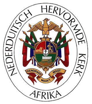
The Dutch Reformed Church in Africa is a Reformed Christian denomination based in South Africa. It also has congregations in Namibia, Botswana, Zambia and Zimbabwe. Along with the Dutch Reformed Church in South Africa (NGK) and the Reformed Churches in South Africa, the NHKA is one of the three Dutch Reformed sister churches of South Africa. The NHKA retains the old Nomenclature Nederduitsch, the word originally referring to the Dutch language. The word refers to the Low Saxon language today. The Dutch language remained the official language of the church until 1933 when the church started functioning almost exclusively in Afrikaans.

Afrikaners are a Southern African ethnic group descended from predominantly Dutch settlers first arriving at the Cape of Good Hope in 1652. Until 1994, they dominated South Africa's politics as well as the country's commercial agricultural sector.

Loxton is a town in the Karoo region of South Africa's Northern Cape province. Within the Ubuntu Local Municipality of the Pixley ka Seme District Municipality

Riebeek West is a small town situated about 75 km north-east of Cape Town and 5 km north of its twin town Riebeek Kasteel in the Swartland area of the Western Cape, South Africa.

Hopefield is a settlement in West Coast District Municipality in the Western Cape province of South Africa on the R45 between Malmesbury and Vredenburg. The town lies east of Saldanha Bay and Langebaan, 40 km (25 mi) southeast of Vredenburg and 120 km (75 mi) north of Cape Town.
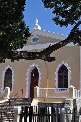
The African Theatre was a theatre in Cape Town, South Africa. It was the first stone theater in the European style in South Africa and one of the first in the Southern Hemisphere. It was also known by other names, such as the Komediehuis, The Theatre, etc. The building was later used as a church by the Dutch Reformed Church in South Africa (NGK) and stands to this day.
Claremont is a suburb of Johannesburg, South Africa, around 9 km west-northwest of City Hall. Under the old municipal borders, it was one of the westernmost suburbs of the city and bordered Roodepoort.


