Jakkalsfontein | |
|---|---|
 Jakkalsfontein  Jakkalsfontein | |
| Coordinates: 33°24′26″S18°15′05″E / 33.40722°S 18.25139°E | |
| Country | South Africa |
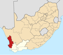
| Province | Western Cape |
| District | West Coast |
| Municipality | Swartland |
| Area | |
• Total | 10.76 km2 (4.15 sq mi) |
| Population (2011) [1] | |
• Total | 96 |
| • Density | 8.9/km2 (23/sq mi) |
| Time zone | UTC+2 (SAST) |
Jakkalsfontein is a settlement in Swartland Local Municipality in the Western Cape province of South Africa, located on the West Coast R27 Road. It is located near the Jakkalsfontein Private Nature Reserve.