This article needs additional citations for verification .(July 2011) |
Eendekuil | |
|---|---|
 Eendekuil Church | |
 Eendekuil  Eendekuil | |
| Coordinates: 32°41′S18°53′E / 32.683°S 18.883°E | |
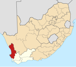
| Country | South Africa |
| Province | Western Cape |
| District | West Coast |
| Municipality | Bergrivier |
| Area | |
• Total | 0.85 km2 (0.33 sq mi) |
| Population (2011) [1] | |
• Total | 1,530 |
| • Density | 1,800/km2 (4,700/sq mi) |
| Racial makeup (2011) | |
| • Black African | 2.2% |
| • Coloured | 89.3% |
| • Indian/Asian | 1.1% |
| • White | 6.5% |
| • Other | 0.9% |
| First languages (2011) | |
| • Afrikaans | 96.9% |
| • Other | 3.1% |
| Time zone | UTC+2 (SAST) |
| PO box | 7335 |
| Area code | 022 |
Eendekuil is a settlement in West Coast District Municipality in the Western Cape province of South Africa.
Situated 30 km (19 mi) north of Piketberg and 145 km (90 km) from Cape Town.The village was the terminus of the Cape Town railway until the end of the Anglo-Boer War, and it remains the railhead for the Citrusdal region, which lies on the other side of the Olifants River. [2]