National routes in South Africa are a class of trunk roads and freeways which connect major cities. They form the highest category in the South African route numbering scheme, and are designated with route numbers beginning with "N", from N1 to N18. Most segments of the national route network are officially proclaimed National Roads that are maintained by the South African National Roads Agency (SANRAL), but some segments are maintained by provincial or local road authorities.

Middelburg is a large farming and industrial town in the South African province of Mpumalanga.

The R35 is a provincial route in Mpumalanga, South Africa that connects Amersfoort with Middelburg via Morgenzon and Bethal. The R35 used to connect with the N3 near Ladysmith, but the portion of the road from Amersfoort onwards is now part of the N11.

The R56 is a provincial route in South Africa that connects Middelburg with Pietermaritzburg via Molteno, Maclear and Kokstad. It is co-signed with the N2 between Kokstad and Stafford's Post for 39 kilometres.

The R82 is a provincial route in South Africa that connects Johannesburg with Kroonstad via Vereeniging and Sasolburg. It starts just south of the M1 Johannesburg Municipal Highway's interchange with the N12 Southern Bypass, going south, meeting the R59, R54, R42 & R28 routes at Vereeniging before crossing the Vaal River into the Free State & proceeding to Kroonstad. It is an alternative, but longer route to the N1 national route between Johannesburg & Kroonstad.
The R104 is a regional route in South Africa that is the designation for some of the old sections of roads that were previously the N4, prior to upgrading. It connects Rustenburg in the North West province with eMalahleni in Mpumalanga province via Mooinooi, Hartbeespoort, Pretoria and Bronkhorstspruit. There are two additional sections in Mpumalanga province: a 50km section connecting Middelburg and Wonderfontein and a 17km section passing through Mbombela.
The R398 is a Regional Route in South Africa that connects Middelburg with Britstown via Richmond.

The N2 is a national route in South Africa that runs from Cape Town through George, Gqeberha, East London, Mthatha, Port Shepstone and Durban to Ermelo. It is the main highway along the Indian Ocean coast of the country. Its current length of 2,255 kilometres (1,401 mi) makes it the longest numbered route in South Africa.

The N4 is a national route in South Africa that runs from Skilpadshek on the Botswana border, past Rustenburg, Pretoria, eMalahleni and Mbombela, to Komatipoort on the Mozambique border. The entire route is a toll road.

Middelburg is a town in the Eastern Cape province of South Africa, in the Great Karoo. It lies in the Upper Karoo, 1,279 m above sea level, with a population of 19,000. It falls under the Inxuba Yethemba Local Municipality, in the Chris Hani District Municipality.

The N9 is a national route in South Africa that connects George with the N1 at Colesberg, via Graaff-Reinet and Middelburg.

The N10 is a national route in South Africa connecting Gqeberha on the Eastern Cape coast with the Namibian border at Nakop, via Cradock, De Aar and Upington.

The N11 is a national route in South Africa which runs from the Botswana border at Groblersbrug, through Mokopane, Middelburg, Ermelo and Newcastle to end at the N3 just after Ladysmith.
The R542 is a Regional Route in South Africa that connects Rethabile with Hendrina.
The R544 is a Regional Route in Mpumalanga, South Africa. It connects Bethal with Kwaggafontein via Witbank (eMalahleni) and Verena.
The R555 is a Regional Route in South Africa that connects Springs with Ohrigstad via Delmas, Ogies, Witbank, Middelburg, Stoffberg and Burgersfort.
Mhluzi is a township just west of the large farming and industrial town Middelburg in the South African province of Mpumalanga.
In South Africa, as elsewhere in the world, the railways played a huge part in development and growth on nearly all terrains in the country. Conversely, events in South Africa and its neighbours over the years had a huge influence on the development of railways.

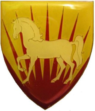
Middelburg Commando was a light infantry regiment of the South African Army. It formed part of the South African Army Infantry Formation as well as the South African Territorial Reserve.

Pretoria–Maputo railway, also called Delagoa Bay railway, Iron railway and Eastern railway, is a railway that connects the city of Maputo, Mozambique, to the city of Pretoria, in South Africa. It is 567 km long, in 1067 mm gauge. The Mozambican section, between Maputo and Ressano Garcia, is managed by the state-owned Mozambique Ports and Railways (CFM) company, and it is officially known in Mozambique as the Ressano Garcia Line; in turn, on the South African stretch, between the town of Komatipoort and city of Pretoria, the administration is done by the company Transnet Freight Rail.


