 | ||||
|---|---|---|---|---|
| Route information | ||||
| Length | 90.3 km (56.1 mi) | |||
| Major junctions | ||||
| From | ||||
| To | ||||
| Location | ||||
| Country | South Africa | |||
| Highway system | ||||
| ||||
The R578 is a Regional Route in South Africa that connects Louis Trichardt with Giyani via Waterval and Bungeni. [1]
| | ||||
|---|---|---|---|---|
| Route information | ||||
| Length | 90.3 km (56.1 mi) | |||
| Major junctions | ||||
| From | ||||
| To | ||||
| Location | ||||
| Country | South Africa | |||
| Highway system | ||||
| ||||
The R578 is a Regional Route in South Africa that connects Louis Trichardt with Giyani via Waterval and Bungeni. [1]
The construction of the large section of the road, from Elim to Giyani (84 km of the road) was surveyed, planned and constructed by the former Gazankulu Government in 1987. The R578 runs through the Tsonga homeland of former Gazankulu, in particular, it runs through Hlanganani and Giyani.The following villages, which are large and densely populated, are found alongside the R578 road; Elim, Njhakanjhaka, Rivoni, Waterval, Shirley, Mbhokota, Bokisi, Chavani, Nwaxinyamani, Bungeni, Nkuzana, Majosi, Nwamatatana, Khomanani, Ntshuxi, the Middle Letaba Dam, Babangu, Ndengeza C, Nhlaneki, Mapuve, Maswanganyi, Bode, Dzingidzingi and Giyani. Elim Hospital, Hubyeni Shopping Centre, Nkuna Kraal Mall and Elim Mall are all situated alongside the R578 road.
Its western terminus is the N1 just south of Louis Trichardt, it heads east-south-east, through the township of Waterval at Elim to end at Giyani at an intersection with the R81. [1]

The Province of the Transvaal, commonly referred to as the Transvaal, was a province of South Africa from 1910 until 1994, when a new constitution subdivided it following the end of apartheid. The name "Transvaal" refers to the province's geographical location to the north of the Vaal River. Its capital was Pretoria, which was also the country's executive capital.

Limpopo is the northernmost province of South Africa. It is named after the Limpopo River, which forms the province's western and northern borders. The term Limpopo is derived from Rivombo (Livombo/Lebombo), a group of Tsonga settlers led by Hosi Rivombo who settled in the mountainous vicinity and named the area after their leader. The Lebombo mountains are also named after them. The river has been called the Vhembe by local Venda communities of the area. The capital and largest city in the province is Polokwane, while the provincial legislature is situated in Lebowakgomo.

The R81 is a provincial route in Limpopo, South Africa that connects Polokwane with the R524 at Nyavani via Giyani.

Gazankulu was a bantustan in South Africa, intended by the apartheid government to be a semi-independent homeland for the Tsonga people. It was located in both the Northern Transvaal, now Limpopo province and Eastern Transvaal, now Mpumalanga province.
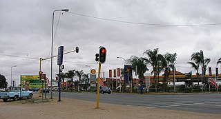
Giyani is a city situated in the north-eastern part of Limpopo Province, South Africa. It is the administrative capital of the Mopani District Municipality and a former capital of the defunct Gazankulu Bantustan. The city of Giyani is divided into seven sections: Section A, Section D1, Section D2, Section E, Section F, Kremetart, and Giyani CBD. Risinga View and Church View are new residential areas in Giyani, but they fall under the local traditional leaders. The Giyani CBD is nicknamed Benstore, and this name is commonly used by residents of the region. Giyani is surrounded by a number of villages with rich Tsonga cultural activities, administered by the Greater Giyani Local Municipality.
The magistrates' courts are the lowest level of the court system in South Africa. They are the courts of first instance for most criminal cases except for the most serious crimes, and for civil cases where the value of the claim is below a fixed monetary limit.

The N17 is a national route in South Africa which runs from Johannesburg to Oshoek (Ngwenya) on the border with Eswatini. It passes through Springs, Bethal and Ermelo.
Malamulele can refer to the town of Malamulele or the area of Malamulele. Both the town and area are in the Limpopo province of South Africa and predominantly occupied by Tsonga people. Malamulele town has one provincial road and one regional road; the R81 to Giyani and the R524 to Thohoyandou respectively. Malamulele is flanked by two rivers, Levubu River (Rivhubye) to the west and Letaba River to the east, meanwhile the Shingwedzi River runs from Malamulele West to Malamulele East, joining the Olifants in Mozambique on its way to the Indian Ocean. Malamulele is the seat of the Collins Chabane Local Municipality.
Middle Letaba Dam is an earth-fill type dam located on the Middle Letaba River, 40 km east of Elim and 40 km west of Giyani, Limpopo, South Africa. The source of the Middle Letaba river rises high in the tropical mountains of Magoebaskloof near Tzaneen, where rainfall is abundant during the summer months. The river passes numerous villages and its flow becomes quite strong when it reaches the village of Magoro.
The R101 is a Regional Route in South Africa that is the designation for some of the old sections of roads that were previously the N1, prior to upgrading. It only has 2 sections, from Bellville to Worcester and from Johannesburg to Polokwane.
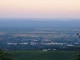
Louis Trichardt, informally shortened to LTT, is a town at the foot of Songozwi, in the Soutpansberg mountain range in the Limpopo province of South Africa. It is the centre of the Makhado Local Municipality, which comprises 16,000 km2 with a population of 270,000 (2001). Louis Trichardt is located in a fertile region where litchis, bananas, mangoes and nuts are produced. The N1 National Route runs through the town. Louis Trichardt is 437 kilometres from Johannesburg and one hour's drive from the Zimbabwean border at Beitbridge. Louis Trichardt was known for a time as Makhado, but it was changed back to Louis Trichardt. Vleifontein, Elim, Tshikota, Madombidzha, Makhado Park and Dzanani surround the town in all directions.
Waterval is a residential township in front of Elim Hospital, it is situated in the Hlanganani district of the former Tsonga homeland of Gazankulu, alongside the R578 road to Giyani in the Limpopo province of South Africa. Waterval includes Njhakanjhaka, Lemana, Elim Hospital, Elim Mall, Hubyeni Shopping centre, Magangeni but excludes Shirley village, which is a separate and stand alone farm, sharing a legal boundary with Waterval and Mbhokota village to the east.
Tiyani is a village situated on the banks of the Middle Letaba Dam in the Hlanganani District of the former Gazankulu homeland, which currently form part of the Vhembe District Municipality in the Limpopo province of South Africa.
Hlanganani, also known as Spelonken, is an amalgamation of various large villages which are situated in the north western portion of the former Tsonga homeland of Gazankulu, South Africa. Hlanganani is situated alongside the R578 road to Giyani and Elim.
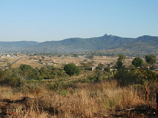
Bungeni is a large sprawling rural settlement situated on top of one of the foothills and tail end of the Soutpansberg mountain in Louis Trichardt, Limpopo Province, South Africa. The Levubu agricultural plantation, where avocado, bananas, litchis, macadamia nuts, peaches and mangoes are grown in abundance is just 3km away north of Bungeni village. It lies 35 km east of Makhado, with the R578 road passing through it. With more than 30 000 people, Bungeni is the largest Tsonga village in Makhado local municipality. In 1994 and in 2016, administrative control of this western portion of Gazankulu has been sub-divided in half and allocated to two Municipalities, first in 1994 to Makhado Local Municipality and in 2016, to the New Malamulele Municipality in the Vhembe district. As of April 2016, the Western portion, known as 'Bungeni West' by the locals, has remained in Makhado local municipality, while the eastern portion, known as 'Bungeni east', has been allocated to the new Malamulele Municipality.
The R523 is a Regional Route in South Africa.
The R524 is a Regional Route in South Africa.
The R529 is a Regional Route in Limpopo, South Africa that connects Giyani with Lenyenye via Letsitele.
The R539 is a Regional Route in Mpumalanga, South Africa. It connects the R36 between Waterval Boven and Mashishing (Lydenburg) with the R37 between Sabie and Nelspruit.
Valdezia is a sprawling rural settlement situated at the foothills of the Soutpansberg mountain range in Louis Trichardt, Limpopo Province, South Africa. It was formerly known as Albasini before Swiss Missionaries renamed it Valdezia in 1875. The village itself was formally established in 1820 by Tsonga refugees who were fleeing despotic rule from Soshangane. It is roughly 10 km east of Elim Hospital in the Hlanganani district in the former Gazankulu homeland, South Africa. It was the site of a Swiss mission station, and it was named after the Swiss canton of Vaud. Valdezia's population, according to the official census of 2011, currently stands at between 7,600 and 8,000 people. It is considered the birthplace of the written Tsonga language in South Africa.
| | This South African road or road transport-related article is a stub. You can help Wikipedia by expanding it. |