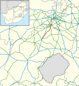
The Western Bypass is a section of the N1 and the Johannesburg Ring Road located in the city of Johannesburg, South Africa. Known at the time as the Concrete Highway, the freeway was initially opened in 1975 as a route to avoid the city centre of Johannesburg and to provide access to the western areas of the Witwatersrand. From the south, the Western Bypass begins at the Diepkloof Interchange in Soweto, where it splits from the N12 freeway and ends at the Buccleuch Interchange, where it merges with the N3 Eastern Bypass, M1 South and N1 Ben Schoeman freeways.

The N1 is a national route in South Africa that runs from Cape Town through Bloemfontein, Johannesburg, Pretoria and Polokwane to Beit Bridge on the border with Zimbabwe. It forms the first section of the famed Cape to Cairo Road.

Kroonstad, which consist of suburbs as follows: Brentpark, Constantia, Constantia Park, Dawid Malanville, Elandia, Gelukwaarts, Goedgedacht, Heuningspruit, Industria, Jordania, KoeKoeVillage, Kroonheuwel, Maokeng, Morewag, Noordhoek, Ou Dorp, Panorama, Phomalong, Presidensia, PrisonArea, Seisoville, Suidrand, Tuinhof, Uitsig, Vooruitsig, WestPark and Wilgenhof. Kroonstad is the fourth largest town in the Free State and lies two hours' drive on the N1 from Gauteng. It is the second-largest commercial and urban centre in the Northern Free State, and an important railway junction on the main line from Cape Town to Johannesburg.

The R24 is a major East-West provincial route in the Gauteng and North West provinces that links OR Tambo International Airport with Rustenburg via Johannesburg, Krugersdorp and Magaliesburg. The section of the route from OR Tambo International westwards up to a point in Roodepoort is has been named Albertina Sisulu Road since 2013, named after anti-apartheid stalwart Albertina Sisulu.

The R28 is a provincial route in Gauteng, South Africa that connects Krugersdorp with Vereeniging via Randfontein. The R28 used to connect with Pretoria, but that section of the road is now part of the N14.

The R30 is a provincial route in South Africa that connects Bloemfontein with Rustenburg via Brandfort, Welkom, Bothaville, Klerksdorp and Ventersdorp. The southern part of the route is tolled, as the R30 forms the first section of the ZR Mahabane Toll Route, with the Brandfort Toll Plaza found 10 kilometres north of its southern terminus junction with the N1 national route. The tolled portion ends at the junction with the R730.

The R34 is a long provincial route in South Africa that connects Vryburg with Richards Bay via Kroonstad and Newcastle. It passes through three provinces, North West, the Free State and KwaZulu-Natal.

The R59 is a provincial route in South Africa that connects Hertzogville with Alberton via Bothaville, Parys and Vereeniging. The R59 is a freeway from the R57 Junction in Sasolburg until the N12 Reading Interchange in Alberton, signposted as the Sybrand van Niekerk Freeway.

The R61 is a long provincial route in South Africa that connects Beaufort West with Port Shepstone via Graaff-Reinet, Komani, Mthatha and Port Edward.

The R76 is a provincial route in Free State, South Africa that connects Orkney with Bethlehem via Kroonstad.

The R82 is a provincial route in South Africa that connects Johannesburg with Kroonstad via Vereeniging and Sasolburg. It starts just south of the M1 Johannesburg Municipal Highway's interchange with the N12 Southern Bypass, going south, meeting the R59, R54, R42 & R28 routes at Vereeniging before crossing the Vaal River into the Free State & proceeding to Kroonstad. It is an alternative, but longer route to the N1 national route between Johannesburg & Kroonstad.
The R104 is a regional route in South Africa that is the designation for some of the old sections of roads that were previously the N4, prior to upgrading. It connects Rustenburg in the North West province with eMalahleni in Mpumalanga province via Mooinooi, Hartbeespoort, Pretoria and Bronkhorstspruit. There are two additional sections in Mpumalanga province: a 50km section connecting Middelburg and Wonderfontein and a 17km section passing through Mbombela.

.

The N12 is a national route in South Africa which runs from George through Beaufort West, Kimberley, Klerksdorp and Johannesburg to eMalahleni.

The N4 is a national route in South Africa that runs from Skilpadshek on the Botswana border, past Rustenburg, Pretoria, eMalahleni and Mbombela, to Komatipoort on the Mozambique border. The entire route is a toll road.
The R101 is a Regional Route in South Africa that is the designation for some of the old sections of roads that were previously the N1, prior to upgrading. It only has 2 sections, from Bellville to Worcester and from Johannesburg to Polokwane.
The R513 is a Regional Route in South Africa that connects Hartbeespoort with Bronkhorstspruit via Akasia, Pretoria North and Cullinan.
The R558 is a Regional Route in Gauteng, South Africa that connects Krugersdorp with Ennerdale via Lenasia. It is made up of two disconnected sections.
The R720 is a Regional Route in Free State, South Africa that connects Vredefort with Senekal via Koppies, Edenville and Steynsrus.
The R730 is a Regional Route in Free State, South Africa. The entire 40-kilometre route is part of the ZR Mahabane Toll Route maintained by the South African National Roads Agency, which goes from Bloemfontein to Kroonstad. Although there are no tollgates on this stretch at the moment, it is labelled as a toll road to the near public and to motorists using the road.


