
Sri Lanka was one of the countries struck by the tsunami resulting from the Indian Ocean earthquake on December 26, 2004. On January 3, 2005, Sri Lankan authorities reported 30,000+ confirmed deaths.
Ratnapura is a major city in Sri Lanka. It is the capital city of Sabaragamuwa Province, as well as the Ratnapura District, and is a traditional centre for the Sri Lankan gem trade. It is located on the Kalu Ganga in south-central Sri Lanka, some 101 km (63 mi) southeast of the country's capital, Colombo. Ratnapura is also spelled as Rathnapura.

Hambantota District is a district in Southern Province, Sri Lanka. It is one of 25 districts of Sri Lanka, the second level administrative division of the country. The district is administered by a District Secretariat headed by a District Secretary appointed by the central government of Sri Lanka.

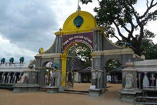
Munneswaram temple is an important regional Hindu temple complex in Sri Lanka. It has been in existence at least since 1000 CE although myths surrounding the temple associate it with the popular Indian epic Ramayana, and its legendary hero-king Rama. The temple is one of the ancient Pancha Ishwarams dedicated to Shiva in the region.

Battaramulla is a suburb of Colombo, situated 8.4 km (5 mi) from the city centre at Colombo Fort, near the Parliament of Sri Lanka. It is one of the fastest developing administrative, commercial and residential areas in the Colombo District, being home to the country's elite. Battaramulla is an important town in Sri Lanka, because of the Sri Lankan government's decision to locate all the government department head offices in this town.
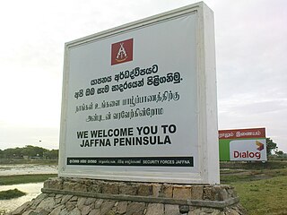
The Jaffna Peninsula is a region in the Northern Province of Sri Lanka. It is home to the capital city of the province, Jaffna, and comprises much of the former land mass of the medieval Jaffna Kingdom.

Bopath Ella is a waterfall situated in the Ratnapura District of Sri Lanka. It has a shape very similar to the leaf of the Sacred fig or "Bo" (බෝ) tree, which has earned it this name. The waterfall is a major tourist attraction in the country. Local myths say that it is haunted and that it hides a treasure trove.
Mabodale is a village in Gampaha District of Sri Lanka. It is situated approximately 12 km (7.5 mi) from the Gampaha, 15 km (9.3 mi) from the Negombo and also in close proximity to suburban areas of Divulapitiya, Minuwangoda and Veyangoda. Mabodale is approximately 20 km2 (7.7 sq mi) in extent and has a population of approx. 5,000. Paddy and betel cultivation had been the main source of income for many families for decades.
Karaitivu is a coastal village situated in the Eastern Coast of Sri Lanka about 30 miles (44 km) south of Batticaloa and is next to Kalmunai town. This is one of the oldest surviving village settlements in the Ampara District.
Maruthamunai is a coastal village located along the eastern coastline, about 358 kilometres away from the capital city, Colombo. The Village has an estimated population of 13,948, predominantly Muslims. Maruthamunai Located in Kalmunai, Ampara District in the Eastern Province of Sri Lanka.

Paragaswewa is a rural village and a fourth-order administrative division located in Kurunegala district, North Western Province of Sri Lanka. The estimated terrain elevation is 220 metres above sea level.

Rathana Ella, at 101 m, is the widest highest waterfall in Sri Lanka Country, situated in Hasalaka City, Kandy District.
Puthukkudiyiruppu is a small town in the Mullaitivu District of Sri Lanka.

The Coast Veddas, by self-designation, form a social group within the minority Sri Lankan Tamil ethnic group of the Eastern province of Sri Lanka. They are primarily found in small coastal villages from the eastern township of Trincomalee to Batticalao. Nevertheless, they also inhabit a few villages south of Batticalao as well. They make a living by fishing, slash and burn agriculture, paddy cultivation of rice, basket weaving for market and occasional wage labor. Anthropologists consider them to be partly descended from the indigenous Vedda people, as well as local Tamils. Residents of the Eastern province consider their Vedar neighbors to have been part of the local social structure from earliest times, whereas some Vedar elders believe that their ancestors may have migrated from the interior at some time in the past.
Haburugala is a small town in Sri Lanka. It is located within Southern Province. Sri Punyarathana Dhamma School in Choola Bodhi Viharaya Buddhist temple, Dharmaraja Vidyalaya, Elakaka Maha Vidyalaya schools are situated in Haburugala. Most of the villagers are farmers who spend their time on paddy fields. The path to the village is surrounded by beautiful scenes such as Dedduwa river, Bentotat river, Bentota beach, Dedduwa marshland. Typical day has the temperature around 26 degrees Celsius.
Kataragama is a pilgrimage town sacred to Hindu, Buddhist and indigenous Vedda people of Sri Lanka. People from South India also go there to worship. The town has the Kataragama temple, a shrine dedicated to Skanda Kumara also known as Kataragama deviyo. Kataragama is located in the Monaragala District of Uva province, Sri Lanka. It is 228 km (142 mi) southeast of Colombo. Although Kataragama was a small village in medieval times, today it is a fast-developing township surrounded by jungle in the southeastern region of Sri Lanka.

Hingurakgoda Divisional Secretariat is a Divisional Secretariat of Polonnaruwa District, of North Central Province, Sri Lanka.
Dodangoda Divisional Secretariat is a Divisional Secretariat of Kalutara District, of Western Province, Sri Lanka.

Dewa people were one of the four main tribes of ancient Sri Lanka who founded the coalition of Sinhalese nationality. Sinhalese people are an Asura ethnic group of the island of Sri Lanka. They were historically known as Hela people, Ceylonese islanders, and Sinhalese islanders. They constitute about 75% of the Sri Lankan population and number greater than 16.2 million. The Sinhalese identity is based on language, cultural heritage and nationality. The Sinhalese people speak Sinhala, an insular Indo-Aryan language, and are predominantly Theravada Buddhists, although a minority of Sinhalese follow branches of Christianity and other religions.

Thirukkovil Temple is the most significant Hindu temple in Thirukkovil, Ampara District of Eastern Province, Sri Lanka. It is dedicated to Chitravelayudhar who was once the guardian deity of Mattakkalappu Desam and this temple enjoyed the honor of Desathukkovil of the Batticaloa region. Archaeological and historical evidences suggest that Cholan, Kotte and Kandyan kings maintained strong relations with this temple in the past.