
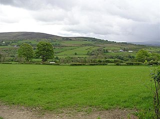
Shanmaghery or Shanmaghry is a small hamlet and townland in County Tyrone, Northern Ireland, situated three miles from Pomeroy and three miles from Galbally. It is situated in the barony of Dungannon Middle and the civil parish of Pomeroy and covers an area of 426 acres. In 1841 the population of the townland was 193 people and in 1851 it was 161 people. "Paul's Planting" was a notable landmark on top of the hill.

Evish is a small rural community area and townland in County Tyrone, Northern Ireland, 3 miles from Strabane and 7 miles from Plumbridge. It is situated in the barony of Strabane Lower and the civil parish of Camus and covers an area of 870 acres.

Aghanaglack or Aghnaglack, is a townland in County Fermanagh, Northern Ireland. It is situated in the civil parish of Boho, as well as Fermanagh and Omagh district.

Carncorran Glebe is a townland in County Tyrone, Northern Ireland. It is situated in the historic barony of Omagh West and the civil parish of Ardstraw and covers an area of 243 acres.

Doocrock is a townland in County Tyrone, Northern Ireland. It is situated in the historic barony of Omagh East and the civil parish of Dromore and covers an area of 426 acres.

Garvaghullion is a townland in County Tyrone, Northern Ireland. It is situated in the barony of Omagh West and the civil parish of Longfield East and covers an area of 640 acres.

Glenmacoffer is a townland in County Tyrone, Northern Ireland. It is situated in the barony of Strabane Upper and the civil parish of Bodoney Lower and covers an area of 2703 acres.

Kilcroagh is a townland in County Tyrone, Northern Ireland, near Castlederg. It is situated in the historic barony of Omagh West and the civil parish of Urney and covers an area of 351 acres.

Killynaght is a townland in County Tyrone, Northern Ireland. It is situated in the barony of Strabane Lower and the civil parish of Leckpatrick and covers an area of 489 acres.
Letterbrat is a townland in County Tyrone, Northern Ireland. It is situated in the barony of Strabane Upper and the civil parish of Bodoney Upper and covers an area of 708 acres.
Lisgobban is a townland in County Tyrone, Northern Ireland. It is situated in the barony of Dungannon Middle and the civil parish of Clonfeacle and covers an area of 135 acres.
Liskincon is a townland in County Tyrone, Northern Ireland. It is situated in the barony of Omagh East and the civil parish of Termonmaguirk and covers an area of 96 acres.
Muntober is a townland in County Tyrone, Northern Ireland. It is situated in the barony of Dungannon Upper and the civil parish of Kildress and covers an area of 613 acres.

Oughtboy is a townland in County Tyrone, Northern Ireland. It is situated in the barony of Strabane Upper and the civil parish of Bodoney Upper and covers an area of 964 acres.

Oughtdoorish is a townland in County Tyrone, Northern Ireland. It is situated in the barony of Strabane Upper and the civil parish of Bodoney Upper and covers an area of 1848 acres.

Reaghan is a townland in County Tyrone, Northern Ireland. It is situated in the barony of Strabane Upper and the civil parish of Cappagh and covers an area of 567 acres.
Tattycor is a townland in County Tyrone, Northern Ireland. It is situated in the barony of Omagh East and the civil parish of Dromore and covers an area of 355 acres.

Tonnagh More is a townland in County Tyrone, Northern Ireland. It is situated in the barony of Omagh East and the civil parish of Donacavey and covers an area of 317 acres.

Carrigans is a townland in County Tyrone, Northern Ireland. It is situated in the historic barony of Strabane Upper and the civil parish of Cappagh and covers an area of 859 acres.

Freughlough is a townland in County Tyrone, Northern Ireland. It is situated in the historic barony of Omagh West and the civil parish of Urney and covers an area of 592 acres.


