
Gmina Czerwieńsk is an urban-rural gmina in Zielona Góra County, Lubusz Voivodeship, in western Poland. Its seat is the town of Czerwieńsk, which lies approximately 11 kilometres (7 mi) north-west of Zielona Góra.

Niwiska is a village in the administrative district of Gmina Nowogród Bobrzański, within Zielona Góra County, Lubusz Voivodeship, in western Poland. It lies approximately 11 kilometres (7 mi) east of Nowogród Bobrzański and 17 km (11 mi) south-west of Zielona Góra.
Skibice is a village in the administrative district of Gmina Nowogród Bobrzański, within Zielona Góra County, Lubusz Voivodeship, in western Poland. It lies approximately 11 kilometres (7 mi) east of Nowogród Bobrzański and 21 km (13 mi) south-west of Zielona Góra.
Sobolice is a village in the administrative district of Gmina Nowogród Bobrzański, within Zielona Góra County, Lubusz Voivodeship, in western Poland. It lies approximately 7 kilometres (4 mi) east of Nowogród Bobrzański and 22 km (14 mi) south-west of Zielona Góra.
Urzuty is a village in the administrative district of Gmina Nowogród Bobrzański, within Zielona Góra County, Lubusz Voivodeship, in western Poland. It lies approximately 12 kilometres (7 mi) east of Nowogród Bobrzański and 18 km (11 mi) south-west of Zielona Góra.

Buchałów is a village in the administrative district of Gmina Świdnica, within Zielona Góra County, Lubusz Voivodeship, in western Poland. It lies approximately 4 kilometres (2 mi) north-west of Świdnica and 11 km (7 mi) west of Zielona Góra.
Dobra is a settlement in the administrative district of Gmina Świdnica, within Zielona Góra County, Lubusz Voivodeship, in western Poland. It lies approximately 7 kilometres (4 mi) west of Świdnica and 14 km (9 mi) west of Zielona Góra.

Drzonów is a village in western Poland, in the administrative district of Świdnica, within Zielona Góra County, Lubusz Voivodeship. It lies approximately 8 kilometres (5 mi) north-west of Świdnica and 13 km (8 mi) west of Zielona Góra. The village is home to the Lubusz Military Museum, housing numerous historical tanks, self-propelled anti-tank guns and aeroplanes. Among the historical landmarks of the village are 19th-century church and a palace.
Grabowiec is a village in the administrative district of Gmina Świdnica, within Zielona Góra County, Lubusz Voivodeship, in western Poland. It lies approximately 9 kilometres (6 mi) west of Świdnica and 17 km (11 mi) west of Zielona Góra.
Koźla is a village in the administrative district of Gmina Świdnica, within Zielona Góra County, Lubusz Voivodeship, in western Poland. It lies approximately 8 kilometres (5 mi) south-west of Świdnica and 17 km (11 mi) south-west of Zielona Góra.

Letnica is a village in the administrative district of Gmina Świdnica, within Zielona Góra County, Lubusz Voivodeship, in western Poland. It lies approximately 5 kilometres (3 mi) west of Świdnica and 13 km (8 mi) west of Zielona Góra.
Lipno is a village in the administrative district of Gmina Świdnica, within Zielona Góra County, Lubusz Voivodeship, in western Poland. It lies approximately 10 kilometres (6 mi) west of Świdnica and 17 km (11 mi) west of Zielona Góra.
Łochowo is a settlement in the administrative district of Gmina Świdnica, within Zielona Góra County, Lubusz Voivodeship, in western Poland. It lies approximately 4 kilometres (2 mi) south of Świdnica and 11 km (7 mi) south-west of Zielona Góra.
Orzewo is a settlement in the administrative district of Gmina Świdnica, within Zielona Góra County, Lubusz Voivodeship, in western Poland. It lies approximately 6 kilometres (4 mi) north-west of Świdnica and 11 km (7 mi) west of Zielona Góra.
Rybno is a settlement in the administrative district of Gmina Świdnica, within Zielona Góra County, Lubusz Voivodeship, in western Poland. It lies approximately 5 kilometres (3 mi) north-east of Świdnica and 4 km (2 mi) west of Zielona Góra.
Słone is a village in the administrative district of Gmina Świdnica, within Zielona Góra County, Lubusz Voivodeship, in western Poland.
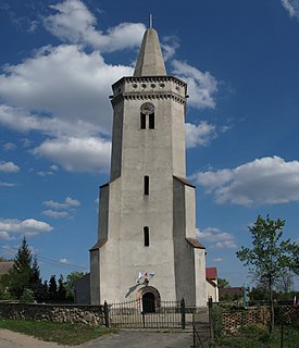
Świdnica is a village in Zielona Góra County, Lubusz Voivodeship, in western Poland. It is the seat of the gmina called Gmina Świdnica. It lies approximately 9 km (6 mi) south-west of Zielona Góra.
Wilkanowo is a village in the administrative district of Gmina Świdnica, within Zielona Góra County, Lubusz Voivodeship, in western Poland. It lies approximately 3 kilometres (2 mi) north-east of Świdnica and 6 km (4 mi) south-west of Zielona Góra.
Wirówek is a settlement in the administrative district of Gmina Świdnica, within Zielona Góra County, Lubusz Voivodeship, in western Poland. It lies approximately 10 kilometres (6 mi) north-west of Świdnica and 15 km (9 mi) west of Zielona Góra.


