William 'Strata' Smith was an English geologist, credited with creating the first detailed, nationwide geological map of any country. At the time his map was first published he was overlooked by the scientific community; his relatively humble education and family connections prevented him from mixing easily in learned society. Financially ruined, Smith spent time in debtors' prison. It was only late in his life that Smith received recognition for his accomplishments, and became known as the "Father of English Geology".
Bath and North East Somerset (B&NES) is a unitary authority district in Somerset, South West England. Bath and North East Somerset Council was created on 1 April 1996 following the abolition of the county of Avon. It is part of the ceremonial county of Somerset.
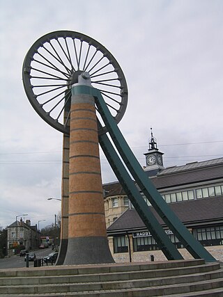
Radstock is a town and civil parish on the northern slope of the Mendip Hills in Somerset, England, about 9 miles (14 km) south-west of Bath and 8 miles (13 km) north-west of Frome. It is within the area of the unitary authority of Bath and North East Somerset. The Radstock built-up area had a population of 9,419 at the 2011 Census.

Midsomer Norton is a town near the Mendip Hills in Bath and North East Somerset, England, 10 miles (16 km) south-west of Bath, 10 miles (16 km) north-east of Wells, 10 miles (16 km) north-west of Frome, 12 miles (19 km) west of Trowbridge and 16 miles (26 km) south-east of Bristol. It has a population of around 13,000. Along with Radstock and Westfield it used to be part of the conurbation and large civil parish of Norton Radstock, but is now a town council in its own right. It is also part of the unitary authority of Bath and North East Somerset.

Pensford is the largest village in the civil parish of Publow in Somerset, England. It lies in the Chew Valley, approximately 7 miles (11 km) south of Bristol, 8 miles (13 km) west of Bath, and 14 miles (23 km) north of Wells. It is on the A37 road from Bristol to Shepton Mallet.

The Somerset Coal Canal was a narrow canal in England, built around 1800. Its route began in basins at Paulton and Timsbury, ran to nearby Camerton, over two aqueducts at Dunkerton, through a tunnel at Combe Hay, then via Midford and Monkton Combe to Limpley Stoke where it joined the Kennet and Avon Canal. This link gave the Somerset coalfield access east toward London. The longest arm was 10.6 miles (17.1 km) long with 23 locks. From Midford an arm also ran via Writhlington to Radstock, with a tunnel at Wellow.

Paulton is a large village and civil parish, with a population of 5,302, located to the north of the Mendip Hills, very close to Norton Radstock in the unitary authority of Bath and North East Somerset (BANES), England.

Farrington Gurney is a village and civil parish in Somerset, England located at the foot of the Mendip Hills on the junction of the A37 and A362. It has a population of 901.
Peasedown St John is a large village and civil parish in Somerset, England, standing on a hilltop roughly 5 miles (8 km) south-southwest of the city of Bath, and 2 miles (3 km) north-east of the town of Radstock at the foot of the Mendip Hills. Peasedown used to be a coal mining village, and after the last of the mines shut in the 1970s it became a dormitory village for Bath, Trowbridge and to a lesser extent Bristol. Its size was increased by substantial housing developments in the 1960s, 1970s and late 1990s, making it one of the largest villages in Somerset.

Kilmersdon is a village and civil parish on the north eastern slopes of the Mendip Hills in Somerset between the towns of Radstock and Frome. It is located on the B3139 between Wells and Trowbridge in Wiltshire. The settlement is recorded in William I's Domesday book and dates back at least 1,000 years; though the core of the village dates from the mid nineteenth century. The parish includes the hamlets of Charlton, South View and Green Parlour.

Bishop Sutton is a village on the northern slopes of the Mendip Hills, within the affluent Chew Valley in Somerset. It lies east of Chew Valley Lake and north east of the Mendip Hills, approximately ten miles south of Bristol on the A368, Weston-super-Mare to Bath road. Bishop Sutton and the neighbouring village of Stowey form the civil parish of Stowey Sutton.
Clutton is a village and civil parish on the eastern edge of the Chew Valley, close to the Cam Brook river, in the Bath and North East Somerset Council area, within the ceremonial county of Somerset, England. The village lies east of the A37 road between Bristol and Shepton Mallet, and west of the A39 between Bath and Wells. It is 9 miles (14 km) from Bristol and Bath, and 11 miles (18 km) from Wells. Close by are the villages of Temple Cloud and High Littleton. The town of Midsomer Norton is 5 miles (8 km) away. The parish, which includes the hamlets of Clutton Hill and Northend, had a population of 1,602 in 2011.
The Chew Valley is an affluent area in North Somerset, England, named after the River Chew, which rises at Chewton Mendip, and joins the River Avon at Keynsham. Technically, the area of the valley is bounded by the water catchment area of the Chew and its tributaries; however, the name Chew Valley is often used less formally to cover other nearby areas, for example, Blagdon Lake and its environs, which by a stricter definition are part of the Yeo Valley. The valley is an area of rich arable and dairy farmland, interspersed with a number of villages.

Clandown is a village lying north of Radstock in Somerset, England, just off the Fosseway. It is 1 mile (1.6 km) north of Radstock. The nearby Bowlditch Quarry is a 0.25 hectare geological Site of Special Scientific Interest.
The Somerset Coalfield in northern Somerset, England is an area where coal was mined from the 15th century until 1973. It is part of a larger coalfield which stretched into southern Gloucestershire. The Somerset coalfield stretched from Cromhall in the north to the Mendip Hills in the south, and from Bath in the east to Nailsea in the west, a total area of about 240 square miles (622 km2). Most of the pits on the coalfield were concentrated in the Cam Brook, Wellow Brook and Nettlebridge Valleys and around Radstock and Farrington Gurney. The pits were grouped geographically, with clusters of pits close together working the same coal seams often under the same ownership. Many pits shared the trackways and tramways which connected them to the Somerset Coal Canal or railways for distribution.

Dunkerton is a small village in the civil parish of Dunkerton and Tunley, 4 miles (6.4 km) north east of Radstock, and 5 miles (8.0 km) south west of Bath, in the Bath and North East Somerset unitary authority, Somerset, England. The parish has a population of 502.
The Bristol and North Somerset Railway was a railway line in the West of England that connected Bristol with Radstock, through Pensford and further into northern Somerset, to allow access to the Somerset Coalfield. The line ran almost due south from Bristol and was 16 miles (26 km) long.

Westfield is a village and civil parish in Bath and North East Somerset in the ceremonial county of Somerset, England. The village lies on the Fosse Way between the towns of Radstock and Midsomer Norton.

Haydon is a village lying between Radstock and Kilmersdon in Somerset, England. It is 1 mile (1.6 km) south-west of Radstock and 1.5 miles (2.4 km) north-east of Kilmersdon.

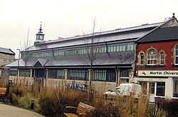
Midsomer Norton Town Hall is a municipal structure at The Island, Midsomer Norton, Somerset, England. The structure, which serves as the meeting place of Midsomer Norton Town Council, is a Grade II listed building.