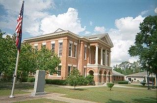
Perry County is a county located in the U.S. state of Mississippi. As of the 2010 census, the population was 12,250. The county seat is New Augusta. The county is named after the War of 1812 naval hero, Oliver Hazard Perry.

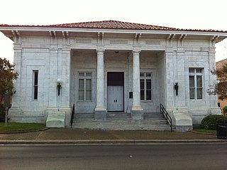
Forrest County is located in the U.S. state of Mississippi. As of the 2010 census, the population was 74,934. Its county seat and largest city is Hattiesburg. The county was created from Perry County in 1908 and named in honor of Nathan Bedford Forrest, a Confederate general in the American Civil War. Forrest County is part of the Hattiesburg, MS Metropolitan Statistical Area.

Crowley's Ridge is a geological formation that rises 250 to 550 feet (170 m) above the alluvial plain of the Mississippi embayment in a 150-mile (240 km) line from southeastern Missouri to the Mississippi River near Helena, Arkansas. It is the most prominent feature in the Mississippi Alluvial Plain between Cape Girardeau, Missouri, and the Gulf of Mexico.

Magnolia grandiflora, commonly known as the southern magnolia or bull bay, is a tree of the family Magnoliaceae native to the southeastern United States, from southeastern North Carolina to central Florida, and west to East Texas. Reaching 27.5 m (90 ft) in height, it is a large, striking evergreen tree, with large dark green leaves up to 20 cm long and 12 cm wide, and large, white, fragrant flowers up to 30 cm (12 in) in diameter.

Camp Shelby is a military post whose North Gate is located at the southern boundary of Hattiesburg, Mississippi, on United States Highway 49. It is the largest state-owned training site in the nation. During wartime, the camp's mission is to serve as a major independent mobilization station of the United States Army Forces Command (FORSCOM). Camp Shelby Joint Forces Training Center is the largest reserve component training site, covering 136,000 acres (550 km2), allowing up to battalion-level maneuver training, Gunnery Table 8-12, field artillery firing points and a wide range of support facilities. This is the normal Annual Training location for National Guard and Reserve units located in Mississippi, Alabama, and Tennessee. However, units from across the country use its assets to support a variety of missions. The 2nd Battalion, 114th Field Artillery conducts its gunnery training and has the bulk of its combat equipment stored in the Mobilization and Annual Training Equipment Site (MATES) located there.

De Soto National Forest, named for 16th-century Spanish explorer Hernando de Soto, is 518,587 acres of pine forests in southern Mississippi. It is one of the most important protected areas for the biological diversity of the Gulf Coast ecoregion of North America.

The Leaf River is a river, about 180 mi (290 km) long, in southern Mississippi in the United States. It is a principal tributary of the Pascagoula River, which flows to the Gulf of Mexico.
Mississippi Highway 13 is a state highway in Mississippi. It runs from north to south for 151.148 miles (243.249 km), serving the counties of Forrest, Pearl River, Lamar, Marion, Jefferson Davis, Simpson, Rankin, Smith, Scott, and Leake.

Mississippi Highway 15 is a state highway in Mississippi. At almost 324 miles (521 km), it is the longest highway in the Mississippi Highway System. MS 15 is divided into two sections due to a large gap between Stone County and Perry County. The southern section begins at Interstate 10 (I-10) and I-110 in Biloxi and ends at a junction with MS 26 near Wiggins, and the northern section begins at a junction with U.S. Route 98 near Beaumont and ends as a continuation as SR 125 near Walnut. It serves a total of 15 counties.

The Hattiesburg Metropolitan Statistical Area is a metropolitan area in southeastern Mississippi that covers four counties - Covington, Forrest, Lamar, and Perry. As of the 2000 census, the MSA had a population of 123,812. It is part of a wider region known as the Pine Belt.

Crowley's Ridge Parkway is a 212.0-mile-long (341.2 km) National Scenic Byway in northeast Arkansas and the Missouri Bootheel along Crowley's Ridge in the United States. Motorists can access the parkway from US Route 49 (US 49) at its southern terminus near the Helena Bridge over the Mississippi River outside Helena-West Helena, Arkansas, or from Missouri Route 25 (Route 25) near Kennett, Missouri. The parkway runs along Crowley's Ridge, a unique geological formation, and also parts of the St. Francis National Forest, the Mississippi River and the Mississippi Alluvial Plain. Along the route are many National Register of Historic Places properties, Civil War battlefields, parks, and other archeological and culturally significant points.

Quercus arkansana, the Arkansas oak, is a species of tree in the beech family. It is native to the southeastern United States. It is threatened by use of its habitat for pine plantations, clearing of land, and diebacks that may be caused by drought.

North American Atlantic Region is a floristic region within the Holarctic Kingdom identified by Armen Takhtajan and Robert F. Thorne, spanning from the Atlantic and Gulf coasts to the Great Plains and comprising a major part of the United States and southeastern portions of Canada. It is bordered by the Circumboreal floristic region in the north, by the Rocky Mountain and Madrean floristic regions in the west and by the Caribbean floristic region of the Neotropical Kingdom in the south of Florida. The flora of the region comprises two endemic monotypic families, Hydrastidaceae and Leitneriaceae, and is characterized by about a hundred of endemic genera. The degree of species endemism is very high, many species are Tertiary relicts, which survived the Wisconsin glaciation and are now concentrated in the Appalachians and the Ozarks. A number of genera are shared only with the Canadian floristic province of the Circumboreal region. Moreover, as has long been noted, a large number of relict genera are shared with the relatively distant Eastern Asiatic Region and sometimes Southeast Asia. R. F. Thorne counted at least 74 genera restricted to eastern North America and Asia. The fossil record indicates that during the Tertiary period a warm temperate zone extended across much of the Northern Hemisphere, linking America to Asia.

The Port Gibson Battlefield is the site near Port Gibson, Mississippi where the 1863 Battle of Port Gibson was fought during the American Civil War. The battlefield covers about 3,400 acres (1,400 ha) of land west of the city, astride Rodney Road, where Union Army forces were establishing a beachhead after crossing the Mississippi River in a bid to take the Confederate fortress of Vicksburg. The Union victory secured that beachhead and paved the way for the eventual fall of Vicksburg. A 2,080-acre (840 ha) area surrounding part of the site was listed on the National Register of Historic Places in 1972, and a larger area was designated a National Historic Landmark in 2005. In 2009, the battlefield was designated by the Civil War Preservation Trust as one of its Top 10 most endangered Civil War battlefields. In 2011, the Civil War Preservation Trust was renamed the Civil War Trust, which in 2018 became a division of the American Battlefield Trust. The Trust and its partners have acquired and preserved 644 acres (2.61 km2) of the Port Gibson battlefield.

Revis Hill Prairie State Natural Area, also known as Revis Hill Prairie Nature Preserve, is a 412.7-acre (167.0 ha) state park located six miles south of Easton in Mason County, Illinois. It is operated by the Illinois Department of Natural Resources (IDNR) as a tallgrass prairie nature preserve and as a fish and wildlife area managed for deer hunting.

The Southeastern conifer forests are a temperate coniferous forest ecoregion of the southeastern United States. It is the largest conifer forest ecoregion east of the Mississippi River.

The 2013 Hattiesburg, Mississippi tornado was a large and violent EF4 multiple-vortex wedge tornado that, on Sunday, February 10, 2013, devastated the city of Hattiesburg, Mississippi as well as portions of surrounding areas of West Hattiesburg, Hattiesburg, and Petal. The tornado was one of eight that touched down in southern Mississippi and southwestern Alabama that day. It reached a maximum path width of 0.75 mi (1.21 km) in its path through the Hattiesburg area and reached estimated maximum sustained winds of 170 mph (270 km/h) in Oak Grove neighborhood of West Hattiesburg. It destroyed many structures and impacted University of Southern Mississippi and two high schools. Mississippi was declared a federal disaster area by President Barack Obama, and a state of emergency was issued by Mississippi Governor Phil Bryant.

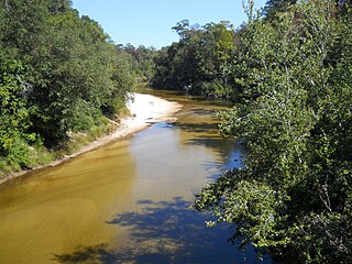
Red Creek is a tributary of the Pascagoula River in the U.S. state of Mississippi. The creek derives its name from naturally occurring tannins that give the water a reddish appearance as it flows over the white sand bottom. A portion of Red Creek has been designated a State Scenic Stream by the Mississippi Legislature.


