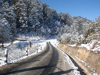
Solukhumbu District (Nepali: सोलुखुम्बु जिल्लाlisten , Sherpa: ཤར་ཁུམ་བུ་རྫོང་ཁ།, Wylie: shar khum bu dzong kha) is one of 14 districts of Province No. 1 of eastern Nepal. As the name suggests, it consists of the subregions Solu and Khumbu.
Prapcha is a village development committee in Okhaldhunga District in the Sagarmatha Zone of mid-eastern Nepal. At the time of the 1991 Nepal census it had a population of 1259 living in 249 individual households.
Chyangli is a village development committee in Gorkha District in the Gandaki Zone of northern-central Nepal. At the time of the 1991 Nepal census it had a population of 5,612 and had 1066 houses in the town.
Baraneshwar is a village development committee in Okhaldhunga District in the Sagarmatha Zone of mid-eastern Nepal. At the time of the 1991 Nepal census it had a population of 3240 living in 656 individual households.
Jyamire, Okhaldhunga is a market in Siddhicharan Municipality in Okhaldhunga District in the Sagarmatha Zone of mid-eastern Nepal. This village center was merged to the Municipality in May 2014. At the time of the 1991 Nepal census it had a population of 2344 residing in 422 individual households.
Pokli is a village development committee in Okhaldhunga District in the Sagarmatha Zone of mid-eastern Nepal. At the time of the 1991 Nepal census it had a population of 2610 living in 529 individual households.

Ratmata is a village development committee in Okhaldhunga District in the Sagarmatha Zone of mid-eastern Nepal. At the time of the 1991 Nepal census it had a population of 2507 living in 450 individual households.
Sisneri is a village development committee in Okhaldhunga District in the Sagarmatha Zone of mid-eastern Nepal. At the time of the 1991 Nepal census it had a population of 3542 living in 636 individual households.
Thoksela is a village development committee in Okhaldhunga District in the Sagarmatha Zone of mid-eastern Nepal. At the time of the 1991 Nepal census it had a population of 2128 living in 651 individual households.
Ubu, Nepal is a Village Development Committee in Okhaldhunga District in the Sagarmatha Zone of mid-eastern Nepal. At the time of the 1991 Nepal census it had a population of 3075 residing in 604 individual households.
Yasam, Nepal is a village development committee in Okhaldhunga District in the Sagarmatha Zone of mid-eastern Nepal. At the time of the 1991 Nepal census it had a population of 1661 living in 330 individual households.
Sanghutar is a village development committee in Ramechhap District in the Janakpur Zone of north-eastern Nepal. At the time of the 1991 Nepal census it had a population of 2177 people living in 394 individual households. The VDC has a small market called Sanghutar Bazaar, situated in the bank of the Likhu River and bordering Okhaldhunga District. The bazaar is flat land near to the bridge ; therefore, its name is Sanghutar. It is a main commercial center of many neighboring villages of Ramechhap and Okhaldhunga District with a higher secondary school called Himaganga.
Govindapur Malahanama is a village development committee in Siraha District in the Sagarmatha Zone of south-eastern Nepal. At the time of the 1991 Nepal census it had a population of 6758.
Sothayan is a village development committee in Siraha District in the Sagarmatha Zone of south-eastern Nepal. At the time of the 1991 Nepal census it had a population of 3004 people living in 539 individual households.
Inarwa is a village development committee in Saptari District in the Sagarmatha Zone of south-eastern Nepal. At the time of the 1991 Nepal census it had a population of 2582 people living in 416 individual households.
Rampura Malhaniya is a village development committee in Saptari District in the Sagarmatha Zone of south-eastern Nepal. At the time of the 1991 Nepal census it had a population of 4728 people living in 835 individual households.
Pipari is a village development committee in Kapilvastu District in the Lumbini Zone of southern Nepal. At the time of the 1991 Nepal census it had a population of 1872 people living in 303 individual households.
Rampur Khadauna is a village development committee in Nawalparasi District in the Lumbini Zone of southern Nepal. At the time of the 1991 Nepal census it had a population of 3665 people living in 506 individual households.

Siddhicharan is a municipality and the district headquarter of Okhaldhunga District in Province No. 1 of Nepal that was established in May 2014 by merging the two former Village development committees Andheri, Thulachhap, Jyamire, Salleri, Rumjatar and Okhaldhunga. It is named after the Nepali poet Siddhicharan Shrestha. At the time of the 2011 Nepal census it had a population of 27,995 people living in 6,994 individual households.


