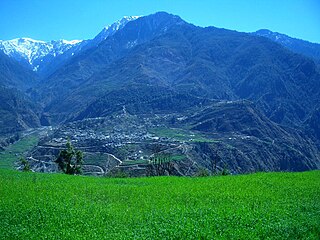
Bajura District, a part of Sudurpashchim Province, is one of the seventy-seven districts of Nepal. The district, with Martadi as its district headquarters, covers an area of 2,188 km2 (845 sq mi) and had a population of 108,781 in 2001 and 134,912 in 2011.

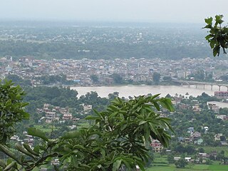
Chitwan District is one of 77 districts of Nepal, and takes up the southwestern corner of Bagmati Province. Bharatpur, largest city of Nepal after Kathmandu, is its administrative centre. It covers 2,238.39 km2 (864.25 sq mi), and in 2011 had a population of 579,984 people. Bharatpur is the commercial and service centre of South Central Nepal and a major destination for higher education, health care and transportation in the region. Chitwan lies in the Terai region of Nepal. It is in the drainage basin of the Gandaki River and is roughly triangular, taking that river as its meandering northwestern border, and a modest watershed border, with India, as the basis of its southern limit. Local government: Bharatpur Metropolitan, Rapti Municipality, Ratnanagar Municipality, Kalika Municipality, Khairahani Municipality, Madi Municipality, Ikshyakamana Gaupalika

Nawalparasi District, part of which belongs to Gandaki Province and part to Lumbini Province, was one of the 75 districts of Nepal before being divided into Parasi District and Nawalpur District in 2015.

Bahrabise is an urban municipality located in Sindhupalchok District of Bagmati Province of Nepal.
Bidyapur is a village development committee in Surkhet District in Karnali Province of mid-western Nepal. At the time of the 1991 Nepal census it had a population of 4053 people living in 707 individual households.
Jijodamandau is a village development committee in Doti District in the Seti Zone of western Nepal. At the time of the 1991 Nepal census it had a population of 1906 living in 365 individual households.
Tikhatar is a village development committee in Doti District in the Seti Zone of western Nepal. At the time of the 1991 Nepal census it had a population of 5222 people in 958 individual households.
Sisawa is a village development committee in Nawalparasi District in the Lumbini Zone of southern Nepal. At the time of the 2001 Nepal census it had a population of 5890.

Urlabari is a city and municipality in Morang District in the Koshi Zone of south-eastern Nepal. It is considered to be the second largest city in Morang District after Biratnagar. At the time of the 1991 Nepal census it had a population of 18,224. At the time of the 2011 Nepal census it had a population of 35,166 and 8,165 households.
Amarapuri is a town in Gaidakot Municipality in Nawalpur District in the Lumbini Zone of southern Nepal. It became a municipality in May 2014 by merging the existing Mukundapur, Amarapuri, Gaidakot, Nawalparasi, VDCs. At the time of the 2011 Nepal census it had a population of 8,762 living in 1,979 households. Amarapuri has three high schools, the Shree Laxmi Higher Secondary School, Amar Jyoti Higher Secondary School and Amar English Higher Secondary Boarding School.

Dedhgaun is a village development committee in Nawalparasi District in the Lumbini Zone of southern Nepal. At the time of the 1991 Nepal census it had a population of 2975 people living in 513 individual households.

Kumarwarti is a village development committee in Nawalparasi District in the Lumbini Zone of southern Nepal. At the time of the 1991 Nepal census it had a population of 4155 people living in 698 individual households. However data derived more recently for marriage and education details has suggested in 2001 the population had grown to over 5000.

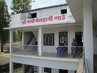
Naya Belhani is a village development committee in Nawalparasi District in the Lumbini Zone of western Nepal. At the time of the 1991 Nepal census it had a population of 9786 people living in 1795 individual households. Naya Belhani is divided into 9 wards, among which ward number 9, Arunkhola is the center of the VDC, which is considered one of an emerging business market of the Nawalparasi district. The VDC's main interesting factor is divided into two parts by Aarungkhola river and East West highway. The river is partition 6, 7 & 9 ward east region and 1,2,3,4,5,8 west region.

Kawasoti (Nepali: कावासोती) is a municipality in Nawalpur District, Gandaki Province, Nepal. It is 31 km (19 mi) west of Bharatpur and 85 km (53 mi) east of Butwal, approximately on the middle of Mahendra Highway. The Naryani River flows south of it, and the Mahabharat Range is north of it.
Giruwari is one of the village located in north part of Nawalparasi district of Lumnini Zone in the western development region of Nepal. Lumbinī is a Buddhist pilgrimage site in the Rupandehi district of Nepal.[1] It is the place where Queen Mayadevi gave birth to Siddhartha Gautama, who is the Buddha. Gautama founded the Buddhist tradition. Buddha lived between roughly 563 and 483 BC. Lumbini is one of four magnets for pilgrimage that sprang up in places pivotal to the life of the Buddha, the others being at Kushinagar, Bodh Gaya and Sarnath.
Bardaghat नेपाली: बर्दघाट is a Municipality in Nawalparasi District in Lumbini Province, Nepal. It is situated in the lap of the Chure range. This municipality was established on 18 May 2014 by merging existing Makar and Panchanagar Village Development Committees (VDCs). Again during the local election, the neighbouring VDC Dawanne devi and some parts of Dhurkot, Jamuniya, and Rupauliya were merged. It has a population of 76,703 with an area of 162.05 km2. The annual population growth rate is 2.77%. It has a literacy rate of 82.05%. It is an emerging town of Nawalparasi District that is developing rapidly with tourist areas.
Gaindakot is a municipality in Nawalpur District in the Gandaki Zone of southern Nepal. It became a municipality in May 2014 by merging the existing Mukundapur, Amarapuri, and Gaindakot VDCs. It was again expanded by merging Ratanpur VDC. It is situated on the shore of Narayani River in the lap of Maula Kalika temple. So this place has a great possibility of tourism development. At the time of the 2011 Nepal census, it had a population of 58,841 and 13,623 individual households according to 2011 Nepal census.

Gokarneshwor is a municipality in Kathmandu District in the Bagmati Province of Nepal that was established on 2 December 2014 by merging the former Village development committees Sundarijal, Nayapati, Baluwa, Jorpati and Gokarna. The office of the municipality is that of the former Jorpati village development committee. The river Bagmati has its origin as the name Bagh Dwar situated in the middle of the Shivapuri jungle in this municipality.
Shahidnagar Danda is the city center in Nawalpur District in Gandaki Province of southern Nepal. It is located in Kawasoti municipality, ward number 16. Shahidnagar Danda is locally known as Danda Bazar. It is the most highly populated areas in Kawasoti municipality after Kawasoti itself and one with a well developed infrastructure.
Rajahar has the first higher secondary school in Nawalparasi district named Devchuli Higher secondary school.


