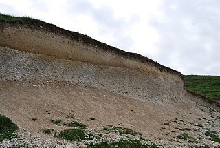
A downland is an area of open chalk hills. This term is especially used to describe the chalk countryside in southern England. Areas of downland are often referred to as downs, deriving from a Celtic word for "hills".

Topsoil is the upper, outermost layer of soil, usually the top 5 inches (13 cm) to 10 inches (25 cm). It has the highest concentration of organic matter and microorganisms and is where most of the Earth's biological soil activity occurs. Topsoil is composed of mineral particles, organic matter, water, and air. Organic matter varies in quantity on different soils. The strength of soil structure decreases with the presence of organic matter, creating weak bearing capacities. Organic matter condenses and settles in different ways under certain conditions, such as roadbeds and foundations. The structure becomes affected once the soil is dewatered. The soil's volume substantially decreases. It decomposes and suffers wind erosion.
USDA soil taxonomy (ST) developed by United States Department of Agriculture and the National Cooperative Soil Survey provides an elaborate classification of soil types according to several parameters and in several levels: Order, Suborder, Great Group, Subgroup, Family, and Series. The classification was originally developed by Guy Donald Smith, former director of the U.S. Department of Agriculture's soil survey investigations.

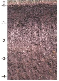
Mollisols are a soil order in USDA soil taxonomy. Mollisols form in semi-arid to semi-humid areas, typically under a grassland cover. They are most commonly found in the mid-latitudes, namely in North America, mostly east of the Rocky Mountains, in South America in Argentina (Pampas) and Brazil, and in Asia in Mongolia and the Russian Steppes. Their parent material is typically base-rich and calcareous and include limestone, loess, or wind-blown sand. The main processes that lead to the formation of grassland Mollisols are melanisation, decomposition, humification and pedoturbation.

In soil science, Podzols are the typical soils of coniferous or boreal forests. They are also the typical soils of eucalypt forests and heathlands in southern Australia. In Western Europe, Podzols develop on heathland, which is often a construct of human interference through grazing and burning. In some British moorlands with Podzolic soils, Cambisols are preserved under Bronze Age barrows.
A soil horizon is a layer parallel to the soil surface, whose physical, chemical and biological characteristics differ from the layers above and beneath. Horizons are defined in many cases by obvious physical features, mainly colour and texture. These may be described both in absolute terms and in terms relative to the surrounding material, i.e. ‘coarser’ or ‘sandier’ than the horizons above and below.

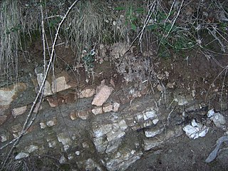
Rendzina is a soil type recognized in various soil classification systems, including those of Britain and Germany as well as some obsolete systems. They are humus-rich shallow soils that are usually formed from carbonate- or occasionally sulfate-rich parent material. Rendzina soils are often found in karst and mountainous regions.

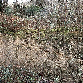
Subsoil is the layer of soil under the topsoil on the surface of the ground. Like topsoil it is composed of a variable mixture of small particles such as sand, silt and/or clay, but with a much lower percentage of organic matter and humus. Below the subsoil is the substratum, which can be residual bedrock, sediments, or aeolian deposits. As it is lacking in dark humus, subsoil is usually paler in color than the overlying topsoil. It may contain the deeper roots of some plants, such as trees, but a majority of plant roots lie within the topsoil.

Brown earth is a type of soil. Brown earths are mostly located between 35° and 55° north of the Equator. The largest expanses cover western and central Europe, large areas of western and trans-Uralian Russia, the east coast of America and eastern Asia. Here, areas of brown earth soil types are found particularly in Japan, Korea, China, eastern Australia and New Zealand. Brown earths cover 45% of the land in England and Wales. They are common in lowland areas on permeable parent material. The most common vegetation types are deciduous woodland and grassland. Due to the reasonable natural fertility of brown earths, large tracts of deciduous woodland have been cut down and the land is now used for farming. They are normally located in regions with a humid temperate climate. Rainfall totals are moderate, usually below 76 cm per year, and temperatures range from 4 °C in the winter to 18 °C in the summer. They are well-drained fertile soils with a pH of between 5.0 and 6.5.
The 1938 soil taxonomy divided soils into three orders dependent on dominant soil forming factors.
In geology, eluvium or eluvial deposits are those geological deposits and soils that are derived by in situ weathering or weathering plus gravitational movement or accumulation.
The Canadian System of Soil Classification is more closely related to the American system than any other, but they differ in several ways. The Canadian system is designed to cover only Canadian soils. The Canadian system dispenses with the sub-order hierarchical level. Solonetzic and Gleysolic soils are differentiated at the order level.

Houdek is a type of soil composed of glacial till and decomposed organic matter. It is found only in the U.S. state of South Dakota where it is the state soil. The soil series was established in 1955 in Spink County, South Dakota. It is unique to the United States, but in particular to South Dakota where it is the state soil.

A Leptosol in the World Reference Base for Soil Resources (WRB) is a very shallow soil over hard rock or highly calcareous material or a deeper soil that is extremely gravelly and/or stony. Leptosols cover approximately 1.7 billion hectares of the Earth's surface. They are found from the tropics to the cold polar regions and from sea level to the highest peaks. Leptosols are particularly widespread in mountain areas, notably in Asia, South America, northern Canada and Alaska; and in the Saharan and Arabian deserts. Elsewhere, Leptosols can be found on hard rocks or where erosion has kept pace with soil formation or removed the top of the soil. In the FAO soil classification for the UNESCO Soil Map of the World (1974) the Leptosols on calcareous rock were called Rendzinas, those on acid rock were Rankers. The very shallow, less than 10 cm deep, Lithic Leptosols in mountain regions are the most extensive Leptosols on Earth.

A Calcisol in the World Reference Base for Soil Resources (WRB) is a soil with a substantial secondary accumulation of lime. Calcisols are common in calcareous parent materials and widespread in arid and semi-arid environments. Formerly Calcisols were internationally known as Desert soils and Takyrs.
The soil biomantle can be described and defined in several ways. Most simply, the soil biomantle is the organic-rich bioturbated upper part of the soil, including the topsoil where most biota live, reproduce, die, and become assimilated. The biomantle is thus the upper zone of soil that is predominantly a product of organic activity and the area where bioturbation is a dominant process. Soil bioturbation consists predominantly of three subsets: faunalturbation, floralturbation, and fungiturbation. All three processes promote soil parent material destratification, mixing, and often particle size sorting, leading with other processes to the formation of soil and its horizons. While the general term bioturbation refers mainly to these three mixing processes, unless otherwise specified it is commonly used as a synonym to faunalturbation.
Argillipedoturbation, sometimes referred to as self-mulching, is a process of soil mixing caused by the shrinking and swelling of the smectite clays contained in the soil. It is an effect specific to soils of the vertisolic variety, and is triggered by the constant cycles of wetting and drying It is characterized by 1 centimetre (0.39 in) wide, 50 centimetres (20 in) deep vertical cracks in the solum that contain differing materials from the rest of the soil layer they are found in, as well as sloughed-in surface materials. In order for argillipedoturbation to occur, the soil must be at least 30% clay content. The expression of argillipedoturbation depends to a large degree on the exact clay content of the soil, as well as on what other minerals make up the soil composition.
White-eye is white soil with lime nodules, which is non-stratified, geologically recent deposits of silty or loamy material, deposited by the wind and cemented together with calcium carbonate concretions.
A Retisol is a Reference Soil Group of the World Reference Base for Soil Resources (WRB). Retisols are characterized by clay migration and an additional specific feature: The clay-poorer and lighter coloured eluvial horizon intercalates netlike into the clay-richer more intensely coloured illuvial horizon. The illuvial horizon is the diagnostic argic horizon, and the intercalation is called retic properties.


