Related Research Articles

The Northrop Grumman E-8 Joint Surveillance Target Attack Radar System is a United States Air Force airborne ground surveillance, battle management and command and control aircraft. It tracks ground vehicles and some aircraft, collects imagery, and relays tactical pictures to ground and air theater commanders. The aircraft is operated by both active duty U.S. Air Force and Air National Guard units and also carries specially trained U.S. Army personnel as additional flight crew.

In telecommunications, a transponder is a device that, upon receiving a signal, emits a different signal in response. The term is a blend of transmitter and responder.

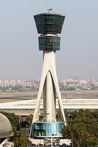
Air traffic control (ATC) is a service provided by ground-based air traffic controllers who direct aircraft on the ground and through a given section of controlled airspace, and can provide advisory services to aircraft in non-controlled airspace. The primary purpose of ATC worldwide is to prevent collisions, organize and expedite the flow of air traffic, and provide information and other support for pilots.

Identification, friend or foe (IFF) is an identification system designed for command and control. It uses a transponder that listens for an interrogation signal and then sends a response that identifies the broadcaster. IFF systems usually use radar frequencies, but other electromagnetic frequencies, radio or infrared, may be used. It enables military and civilian air traffic control interrogation systems to identify aircraft, vehicles or forces as friendly, as opposed to neutral or hostile, and to determine their bearing and range from the interrogator. IFF is used by both military and civilian aircraft. IFF was first developed during World War II, with the arrival of radar, and several friendly fire incidents.
Automatic vehicle location is a means for automatically determining and transmitting the geographic location of a vehicle. This vehicle location data, from one or more vehicles, may then be collected by a vehicle tracking system to manage an overview of vehicle travel. As of 2017, GPS technology has reached the point of having the transmitting device be smaller than the size of a human thumb, able to run 6 months or more between battery charges, easy to communicate with smartphones — all for less than $20 USD.

The Kolchuga passive sensor is an electronic-warfare support measures system developed in the Soviet Union and manufactured in Ukraine. Its detection range is limited by line-of-sight but may be up to 800 km (500 mi) for very high altitude, very powerful emitters. Frequently referred to as Kolchuga Radar, the system is not really a radar, but an ESM system comprising three or four receivers, deployed tens of kilometres apart, which detect and track aircraft by triangulation and multilateration of their RF emissions.

The AN/MPQ-64 Sentinel is an X-band electronically steered pulse-Doppler 3D radar system used to alert and cue Short Range Air Defense (SHORAD) weapons to the locations of hostile targets approaching their front line forces. It is currently produced by Raytheon Missiles & Defense.

Secondary surveillance radar (SSR) is a radar system used in air traffic control (ATC), that unlike primary radar systems that measure the bearing and distance of targets using the detected reflections of radio signals, relies on targets equipped with a radar transponder, that reply to each interrogation signal by transmitting encoded data such as an identity code, the aircraft's altitude and further information depending on its chosen mode. SSR is based on the military identification friend or foe (IFF) technology originally developed during World War II, therefore the two systems are still compatible. Monopulse secondary surveillance radar (MSSR), Mode S, TCAS and ADS-B are similar modern methods of secondary surveillance.

The Denel Dynamics Seeker is an unmanned aerial vehicle (UAV) manufactured in South Africa by Denel Dynamics. The system is designed to perform tactical reconnaissance in real time and can conduct day and night surveillance in all threat environments.

The VERA passive radar is an electronic support measures (ESM) system that uses measurements of time difference of arrival (TDOA) of pulses at three or four sites to accurately detect and track airborne emitters. It is reportedly able to detect military "invisible aircraft". The manufacturer is ERA a.s., based in Pardubice.

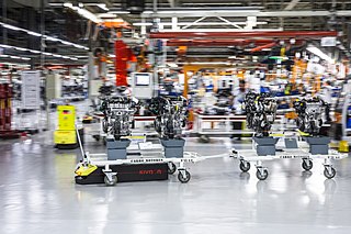
An automated guided vehicle (AGV), different from an autonomous mobile robot (AMR), is a portable robot that follows along marked long lines or wires on the floor, or uses radio waves, vision cameras, magnets, or lasers for navigation. They are most often used in industrial applications to transport heavy materials around a large industrial building, such as a factory or warehouse. Application of the automatic guided vehicle broadened during the late 20th century.

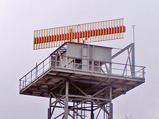
An airport surveillance radar (ASR) is a radar system used at airports to detect and display the presence and position of aircraft in the terminal area, the airspace around airports. It is the main air traffic control system for the airspace around airports. At large airports it typically controls traffic within a radius of 60 miles (96 km) of the airport below an elevation of 25,000 feet. The sophisticated systems at large airports consist of two different radar systems, the primary and secondary surveillance radar. The primary radar typically consists of a large rotating parabolic antenna dish that sweeps a vertical fan-shaped beam of microwaves around the airspace surrounding the airport. It detects the position and range of aircraft by microwaves reflected back to the antenna from the aircraft's surface. The secondary surveillance radar consists of a second rotating antenna, often mounted on the primary antenna, which interrogates the transponders of aircraft, which transmits a radio signal back containing the aircraft's identification, barometric altitude, and an emergency status code, which is displayed on the radar screen next to the return from the primary radar.

An infrared countermeasure (IRCM) is a device designed to protect aircraft from infrared homing missiles by confusing the missiles' infrared guidance system so that they miss their target. Heat-seeking missiles were responsible for about 80% of air losses in Operation Desert Storm. The most common method of infrared countermeasure is deploying flares, as the heat produced by the flares creates hundreds of targets for the missile.
Radar MASINT is a subdiscipline of measurement and signature intelligence (MASINT) and refers to intelligence gathering activities that bring together disparate elements that do not fit within the definitions of signals intelligence (SIGINT), imagery intelligence (IMINT), or human intelligence (HUMINT).
Common ARTS is an air traffic control computer system that air traffic controllers use to track aircraft.
AirNav Systems is a Tampa-based global flight tracking and data services company founded in 2001. The company operates a flight tracking website and mobile app called Radarbox which offers worldwide tracking of commercial and general aviation flights. AirNav Systems also owns and operates a ground-based ADS-B tracking network that is supported by over 20,000 active volunteer ADS-B data feeders from over 180 countries. The company's real-time tracking and data services are also used by 25,000 aviation related businesses, government agencies, airlines, media channels and airports in over 60 countries.

Automatic Dependent Surveillance–Broadcast (ADS-B) is a surveillance technology and form of Electronic Conspicuity in which an aircraft determines its position via satellite navigation or other sensors and periodically broadcasts it, enabling it to be tracked. The information can be received by air traffic control ground stations as a replacement for secondary surveillance radar, as no interrogation signal is needed from the ground. It can also be transmitted and received point-to-point by other aircraft to provide situational awareness and allow self-separation. ADS-B is "automatic" in that it requires no pilot or external input. It is "dependent" in that it depends on data from the aircraft's navigation system.

Brüel & Kjær was a Danish multinational engineering and electronics company headquartered in Nærum, near Copenhagen. It was the largest producer in the world of equipment for acoustic and vibrational measurements Brüel & Kjær is a subsidiary of Spectris.
Airport surveillance and broadcast systems are a set of runway-safety tools that display aircraft on and near an airport.
References
- ↑ SRA's 10K form from 2009 (page 7)
- Avionics Magazine, June 1, 2001: Will Multilateration Become Mainstream? discusses Rannoch's AirScene systems.