Athens Township is a township in Crawford County, Pennsylvania, United States. The population was 734 at the 2010 census.
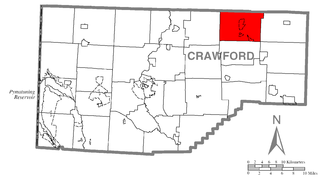
Bloomfield Township is a township in Crawford County, Pennsylvania, United States. The population was 1,919 at the 2010 census.

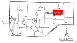
Troy Township is a township in Crawford County, Pennsylvania, United States. The population was 1,235 at the 2010 census.

Union Township is a township in Erie County, Pennsylvania, United States. The population was 1,655 at the 2010 census.

Lakhdaria, formerly known as Palestro, is a town in northern Algeria, in the Bouïra Province. It is located 50 miles (75 km) south east of Algiers. It is surrounded by the Kabylie mountains, and by a 3 miles long river named oued Isser, passing by rocky mountains called the grottoes of Lakhdaira.

The University of Algiers Benyoucef Benkhedda is a university located in Algiers, Algeria. It was founded in 1909 and is organized into seven faculties.
The Algerian Air Force (AAF) is the aerial arm of the Algerian People's Military.

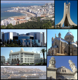
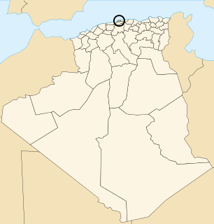
Alger Centre is a municipality in Algiers Province, Algeria. It is administratively part of Sidi M'Hamed district, and it has a population of 96,329 as of the 1998 census, which gives it 15 seats in the PMA.
Birtouta is a district in Algiers Province, Algeria. It was named after its capital, Birtouta.
Draria is a district in Algiers Province, Algeria. It was named after its capital, Draria.
Aïn Benian, Algiers is a commune in Algiers Province and suburb of the city of Algiers in northern Algeria. As of the 2008 census, the commune had a population of 68,354.
Beni Messous is a commune in Algiers Province and suburb of the city of Algiers in northern Algeria. As of the 2008 census, the commune had a population of 36,191.
Dely Ibrahim is a suburb of the city of Algiers in northern Algeria. Here is located Serbian Military cemetery, created between 1916 and 1919. At the time in several coastal towns and villages in Algeria were more French military hospitals where the wounded and exhausted Serbian soldiers were treated. Those soldiers were from the island of Corfu and Vido transported for further treatment in the Allied military hospital in North Africa.
El Achour is a suburb of the city of Algiers in northern Algeria.

Khraicia is a suburb of the city of Algiers in northern Algeria.

The University of Science and Technology – Houari Boumediene is a university located in the town of Bab-Ezzouar 15 kilometres (9.3 mi) from Algiers, Algeria. The university was designed by Brazilian architect Oscar Niemeyer and was inaugurated in 1974.
Empire Commerce was a 3,722 GRT tanker that was built in 1942 by Sir J Laing & Sons Ltd, Sunderland for the Ministry of War Transport(MoWT). She entered service in March 1943 and was torpedoed on 1 October 1943 and sunk by U-410.

Empire Day was a 7,241 GRT cargo ship that was built in 1941 as a CAM ship by William Doxford & Sons Ltd, Sunderland, Co Durham, United Kingdom for the Ministry of War Transport (MoWT). In 1943, she was converted to a standard cargo ship. She served until August 1944 when she was torpedoed and sunk by U-198.
Karlık is a village in the District of Taşova, Amasya Province, Turkey.

Kafr Laha is a town in the Homs Governorate north of Homs in northern Syria. In 2004 it had a population of 20,041 according to the Central Bureau of Statistics of Syria. Its inhabitants are predominantly Sunni Muslims. It is the largest town in the Houla region. Nearby localities include Tallaf to the northeast, Tell Dahab to the north, Aqrab to the northwest, Qarmas and Maryamin to the west, al-Taybah al-Gharbiyah to the southwest and Taldou to the southeast.