
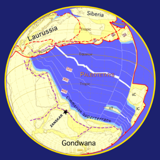
The Geography of Pakistan encompasses a wide variety of landscapes varying from plains to deserts, forests, and plateaus ranging from the coastal areas of the Indian Ocean in the south to the mountains of the Karakoram, Hindukush, Himalayas ranges in the north. Pakistan geologically overlaps both with the Indian and the Eurasian tectonic plates where its Sindh and Punjab provinces lie on the north-western corner of the Indian plate while Balochistan and most of the Khyber Pakhtunkhwa lie within the Eurasian plate which mainly comprises the Iranian Plateau.

The Hindu Kush is an 800-kilometre-long (500 mi) mountain range in Central and South Asia to the west of the Himalayas. It stretches from central and eastern Afghanistan into northwestern Pakistan and far southeastern Tajikistan. The range forms the western section of the Hindu Kush Himalayan Region (HKH); to the north, near its northeastern end, the Hindu Kush buttresses the Pamir Mountains near the point where the borders of China, Pakistan and Afghanistan meet, after which it runs southwest through Pakistan and into Afghanistan near their border.

The Karakoram is a mountain range in the Kashmir region spanning the borders of Pakistan, China, and India, with the northwestern extremity of the range extending to Afghanistan and Tajikistan. Most of the Karakoram mountain range falls under the jurisdiction of Gilgit-Baltistan, which is administered by Pakistan. Its highest peak, K2, is located in Gilgit-Baltistan. It begins in the Wakhan Corridor (Afghanistan) in the west, encompasses the majority of Gilgit-Baltistan, and extends into Ladakh and Aksai Chin.

The Sivalik Hills, also known as the Shivalik Hills and Churia Hills, are a mountain range of the outer Himalayas that stretches over about 2,400 km (1,500 mi) from the Indus River eastwards close to the Brahmaputra River, spanning the northern parts of the Indian subcontinent. It is 10–50 km (6.2–31.1 mi) wide with an average elevation of 1,500–2,000 m (4,900–6,600 ft). Between the Teesta and Raidāk Rivers in Assam is a gap of about 90 km (56 mi). The literal translation of "Sivalik" is 'tresses of Shiva'. Sivalik region is home to the Soanian archaeological culture. The hills are well known for their Neogene and Pleistocene aged vertebrate fossils.
The geology of the Himalayas is a record of the most dramatic and visible creations of the immense mountain range formed by plate tectonic forces and sculpted by weathering and erosion. The Himalayas, which stretch over 2400 km between the Namcha Barwa syntaxis at the eastern end of the mountain range and the Nanga Parbat syntaxis at the western end, are the result of an ongoing orogeny — the collision of the continental crust of two tectonic plates, namely, the Indian Plate thrusting into the Eurasian Plate. The Himalaya-Tibet region supplies fresh water for more than one-fifth of the world population, and accounts for a quarter of the global sedimentary budget. Topographically, the belt has many superlatives: the highest rate of uplift, the highest relief, among the highest erosion rates at 2–12 mm/yr, the source of some of the greatest rivers and the highest concentration of glaciers outside of the polar regions. This last feature earned the Himalaya its name, originating from the Sanskrit for "the abode of the snow".

The geology of India is diverse. Different regions of India contain rocks belonging to different geologic periods, dating as far back as the Eoarchean Era. Some of the rocks are very deformed and altered. Other deposits include recently deposited alluvium that has yet to undergo diagenesis. Mineral deposits of great variety are found in the Indian subcontinent in huge quantities. Even India's fossil record is impressive in which stromatolites, invertebrates, vertebrates and plant fossils are included. India's geographical land area can be classified into the Deccan Traps, Gondwana and Vindhyan.

The geology of Nepal is dominated by the Himalaya, the highest, youngest and a very highly active mountain range. Himalaya is a type locality for the study of on-going continent-continent collision tectonics. The Himalayan arc extends about 2,400 km (1,500 mi) from Nanga Parbat by the Indus River in northern Pakistan eastward to Namche Barwa by the gorge of the Tsangpo-Brahmaputra in eastern Tibet. About 800 km (500 mi) of this extent is in Nepal; the remainder includes Bhutan and parts of Pakistan, India, and China.
Peter Clift is a British marine geologist and geophysicist specializing in the geology of Asia and the western Pacific. He is currently the Charles T. McCord Professor of Petroleum Geology at Louisiana State University, which he joined in 2012.
John Bicknell Auden was an English geologist and explorer, older brother of the poet W. H. Auden, who worked for many years in India with the Geological Survey of India and later with the Food and Agriculture Organization. He studied the Himalayan strata, particularly the Krol Belt where he recognized rocks from the Peninsula thrusting north into the Himalayas. He also studied groundwater and was involved in studying the geology of many dam sites in India. Auden's Col is named after him.
Magnetostratigraphy is a geophysical correlation technique used to date sedimentary and volcanic sequences. The method works by collecting oriented samples at measured intervals throughout the section. The samples are analyzed to determine their characteristic remanent magnetization (ChRM), that is, the polarity of Earth's magnetic field at the time a stratum was deposited. This is possible because volcanic flows acquire a thermoremanent magnetization and sediments acquire a depositional remanent magnetization, both of which reflect the direction of the Earth's field at the time of formation. This technique is typically used to date sequences that generally lack fossils or interbedded igneous rock. It is particularly useful in high-resolution correlation of deep marine stratigraphy where it allowed the validation of the Vine–Matthews–Morley hypothesis related to the theory of plate tectonics.
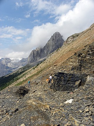
The Stephen Formation is a geologic formation exposed in the Canadian Rockies of British Columbia and Alberta, on the western edge of the Western Canada Sedimentary Basin. It consists of shale, thin-bedded limestone, and siltstone that was deposited during Middle Cambrian time. It is famous for the exceptional preservation of soft-bodied fossils: the Burgess Shale biota. The formation overlies the Cathedral escarpment, a submarine cliff; consequently it is divided into two quite separate parts, the 'thin' sequence deposited in the shallower waters atop the escarpment, and the 'thick' sequence deposited in the deeper waters beyond the cliff. Because the 'thick' Stephen Formation represents a distinct lithofacies, some authors suggest it warrants its own name, and dub it the Burgess Shale Formation. The stratigraphy of the Thin Stephen Formation has not been subject to extensive study, so except where explicitly mentioned this article applies mainly to the Thick Stephen Formation.

M. Qasim Jan is a geologist and research scientist from Pakistan. He has been the vice-chancellor of three Pakistani universities. His research has been in geology, mineralogy, petrology, geochemistry, and tectonics. He has authored or edited a dozen books, and has published numerous papers on geology and tectonics of the North-West Himalayas. Presently, he is Professor Emeritus at the National Centre of Excellence in Geology, University of Peshawar. Jan is also currently the Secretary General of the Pakistan Academy of Sciences, and of the Association of the Academies of Sciences in Asia. He is also a fellow of the Academy of Sciences for the Developing World (TWAS).
A river anticline is a geologic structure that is formed by the focused uplift of rock caused by high erosion rates from large rivers relative to the surrounding areas. An anticline is a fold that is concave down, whose limbs are dipping away from its axis, and whose oldest units are in the middle of the fold. These features form in a number of structural settings. In the case of river anticlines, they form due to high erosion rates, usually in orogenic settings. In a mountain building setting, like that of the Himalaya or the Andes, erosion rates are high and the river anticline's fold axis will trend parallel to a major river. When river anticlines form, they have a zone of uplift between 50-80 kilometers wide along the rivers that form them.

Neil D. Opdyke was an American geologist.
Provenance in geology, is the reconstruction of the origin of sediments. The Earth is a dynamic planet, and all rocks are subject to transition between the three main rock types: sedimentary, metamorphic, and igneous rocks. Rocks exposed to the surface are sooner or later broken down into sediments. Sediments are expected to be able to provide evidence of the erosional history of their parent source rocks. The purpose of provenance study is to restore the tectonic, paleo-geographic and paleo-climatic history.

The Himalayan foreland basin is an active collisional foreland basin system in South Asia. Uplift and loading of the Eurasian Plate on to the Indian Plate resulted in the flexure (bending) of the Indian Plate, and the creation of a depression adjacent to the Himalayan mountain belt. This depression was filled with sediment eroded from the Himalaya, that lithified and produced a sedimentary basin ~3 to >7 km deep. The foreland basin spans approximately 2,000 kilometres (1,200 mi) in length and 450 kilometres (280 mi) in width. From west to east the foreland basin stretches across five countries: Pakistan, India, Nepal, Bangladesh, and Bhutan.
Sampat Kumar Tandon is an Indian geologist and a professor emeritus of geology at the University of Delhi. He is a former pro-vice chancellor of Delhi University, Sir J. C. Bose Chair Professor of the department of Earth and Environmental Sciences at the Indian Institute of Science Education and Research, Bhopal and a D. N. Wadia Chair Professor of the department of Earth Sciences at the Indian Institute of Technology, Kanpur.

The Scandinavian Caledonides are the vestiges of an ancient, today deeply eroded orogenic belt formed during the Silurian–Devonian continental collision of Baltica and Laurentia, which is referred to as the Scandian phase of the Caledonian orogeny. The size of the Scandinavian Caledonides at the time of their formation can be compared with the size of the Himalayas. The area east of the Scandinavian Caledonides, including parts of Finland, developed into a foreland basin where old rocks and surfaces were covered by sediments. Today, the Scandinavian Caledonides underlay most of the western and northern Scandinavian Peninsula, whereas other parts of the Caledonides can be traced into West and Central Europe as well as parts of Greenland and eastern North America.
Carol Denison Frost is an American isotope geologist, petrologist and professor. Her primary research focuses on the evolution of the continental crust and granite petrogenesis. She has spent over thirty-five years investigating the geologic history of the Wyoming Province and the formation and geochemical classification of granite. Other contributions include isotopic fingerprinting of natural waters, including water associated with energy production. She served as Director of the Earth Sciences Division, National Science Foundation, from December 2014 to January 2018.
Anne Meltzer is a seismologist known for her research on earthquakes and the formation of mountain ranges. Her research primarily focused on the evolution of the Earth's lithosphere and the surface processes associated with faulting and deformation in the Earth's crust. Through her own personal research and collaboration with other colleagues, she strived to make advancements in the efficiency and effectiveness of monitoring earthquakes. In addition, her work aimed to effectively reduce earthquake destruction in countries that experience frequent seismic phenomena.