The Hill of Tara is a hill and ancient ceremonial and burial site near Skryne in County Meath, Ireland. Tradition identifies the hill as the inauguration place and seat of the High Kings of Ireland; it also appears in Irish mythology. Tara consists of numerous monuments and earthworks—dating from the Neolithic to the Iron Age—including a passage tomb, burial mounds, round enclosures, a standing stone, and a ceremonial avenue. There is also a church and graveyard on the hill. Tara forms part of a larger ancient landscape and Tara itself is a protected national monument under the care of the Office of Public Works, an agency of the Irish Government.

Rathkeale is a town in west County Limerick, in Ireland. It is 30 km (18 mi) southwest of Limerick city on the N21 road to Tralee, County Kerry, and lies on the River Deel. The town is in a townland and civil parish of the same name.

Patrickswell, historically known as Toberpatrick, is a small town in County Limerick, Ireland. It is primarily a commuter village for people working in Limerick, including the nearby industrial suburb of Raheen. The population was 848 at the 2022 census.

Charleville is a town in County Cork, Ireland. It lies in the Golden Vale, on a tributary of the River Maigue, near the border with County Limerick. Charleville is on the N20 road and is the second-largest town between Limerick and Cork, the largest being Mallow. The Roman Catholic parish of Charleville is within the Diocese of Cloyne. Significant industries in the town include Kerry Co-Op and the construction and services sectors.

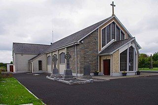
Athea is a village in west County Limerick, Ireland. Athea has a Roman Catholic church, and is the centre for the parish of Athea, which encompasses several nearby townlands.

Rathdowney or Rathdowny is a town in southwest County Laois, Ireland. It lies some 32 km southwest of Portlaoise in the Irish Midlands, at the point where the R433 regional road from Abbeyleix to Templemore is crossed by the R435 from Borris-in-Ossory to Johnstown. The R433 provides access for Rathdowney to the Dublin-Cork M8 motorway, while the R435 links the town to the Dublin-Limerick M7. As of the 2016 census, the population of Rathdowney was 1,271. The town is in a townland and civil parish of the same name.

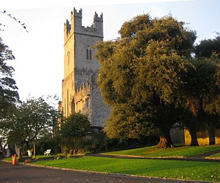
Saint Mary's Cathedral, Limerick, is a cathedral of the Church of Ireland in Limerick, Ireland, which is dedicated to the Blessed Virgin Mary. It is in the ecclesiastical province of Dublin. Previously the cathedral of the Diocese of Limerick, Ardfert and Aghadoe, it is now one of six cathedrals in the Diocese of Tuam, Limerick and Killaloe.

Rathmore is a small town in County Kerry, Ireland, lying immediately west of the border with County Cork. Rathmore is divided into two parts, one being the main commercial centre, and the other being the administrative centre where the schools and churches are located which is colloquially known as Rath Beg. It lies at the heart of the Sliabh Luachra area known for its traditional Irish music and culture. The local GAA club is Rathmore GAA. The SAG is in Rathmore and helps the elderly in the area. The town host the farmer's market every Saturday in the community centre.

The Turoe stone is a granite stone decorated in a Celtic style located in the village of Bullaun, County Galway, Ireland, 6 km north of Loughrea off the R350 regional road. It probably dates to about the period 100 BC to 100 AD. The stone is positioned in a covered protective structure on the lawn in front of Turoe House, set in a concrete base surrounded by a metal cattle grill. The Turoe stone is National Monument of Ireland Nr. 327 (NM#327)

Kilnaboy or Killinaboy is a village, townland and civil parish in County Clare, Ireland. It is located in the Burren, and as of the 2011 census the area had 347 inhabitants.

Ashbourne is a town in County Meath, Ireland. Located about 20 km north of Dublin and close to the M2 motorway, Ashbourne is a commuter town within Greater Dublin. In the 26 years between the 1996 and 2022 census, the town tripled in population from approximately 4,900 to 15,680 inhabitants. The town is passed by the Broad Meadow Water, which comes from Ratoath and Dunshaughlin.

Ardagh is a village and civil parish in County Limerick, Ireland. The village is situated round the junctions of the R523 and R521 roads. The nearest town is Newcastle West, 5 kilometres (3 mi) to the south. Primary level education for the village and its surroundings is provided by St Molua's National School. The parish is bounded to the west by Athea, to the north by the parish of Coolcappa, to the east Rathkeale and to the south by Newcastle West. The local GAA club is St. Kierans which represents both the parish of Ardagh-Carrigkerry as well as Coolcappagh-Kilcolman.
Mullaghreelan Rath is a ringfort (rath) and National Monument located in County Kildare, Ireland.
Ballylanders fort is a ringfort (rath) and National Monument located in County Limerick, Ireland.
Carron fort is a ringfort (rath) and National Monument located in County Tipperary, Ireland.

Ballyallaban ringfort or sometimes An Rath is an earthen ringfort south of Ballyvaughan in the Burren area, in County Clare, Ireland. It is a National Monument.
The Cush Earthworks are a series of earthworks, and a National Monument, located in County Limerick, Ireland.

Ardagh Fort is a ringfort (rath) and National Monument in County Limerick, Ireland, famous as the discovery site of the Ardagh Hoard.

Fanning's Castle, also called Whitamore's Castle, is the remains of a tower house and National Monument located in Limerick, Ireland.
Kilmihill Ringfort is a ringfort (rath) and National Monument located in County Limerick, Ireland. On the Record of Monuments and Places its code is LI037-042.


