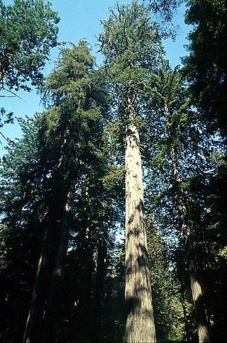
Rattlesnake Canyon stretches from Skofield Park into the Santa Ynez mountains. The Spanish called the canyon Las Canoas (The Canoes).
Contents

Rattlesnake Canyon stretches from Skofield Park into the Santa Ynez mountains. The Spanish called the canyon Las Canoas (The Canoes).
Around 1808, the Santa Barbara Mission received water from Mission Creek through an aqueduct that was made by the Chumash people. [1] Water was funneled from Rattlesnake Canyon into Mission Creek. The native Chumash people helped dig the channel and build the flumes. In 1808, to build a more permanent structure, dams were built by Mexican artisans on Mission Creek and in Rattlesnake Canyon. Only remnants of the dam still exist, and the reservoir has been filled with sediment from the creek.
In the 1920s the entire canyon was owned by Ray Skofield, a wealthy New Yorker who had moved to Santa Barbara. His son Hobart Skofield planted pine trees in the canyon in the early 1930s. In the Coyote Fire the trees burned, and were replaced in 1966 by the Sierra Club. In 1970, Hobart Skofield sold the upper 450 acres (1.8 km2) of the canyon for $150,000 (less than half of its value) to be made into a wilderness park, the Rattlesnake Canyon Wilderness Area. [1]

Mission Santa Barbara is a Spanish mission in Santa Barbara, California, United States. Often referred to as the 'Queen of the Missions', it was founded by Padre Fermín Lasuén for the Franciscan order on December 4, 1786, the feast day of Saint Barbara, as the tenth mission of what would later become 21 missions in Alta California.

Ventura County is a county located in the southern part of the U.S. state of California. As of the 2020 census, the population was 843,843. The largest city is Oxnard, and the county seat is the city of Ventura.
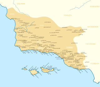
The Chumash are a Native American people of the central and southern coastal regions of California, in portions of what is now Kern, San Luis Obispo, Santa Barbara, Ventura and Los Angeles counties, extending from Morro Bay in the north to Malibu in the south to Mt Pinos in the east. Their territory includes three of the Channel Islands: Santa Cruz, Santa Rosa, and San Miguel; the smaller island of Anacapa was likely inhabited seasonally due to the lack of a consistent water source.

Santa Barbara is a coastal city in Santa Barbara County, California, of which it is also the county seat. Situated on a south-facing section of coastline, the longest such section on the West Coast of the United States excepting Alaska, the city lies between the steeply rising Santa Ynez Mountains and the Pacific Ocean. Santa Barbara's climate is often described as Mediterranean, and the city has been dubbed "The American Riviera". According to the 2020 U.S. Census, the city's population was 88,665.

Malibu Creek State Park is a state park of California, United States, preserving the Malibu Creek canyon in the Santa Monica Mountains. The 8,215-acre (3,324 ha) park was established in 1974. Opened to the public in 1976, the park is also a component of Santa Monica Mountains National Recreation Area.

The Santa Barbara Museum of Natural History is a natural history museum in Santa Barbara, California.

The Santa Ynez River is one of the largest rivers on the Central Coast of California. It is 92 miles (148 km) long, flowing from east to west through the Santa Ynez Valley, reaching the Pacific Ocean at Surf, near Vandenberg Space Force Base and the city of Lompoc.
Rattlesnake Canyon is the name of a number of scenic canyons in the Southwestern United States:

Malibu Creek is a year-round stream in western Los Angeles County, California. It drains the southern Conejo Valley and Simi Hills, flowing south through the Santa Monica Mountains, and enters Santa Monica Bay in Malibu. The Malibu Creek watershed drains 109 square miles (280 km2) and its tributary creeks reach as high as 3,000 feet (910 m) into Ventura County. The creek's mainstem begins south of Westlake Village at the confluence of Triunfo Creek and Lobo Canyon Creek, and flows 13.4 miles (21.6 km) to Malibu Lagoon.

Sespe Creek is a stream, some 61 miles (98 km) long, in Ventura County, southern California, in the Western United States. The creek starts at Potrero Seco in the eastern Sierra Madre Mountains, and is formed by more than thirty tributary streams of the Sierra Madre and Topatopa Mountains, before it empties into the Santa Clara River in Fillmore.

Alameda Creek is a large perennial stream in the San Francisco Bay Area. The creek runs for 45 miles (72 km) from a lake northeast of Packard Ridge to the eastern shore of San Francisco Bay by way of Niles Canyon and a flood control channel. Along its course, Alameda Creek provides wildlife habitat, water supply, a conduit for flood waters, opportunities for recreation, and a host of aesthetic and environmental values. The creek and three major reservoirs in the watershed are used as water supply by the San Francisco Public Utilities Commission, Alameda County Water District and Zone 7 Water Agency. Within the watershed can be found some of the highest peaks and tallest waterfall in the East Bay, over a dozen regional parks, and notable natural landmarks such as the cascades at Little Yosemite and the wildflower-strewn grasslands and oak savannahs of the Sunol Regional Wilderness.

Aliso Creek is a 19.8-mile (31.9 km)-long, mostly urban stream in south Orange County, California. Originating in the Cleveland National Forest in the Santa Ana Mountains, it flows generally southwest and empties into the Pacific Ocean at Laguna Beach. The creek's watershed drains 34.9 square miles (90 km2), and it is joined by seven main tributaries. As of 2018, the watershed had a population of 144,000 divided among seven incorporated cities.

Chumash rock art is a genre of paintings on caves, mountains, cliffs, or other living rock surfaces, created by the Chumash people of Southern California. Pictographs and petroglyphs are common through interior California, the rock painting tradition thrived until the 19th century. Chumash rock art is considered to be some of the most elaborate and plentiful rock art tradition in the region.

Matilija Creek is a major stream in Ventura County in the U.S. state of California. It joins with North Fork Matilija Creek to form the Ventura River. Many tributaries feed the mostly free flowing, 17.3-mile (27.8 km) creek, which is largely contained in the Matilija Wilderness. Matilija was one of the Chumash rancherias under the jurisdiction of Mission San Buenaventura. The meaning of the Chumash name is unknown.

Mission Historical Park is a 10-acre park (4.0 ha) located to the east of the Santa Barbara Mission in Santa Barbara, California. The park hosts a large open grassy area, the A.C. Postel Memorial Rose Garden, a fountain, hiking trails, a variety of sycamore and native oak trees, a historic olive grove dedicated to World War I veterans, remains of tannery vats, a pottery, gristmill, and a historic reservoir and aqueduct system. The park and the Mission were designated as a California State Historical Landmark on July 12, 1939.

Arroyo Conejo carries part of the longest creek in the Conejo Valley which sprawls past the cities of Thousand Oaks and Camarillo, and the communities of Newbury Park, Casa Conejo and Santa Rosa Valley. Arroyo Conejo is the primary drainage for the City of Thousand Oaks. Its watershed covers 57 square miles (150 km2) of which 43 square miles (110 km2) are in the Conejo Valley and 14 square miles (36 km2) in the Santa Rosa Valley.
Satwiwa was a former Chumash village in the Santa Monica Mountains of Newbury Park, California. The current Satwiwa Native American Indian Culture Center is operated by the National Park Service in cooperation with the Friends of Satwiwa. Satwiwa has been inhabited by Chumash Indians for over 10,000 years. It is situated at the foothills of Boney Mountain, a sacred mountain for the Chumash.

Wheeler Springs is an unincorporated community that grew around a set of sulphurated hot springs in Ventura County, California. It is located 6 miles north of the Ojai Valley, within Los Padres National Forest. It is named for Wheeler Blumberg, who founded the town in 1891, and the many natural hot springs.
The Matilija Wilderness is a 29,207-acre (11,820 ha) wilderness area in Ventura and Santa Barbara Counties, Southern California. It is managed by the U.S. Forest Service, being situated within the Ojai Ranger District of the Los Padres National Forest. It is located adjacent to the Dick Smith Wilderness to the northwest and the Sespe Wilderness to the northeast, although it is much smaller than either one. The Matilija Wilderness was established in 1992 in part to protect California condor habitat.
There are nine national parks located in the state of California managed by the National Park Service. National parks protect significant scenic areas and nature reserves, provide educational programs, community service opportunities, and are an important part of conservation efforts in the United States. There are several other locations inside of California managed by the National Park Service, but carry other designations such as National Monuments. Many of the national parks in California are also part of national forests and National Wildlife Refuges, and contain Native American Heritage Sites and National Monuments.
×
| | This Santa Barbara County, California-related article is a stub. You can help Wikipedia by expanding it. |