Walsall is a large industrialised market town in the West Midlands. Historically part of Staffordshire, it is located 8 miles (13 km) north-west of Birmingham, 6 miles (10 km) east of Wolverhampton and 9 miles (14 km) from Lichfield.
The West Midlands is a metropolitan county in western-central England with a 2014 estimated population of 2,808,356, making it the second most populous county in England after Greater London. It came into existence as a metropolitan county in 1974 after the passage of the Local Government Act 1972, formed from parts of Staffordshire, Worcestershire and Warwickshire. The county itself is a NUTS 2 region within the wider NUTS 1 region of the same name. The county consists of seven metropolitan boroughs: the City of Birmingham, the City of Coventry and the City of Wolverhampton, as well as the boroughs of Dudley, Sandwell, Solihull and Walsall.
England is a country that is part of the United Kingdom. It shares land borders with Wales to the west and Scotland to the north-northwest. The Irish Sea lies west of England and the Celtic Sea lies to the southwest. England is separated from continental Europe by the North Sea to the east and the English Channel to the south. The country covers five-eighths of the island of Great Britain, which lies in the North Atlantic, and includes over 100 smaller islands, such as the Isles of Scilly and the Isle of Wight.
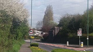
It is surrounded by the residential areas of Birchills and Beechdale, and is about half a mile west of Walsall town centre.
Birchills is a residential area of Walsall in the West Midlands of England. The appropriate Walsall ward is Birchills Leamore. The population of this ward taken at the 2011 census was 14,775.
The park featured an outdoor public swimming pool a number of years ago; it was popular and in constant use in the 1920s, 1930s, 1940s, and 1950s. This has now been demolished. The park has a skating ramp as well as a children's play area and a basketball court.
A geographic coordinate system is a coordinate system that enables every location on Earth to be specified by a set of numbers, letters or symbols. The coordinates are often chosen such that one of the numbers represents a vertical position and two or three of the numbers represent a horizontal position; alternatively, a geographic position may be expressed in a combined three-dimensional Cartesian vector. A common choice of coordinates is latitude, longitude and elevation. To specify a location on a plane requires a map projection.
This page is based on this Wikipedia article Text is available under the CC BY-SA 4.0 license; additional terms may apply. Images, videos and audio are available under their respective licenses.
Related Research Articles
Walsall railway station is the principal railway station of Walsall, West Midlands, England and situated in the heart of the town. It is operated by West Midlands Trains, with services provided by West Midlands Railway. The main entrance is situated inside the Saddlers Shopping Centre.
Wednesfield South is a ward of Wolverhampton City Council, in the English county of West Midlands. It covers the southern and eastern parts of the town of Wednesfield, as well its town centre. It borders the East Park, Heath Town and Wednesfield North wards, as well as the Metropolitan Borough of Walsall. It forms part of the Wolverhampton North East constituency.
Tipton railway station is located in the town of Tipton in the borough of Sandwell, West Midlands, England and was known as Tipton Owen Street until 1968. It is situated on the West Coast Main Line. The station is operated by West Midlands Trains, and all services are provided by West Midlands Railway.
Bentley is an area in the Metropolitan Borough of Walsall located around Junction 10 of the M6 Motorway. It is also a rural village of houses towards its eastern sides. It shares borders with the areas of Willenhall, Beechdale, Ashmore Park, Pleck, Darlaston and Alumwell.
Alumwell is a suburb on the west side of Walsall, in the West Midlands of England. The area is home to Walsall Manor Hospital. The neighbourhood is adjacent to the M6 and can be seen from the motorway by passing drivers. The neighbourhood is by a primary and secondary school. Most of the houses on the estate were built by the local authority during the 1950s.
Bloxwich North railway station serves the town of Bloxwich, in the Metropolitan Borough of Walsall, West Midlands, England.
The station, and all trains serving it, are operated by West Midlands Trains.
Palfrey is a neighbourhood in the Metropolitan Borough of Walsall, in the West Midlands.
Walsall Wood Football Club are a football club based in Walsall Wood, near Walsall in the West Midlands, England. For the 2018–19 season, they are members of the Midland League Premier Division, which sits at level 10 of the English football league system, following their promotion from the Midland League Division One.
Walsall Arboretum is a Victorian public park located very close to Walsall town centre in the West Midlands. Part of the park and surrounding housing are covered by the Arboretum conservation area. In the early 2010s, the park has undergone a major restoration and redevelopment programme funded largely by the Heritage Lottery Fund.
Park Hall is an affluent area near to the south-eastern edge of Walsall in the West Midlands of England. Officially. It is considered that the area near to the local Park Hall Primary and Infant schools and the Gillity Village shops are classed as Park Hall.
Fellows Park was a football stadium in Walsall, England. It was the home ground of Walsall F.C. from 1896 until 1990, when the team moved to the Bescot Stadium.
The Saddlers Centre is a shopping centre located in Walsall, West Midlands, United Kingdom.
The shopping centre takes its name from the town's saddle manufacturing heritage and is also known as the nickname for the towns football team Walsall FC.
The Darlaston Loop was a railway which connected the towns of Walsall, Darlaston and Wednesbury in the West Midlands of England. It was so named because it passed through the town of Darlaston.
Pleck, in the borough of Walsall, neighbours Palfrey and stretches from the bridge on Wednesbury Road to Junction 9 of the M6 motorway. It consists of a large green space called Pleck Park and housing estates. Pleck is close to Walsall Manor Hospital and Bescot Stadium, home of Walsall F.C.
Bentley railway station was a railway station built by the Wolverhampton and Walsall Railway in 1872, and was operated by the Midland Railway from 1876 onwards. Situated on Bloxwich Lane, it served the area of Bentley, located between Willenhall and Walsall in the English West Midlands. The station closed in 1898.
The Delves is a neighbourhood located in the south side of Walsall between Palfrey and Yew Tree estate in Walsall located on the outskirts of Walsall just before Sandwell.
Salt Point State Marine Conservation Area (SMCA) is a marine protected area that lies onshore from Fisk Mill Cove and south along Salt Point State Park in Sonoma County on California’s north central coast. The marine protected area covers 3.12 square miles. Salt Point SMCA prohibits the take of all living marine resources, except the recreational take of abalone and finfish.
East Park is the name of a ward of Wolverhampton City Council, West Midlands, England. It lies to the east of Wolverhampton city centre, stretching to the city's boundary with the Metropolitan Borough of Walsall. It also borders the wards of Bilston North, Ettingshall, St Peter's, Heath Town and Wednesfield South. It forms part of the Wolverhampton South East constituency.