Reichenau, Carinthia

Last updated
Reichenau
Ebene Reichenau.jpg
Ebene Reichenau with St Martin Church
Wappen at reichenau.png
Austria adm location map.svg
Red pog.svg
Reichenau
Location within Austria
Coordinates: 46°51′N13°55′E / 46.850°N 13.917°E / 46.850; 13.917
Country Austria
State Carinthia
District Feldkirchen
Government
   Mayor Karl Lessiak (SPÖ)
Area
[1]
  Total113.99 km2 (44.01 sq mi)
Elevation
1,095 m (3,593 ft)
Population
 (2018-01-01) [2]
  Total1,822
  Density16/km2 (41/sq mi)
Time zone UTC+1 (CET)
  Summer (DST) UTC+2 (CEST)
Postal code
9564, 9565
Website reichenau.gv.at

Reichenau (Slovene : Rajnava[ citation needed ]) is a municipality in the district of Feldkirchen in the Austrian state of Carinthia.

Contents

Geography

South-southeast view of Reichenau Reichenau (Karnten) - Sudsudostansicht.JPG
South-southeast view of Reichenau

The municipal area is situated in the upper valley of the Gurk River within the Nock Mountains range (part of the Gurktal Alps). In the north, the road from Feldkirchen leads up to Turracher Höhe Pass and Turracher See at a height of 1,763 m (5,784 ft) AA on the border with Predlitz-Turrach in Styria and further down into the Mur Valley. Another small mountain lake is Falkertsee at 1,872 m (6,142 ft) in the west. Reichenau is the eastern terminus of the Nockalmstraße scenic route through the Nock Mountains to Krems.

Reichenau consists of the cadastral communities Ebene Reichenau, Sankt Lorenzen, Sankt Margarethen, Wiedweg, and Winkl.

Neighboring municipalities

Predlitz-Turrach
Bad Kleinkirchheim CompassRose16 N.png Albeck, Carinthia
Feld am See
Afritz am See
Arriach Gnesau

History

Farmsteads in Gurk Valley Reichenau Seebach Gurktal 18032011 222.jpg
Farmsteads in Gurk Valley

The remote and densely forested area of the upper Gurk Valley was settled by Celtic colonists when the region was part of the Noricum kingdom, which in 15 BC was incorporated as a province of the Roman Empire. From about 590 Alpine Slavs immigrated into the lower parts of the valley, followed by Bavarian settlers in the 10th century.

In the High Middle Ages, when the area was part of the Duchy of Carinthia, the valley belonged to the estates of Millstatt Abbey. From about 1300 the Benedictine monks had large parts of the woodland cleared. The village of Reichenau (possibly derived from German : Rauch, "smoke" referring to slash-and-burn agriculture) was first mentioned in a 1332 deed. A chapel in the neighbouring village of Sankt Lorenzen at a height of 1,477 m (4,846 ft) (today the highest situated parish church in Carinthia) was already documented in 1216.

A Protestant prayer house ( Toleranzbethaus ) in Wiedweg was first mentioned in 1787. About 16% of the local population confess to the Protestant Church.

Politics

Seats in the municipal assembly (Gemeinderat) as of 2009 elections:

Twin towns — sister cities

Reichenau is twinned with:

Notable people

Related Research Articles

<span class="mw-page-title-main">Malta, Austria</span> Place in Carinthia, Austria

Malta is a municipality and a village in the district of Spittal an der Drau, in the Austrian state of Carinthia.

<span class="mw-page-title-main">Sankt Lambrecht</span> Place in Styria, Austria

Sankt Lambrecht is a market town in the district of Murau in Styria, Austria. It is known for St. Lambrecht's Abbey, one of the most important Benedictine monasteries in Austria. The monastery complex and its gardens are part of the Zirbitzkogel-Grebenzen nature park.

<span class="mw-page-title-main">Straßburg, Austria</span> Place in Carinthia, Austria

Straßburg is a town in the district of Sankt Veit an der Glan in Carinthia, Austria.

<span class="mw-page-title-main">Bad Kleinkirchheim</span> Place in Carinthia, Austria

Bad Kleinkirchheim is a municipality and spa town in the district of Spittal an der Drau, in Carinthia, Austria.

<span class="mw-page-title-main">Feldkirchen in Kärnten</span> Place in Carinthia, Austria

Feldkirchen in Kärnten is a town in the Austrian state of Carinthia and the capital of the district of the same name. It consists of the Katastralgemeinden Fasching, Feldkirchen, Glanhofen, Gradisch, Hoefling, Klein Sankt Veit, Pernegg, Rabensdorf, Sankt Ulrich, Sittich, Tschwarzen and Waiern. The name Feldkirchen means the church in the fields.

<span class="mw-page-title-main">Albeck, Carinthia</span> Place in Carinthia, Austria

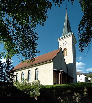
Albeck is a municipality in the district of Feldkirchen in the Austrian state of Carinthia.

<span class="mw-page-title-main">Sankt Urban</span> Place in Carinthia, Austria

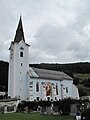
Sankt Urban is a town in the district of Feldkirchen in the Austrian state of Carinthia.

<span class="mw-page-title-main">Lesachtal</span> Place in Carinthia, Austria

Lesachtal is a municipality in Hermagor District, in the Austrian state of Carinthia. It comprises the western part of the eponymous valley formed by the upper Gail River, and stretches from the Carinthian border with East Tyrol down to Kötschach-Mauthen in the east.

<span class="mw-page-title-main">Deutsch-Griffen</span> Place in Carinthia, Austria

Deutsch-Griffen is a municipality in the district of Sankt Veit an der Glan in Austrian state of Carinthia.

<span class="mw-page-title-main">Glödnitz</span> Place in Carinthia, Austria

Glödnitz is a municipality in the district of Sankt Veit an der Glan in the Austrian state of Carinthia.

<span class="mw-page-title-main">Liebenfels</span> Place in Carinthia, Austria

Liebenfels is a market town in the district of Sankt Veit an der Glan in the Austrian state of Carinthia.

<span class="mw-page-title-main">Sankt Georgen am Längsee</span> Place in Carinthia, Austria

Sankt Georgen am Längsee is a municipality in the district of Sankt Veit an der Glan in Carinthia, Austria.

<span class="mw-page-title-main">Krems, Carinthia</span> Place in Carinthia, Austria

Krems in Kärnten is a municipality in the district of Spittal an der Drau in Carinthia in Austria.

<span class="mw-page-title-main">Radenthein</span> Place in Carinthia, Austria

Radenthein is a town in Spittal an der Drau District, in the Austrian state of Carinthia.

<span class="mw-page-title-main">Rennweg am Katschberg</span> Place in Carinthia, Austria

Rennweg am Katschberg is a market town in the district of Spittal an der Drau in Carinthia, Austria.

<span class="mw-page-title-main">Arriach</span> Place in Carinthia, Austria

Arriach is a municipality in the district of Villach-Land in the Austrian state of Carinthia.

<span class="mw-page-title-main">Feld am See</span> Place in Carinthia, Austria

Feld am See is a municipality in the district of Villach-Land in the Austrian state of Carinthia.

<span class="mw-page-title-main">Fresach</span> Place in Carinthia, Austria

Fresach is a municipality in Villach-Land District, in the Austrian state of Carinthia.

<span class="mw-page-title-main">Bad Sankt Leonhard im Lavanttal</span> Place in Carinthia, Austria

Bad Sankt Leonhard im Lavanttal is a spa town in the district of Wolfsberg in the Austrian state of Carinthia.

<span class="mw-page-title-main">Gurktal Alps</span>

The Gurktal Alps is a mountain range in the Central Eastern Alps in Austria which is named after the valley of the Gurk river. The range stretches west to Lake Millstatt and east to Neumarkter Sattel. The highest peak is Eisenhut at 2,441m .

References

  1. "Dauersiedlungsraum der Gemeinden Politischen Bezirke und Bundesländer - Gebietsstand 1.1.2018". Statistics Austria. Retrieved 10 March 2019.
  2. "Einwohnerzahl 1.1.2018 nach Gemeinden mit Status, Gebietsstand 1.1.2018". Statistics Austria. Retrieved 9 March 2019.