
The Bavarian Forest is a wooded, low-mountain region in Bavaria, Germany that is about 100 kilometres long. It runs along the Czech border and is continued on the Czech side by the Bohemian Forest. Most of the Bavarian Forest lies within the province of Lower Bavaria, but the northern part lies within Upper Palatinate. In the south it reaches the border with Upper Austria.

Meiringen is a municipality in the Interlaken-Oberhasli administrative district in the canton of Bern in Switzerland. Besides the village of Meiringen, the municipality includes the settlements of Balm, Brünigen, Eisenbolgen, Hausen, Prasti, Sand, Stein, Unterbach, Unterheidon, Wylerli and Zaun. The municipal coat of arms shows a black eagle in a yellow field. Formerly the coat of arms of the entire Oberhasli Talschaft, this design continues the imperial coat of arms.
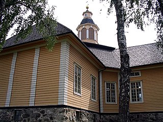
Nastola is a former municipality of Finland. It was merged with the city of Lahti on 1 January 2016.
Reichenbach may refer to:
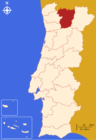
The District of Vila Real is a district of northern Portugal. With an area of 4,239 km2 (1,637 sq mi), the district is located east of the port city of Porto and north of the Douro River. Vila Real has always belonged to the historical province of Trás-os-Montes. Approximate population in the 2001 census was 230,000. The population has shown negative rates in recent years due to emigration and aging. Many of the villages have lost population and have become deserted while the district capital has gained in population. It is bordered by Spain (Galicia) in the north and east, Braga District and Porto District in the west, Viseu District in the south and Bragança District in the east.

The Sainte-Anne River, a north shore tributary of Saint Lawrence River, the mouth river is located at Sainte-Anne-de-la-Pérade. This river flows in the province of Quebec, Canada.
Administrative regions
Capitale-Nationale:
Mauricie:
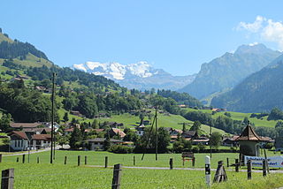
Reichenbach im Kandertal is a village and municipality in the Frutigen-Niedersimmental administrative district in the canton of Bern in Switzerland. Until 1957 it was known as Reichenbach bei Frutigen. Besides the village of Reichenbach, the municipality includes several other settlements, including Aris, Faltsche, Griesalp, Kien, Kiental, Ramslauenen, Reudlen, Scharnachtal, Schwandi and Wengi. Additionally, the village of Mülenen is shared between Reichenbach and Aeschi bei Spiez municipalities.
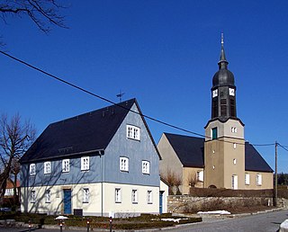
Haselbachtal is a municipality in the district of Bautzen in Saxony, Germany with a population of 3,997 (2020). It consists of the villages Bischheim, Häslich, Gersdorf, Möhrsdorf, Reichenau, and Reichenbach.
Oberstaufenbach is an Ortsgemeinde – a municipality belonging to a Verbandsgemeinde, a kind of collective municipality – in the Kusel district in Rhineland-Palatinate, Germany. It belongs to the Verbandsgemeinde of Kusel-Altenglan, whose seat is in Kusel.
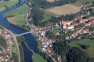
Reichenbach, also known as Reichenbach am Regen, is a municipality in the district of Cham in Bavaria, Germany. It lies on the river Regen, approximately 20 kilometres northeast of Regensburg. The town is home to the Kloster Reichenbach, a former Benedictine monastery and baroque church dating back to the Middle Ages. Currently living within the renovated monastery are more than 400 people with physical and mental disabilities and about 500 staff. This makes it the most important employer in the region.

Lautertal (Odenwald) is a municipality in the Bergstraße district in the Hessian Odenwald in Germany that came into being with the merger of several former communities.
Frauenberg is an Ortsgemeinde – a municipality belonging to a Verbandsgemeinde, a kind of collective municipality – in the Birkenfeld district in Rhineland-Palatinate, Germany. It belongs to the Verbandsgemeinde of Baumholder, whose seat is in the like-named town.

Nohen is an Ortsgemeinde – a municipality belonging to a Verbandsgemeinde, a kind of collective municipality – in the Birkenfeld district in Rhineland-Palatinate, Germany. It belongs to the Verbandsgemeinde of Birkenfeld, whose seat is in the like-named town.
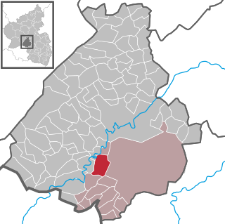
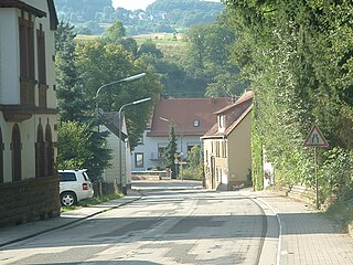
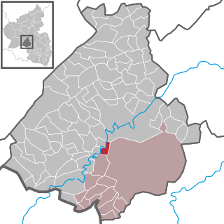
Reichenbach is an Ortsgemeinde – a municipality belonging to a Verbandsgemeinde, a kind of collective municipality – in the Birkenfeld district in Rhineland-Palatinate, Germany. It belongs to the Verbandsgemeinde of Baumholder, whose seat is in the like-named town.
Bosenbach is an Ortsgemeinde – a municipality belonging to a Verbandsgemeinde, a kind of collective municipality – in the Kusel district in Rhineland-Palatinate, Germany. It belongs to the Verbandsgemeinde of Kusel-Altenglan, whose seat is in Kusel.
Jettenbach is an Ortsgemeinde – a municipality belonging to a Verbandsgemeinde, a kind of collective municipality – in the Kusel district which belongs to the federal state of Rhineland-Palatinate in Germany. It belongs to the Verbandsgemeinde Lauterecken-Wolfstein.
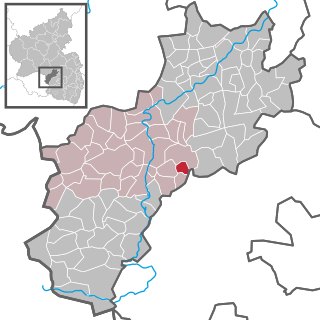
Niederstaufenbach is an Ortsgemeinde – a municipality belonging to a Verbandsgemeinde, a kind of collective municipality – in the Kusel district in Rhineland-Palatinate, Germany. It belongs to the Verbandsgemeinde of Kusel-Altenglan, whose seat is in Kusel.

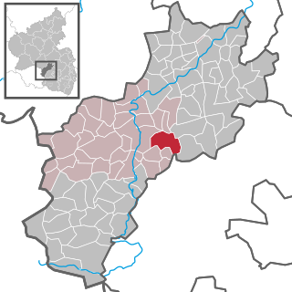
Neunkirchen am Potzberg is an Ortsgemeinde – a municipality belonging to a Verbandsgemeinde, a kind of collective municipality – in the Kusel district in Rhineland-Palatinate, Germany. It belongs to the Verbandsgemeinde of Kusel-Altenglan, whose seat is in Kusel.

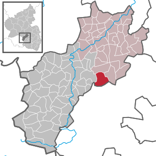
Theisbergstegen is an Ortsgemeinde – a municipality belonging to a Verbandsgemeinde, a kind of collective municipality – in the Kusel district in Rhineland-Palatinate, Germany. It belongs to the Verbandsgemeinde of Kusel-Altenglan, whose seat is in Kusel.
Boštanj is a village in the Lower Sava Valley in southeastern Slovenia. It consists of a nucleated centre on two terraces on the right bank of the Sava River along the main road from Celje to Krško, and two hamlets, Puše and Redna, on the slopes of the nearby hills. It is the central settlement of the Local Community of Boštanj, the largest local community in the Municipality of Sevnica. The village has a post office, a fire station, a primary school, two shops, a gas station, two bars, a restaurant, and a cultural hall named the TVD Partizan Hall. It is surrounded by fields and orchards.


