Rhode Island Route 12

Last updated

Rhode Island 12.svg

Route 12
Route information
Maintained by RIDOT
Length 17.0 mi [1] (27.4 km)
Major junctions
West endRhode Island 14.svgRhode Island 102.svg Route 14 / Route 102 in Scituate
 US 1.svg US 1 in Cranston
Rhode Island 10.svg Route 10 in Cranston
US 1A.svgRhode Island 117.svg US 1A / Route 117 in Cranston
East end Broad Street in Cranston
Location
Counties Providence
Highway system

Rhode Island Routes

Rhode Island 11.svg Route 11 Route 14 Rhode Island 14.svg
Route 12 sign RI 12 old shield.jpg
Route 12 sign

Route 12 is a numbered state highway in Rhode Island, United States. It runs approximately 17 miles (27 km) from Route 14 in Foster to Broad Street in Cranston.

A state highway, state road, or state route is usually a road that is either numbered or maintained by a sub-national state or province. A road numbered by a state or province falls below numbered national highways in the hierarchy. Roads maintained by a state or province include both nationally numbered highways and un-numbered state highways. Depending on the state, "state highway" may be used for one meaning and "state road" or "state route" for the other.

Rhode Island State of the United States of America

Rhode Island, officially the State of Rhode Island and Providence Plantations, is a state in the New England region of the United States. It is the smallest state in area, the seventh least populous, the second most densely populated, and it has the longest official name of any state. Rhode Island is bordered by Connecticut to the west, Massachusetts to the north and east, and the Atlantic Ocean to the south via Rhode Island Sound and Block Island Sound. It also shares a small maritime border with New York. Providence is the state capital and most populous city in Rhode Island.

Route 14 is a numbered state highway in the U.S. state of Rhode Island. It runs approximately 23 miles (37 km) from Connecticut routes 14 and 14A at the border with Sterling, CT to Route 6 in Providence.

Contents

Route description

Route 12 starts at Route 14 and Route 102 in Foster. It roughly follows the shore of the Scituate Reservoir before passing over its dam. It passes over I-295 without an interchange and heads towards downtown Cranston. After passing the city center as a main eastwest corridor, Route 2 passes Route 10's southern terminus. It passes US 1A and ends at Broad Street, an old alignment of US 1A, 0.3 miles (0.48 km) later.

Route 102 is a numbered state highway running 44.4 miles (71.5 km) in Rhode Island. Route 102 serves as a non-freeway beltway around the Providence metro area. It begins in the village of Wickford and travels through less developed areas of western Rhode Island. The route ends in the village of Slatersville.

Foster, Rhode Island Town in Rhode Island, United States

Foster is a town in Providence County, Rhode Island, in the United States. The population was 4,606 at the 2010 census.

Scituate Reservoir

The Scituate Reservoir is the largest inland body of water in the state of Rhode Island. It has an aggregate capacity of 39 billion US gallons (150,000,000 m3) and a surface area of 5.3 square miles (13.7 km²). It and its six tributary reservoirs—which make up a total surface area of 7.2 square miles (18.6 km²)—supply drinking water to more than 60 percent of the state population, including Providence.

History

Major intersections

The entire route is in Providence County.

Locationmi [1] kmDestinationsNotes
Scituate 0.00.0Rhode Island 14.svgRhode Island 102.svg Route 14 / Route 102 (Plainfield Pike)
7.211.6Rhode Island 116.svg Route 116 (East Road)
Cranston 12.520.1Rhode Island 51.svg Route 51 south (Phenix Avenue)Northern end of Route 51
12.920.8Rhode Island 5.svg Route 5 (Atwood Avenue)
14.623.5Rhode Island 2.svg Route 2 (Reservoir Avenue)
15.625.1US 1.svg US 1 (Elmwood Avenue)
15.825.4Rhode Island 10.svgI-95.svg Route 10 north to I95 Interchange, southern end of Route 10
16.626.7US 1A.svgRhode Island 117.svg US 1A / Route 117 (Warwick Avenue)
17.027.4Broad Street
1.000 mi = 1.609 km; 1.000 km = 0.621 mi

Related Research Articles

Rhode Island Route 2 highway in Rhode Island

Route 2 is a state highway in the U.S. state of Rhode Island. It runs approximately 36 miles (58 km) from US 1 in Charlestown to US 1 in Providence.

Rhode Island Route 5 highway in Rhode Island

Route 5 is a state highway in the U.S. state of Rhode Island. It runs approximately 26 miles (42 km) from US 1 in Warwick to the Massachusetts state line in North Smithfield.

Rhode Island Route 7 highway in Rhode Island

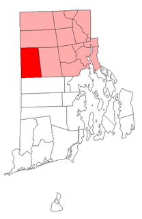
Route 7 is a numbered state highway in Rhode Island, United States. It runs approximately 16 miles (26 km) from Route 246 in Providence to Joslin Road in Burrillville.

Route 33 is a state highway in the U.S. state of Rhode Island. It runs approximately 6.5 miles (10.5 km) from Route 3 in Coventry to Route 2 in Cranston.

Rhode Island Route 37 highway in Rhode Island

Route 37, also known as the Lincoln Avenue Freeway, is a state highway running 3.47 miles (5.58 km) in Providence County and Kent County, Rhode Island, United States. A freeway for its entire length, it serves the cities of Cranston and Warwick and is also a major east–west freeway in the Providence metropolitan area, linking T. F. Green Airport with Interstate 295. The western terminus of Route 37 is an at-grade intersection with Natick Avenue in Cranston. The freeway has numbered interchanges with I-295, Rhode Island Route 2, Pontiac Avenue, and I-95 before terminating at a trumpet interchange with U.S. Route 1 in Warwick.

Route 51 is a state highway in the U.S. state of Rhode Island. It runs approximately 5.4 miles (8.7 km) from Route 115 in West Warwick to Route 12 in Cranston.

Route 91 is a numbered state highway running 12.0 miles (19.3 km) in Rhode Island.

Route 94 is a numbered state highway running 12.7 miles (20.4 km) in Rhode Island.

Route 101 is a numbered state highway running 9.7 miles (15.6 km) in Rhode Island. It begins at the Connecticut state line in the town of Foster and ends at U.S. Route 6 in the town of Scituate.

Route 108 is a 8.6-mile (13.8 km) long state highway in Washington County, Rhode Island. The route begins at an intersection with Ocean Road in the village of Narragansett Pier, just north of Point Judith Light. The route's northern terminus is at an intersection with Route 138 in the town of South Kingstown, just east of the University of Rhode Island. In between, Route 108 connects to the Block Island Sound community of Galilee and passes through the villages of Wakefield and Peace Dale.

Route 114A is an alternate state route to Rhode Island Route 114, located along the Massachusetts – Rhode Island border in East Providence, RI and Seekonk, MA. The road begins and ends within East Providence in Rhode Island at Route 114. Most of the road, however, is located within Seekonk in Massachusetts.

Route 115 is a numbered State Highway running 6.0 miles (9.7 km) in Rhode Island.

Route 117 is a state route in the U.S. state of Rhode Island.

U.S. Route 1A is the name of several highways found in the United States.

Route 122 is a numbered State Highway running 14.2 miles (22.9 km) in Rhode Island, United States.

Route 123 is a state highway running 7.7 miles (12.4 km) in the U.S. state of Rhode Island.

Route 246 is a numbered state highway running 8 miles (13 km) in Rhode Island.

Massachusetts Route 152 is a state highway in the U.S. state of Massachusetts. The highway begins at the Rhode Island state line, where the road continues into East Providence as Rhode Island Route 152 to U.S. Route 1A and Rhode Island Route 114. Route 152 runs 14.8821 miles (23.9504 km) through Seekonk, Attleboro, and North Attleboro to US 1 in Plainville.

References

  1. 1 2 Google (December 23, 2013). "Route 12" (Map). Google Maps . Google. Retrieved December 23, 2013.

Route map: Google

KML file (edithelp)
KML is from Wikidata